Pre-CalNex TOPAZ Lidar data
July 13 - Preliminary Data
| Previous Flight | Archive Calendar | Next Flight |
|---|
Flight #2 (Monday): San Joaquin Valley
Flight level: 12500' & 16500', Takeoff: 16:15 PST, Duration: 4:15 h
We flew a box pattern over the San Joaquin Valley, with two SW-NE legs over the valley and roughly N-S oriented legs over the Sierra Nevada and the Coastal Range. We flew the exact same box pattern twice. We measured high ozone levels of up to 125 ppb on the east side of the San Joaquin Valley and along the slopes of the Sierra Nevada. Another persistent feature we observed was a layer with very low ozone values at about 2500 m ASL.
Select an image to view full resolution
Ozone Cross-section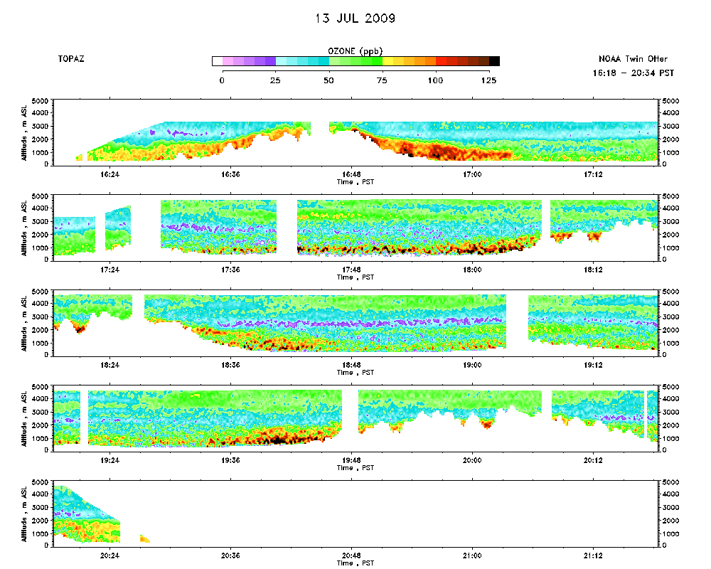 |
Aerosol Cross-section |
Ozone Map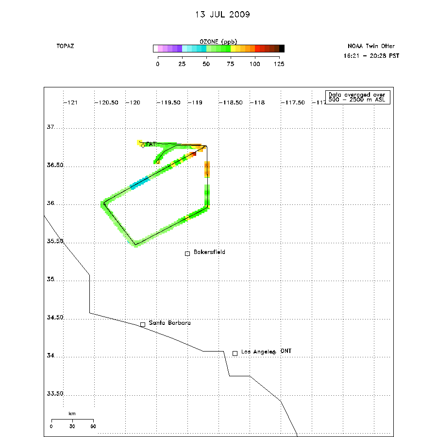 |