Pre-CalNex TOPAZ Lidar data
July 15 - Preliminary Data
| Previous Flight | Archive Calendar | Next Flight |
|---|
Flight #3 (Wednesday): Transit flight from Fresno to Ontario
Flight level: 14500' & 16500', Takeoff: 12:40 PST, Duration: 4:00 h
We flew two SW-NE legs over the southern San Joaquin Valley and then proceeded over the Tehachapi and Tejon Pass areas. We observed elevated ozone over Tehachapi Pass but hardly any increase in ozone over Tejon Pass. Given that the larger scale flow in the San Joaquin Valley was from the NW (as is typical for July) this might indicate that on this day pollution was exiting the San Joaquin Valley via Tehachapi Pass. We continued our flight south towards the Ventura/Oxnard area, then west across the San Fernando Valley, over the San Gabriel, San Bernardino, and San Jacinto Mountains (to the north and east of Los Angeles), and then descended into Ontario. During the second half of the flight, we observed elevated ozone near the surface and a layer of very low ozone aloft in the Ventura/Oxnard/San Fernando Valley areas. Along the slopes of the San Gabriel and San Bernardino Mountains we saw plumes of high ozone presumambly transported up from the LA Basin by upslope winds. We also oberved high ozone levels exceeding 125 ppb over San Gorgonio Pass (east of Riverside), but no significant ozone enhancement over Cajon Pass. As we descended towards Ontario we probed the eastern edge of the ozone plume in the LA Basin.
Select an image to view full resolution
Ozone Cross-section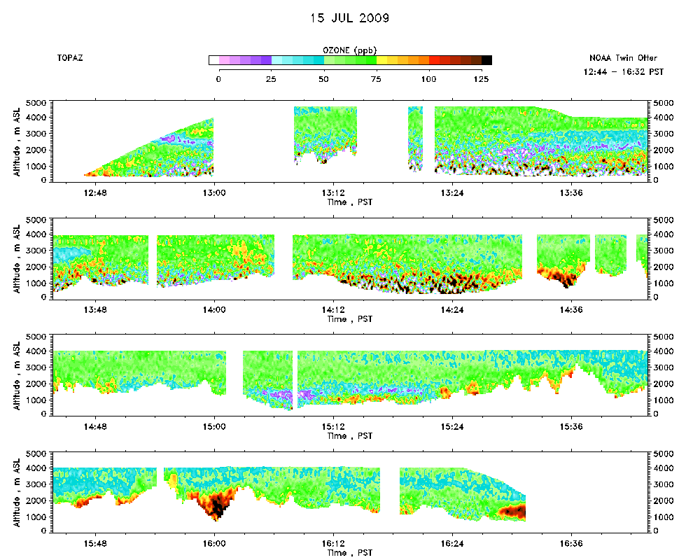 |
Aerosol Cross-section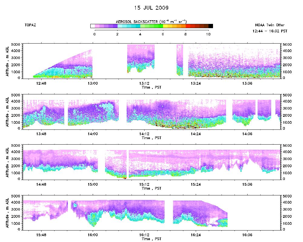 |
Ozone Map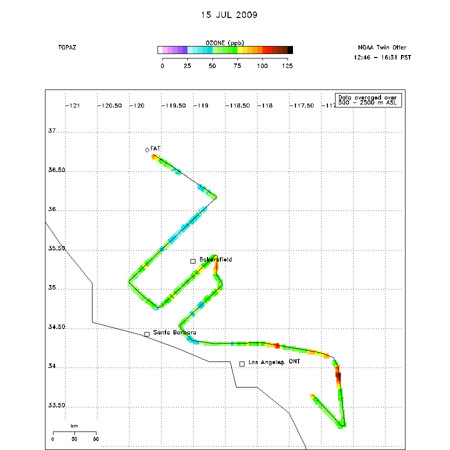 |