Pre-CalNex TOPAZ Lidar data
July 17 - Preliminary Data
| Previous Flight | Archive Calendar | Next Flight |
|---|
Flight #4 (Friday): Los Angeles area
Flight level: 14500', Takeoff: 14:45 PST, Duration: 4:00 h
During this flight we mapped out the ozone and aerosol distribution over the Los Angeles Basin and the adjacent mountainous areas. The weather was generally sunny and hot. Due to influx of mid-level moisture, convective clouds built up over the mountains, but no precipitation or thunderstorm activity occurred. We observed many interesting features in the ozone cross sections, including high ozone levels in the LA Basin with a thin layer of clean air right above the surface (perhaps brought in by the sea breeze), and high ozone along the mountain slopes. Perhaps the most sriking features are extensive plumes of elevated ozone (up to 130 ppb) extending to altitudes of at least 4000 m ASL over and near the tallest mountain peaks. These plumes of high ozone may have been transported upwards by the convective clouds that had formed over the mountain ranges.
Select an image to view full resolution
Ozone Cross-section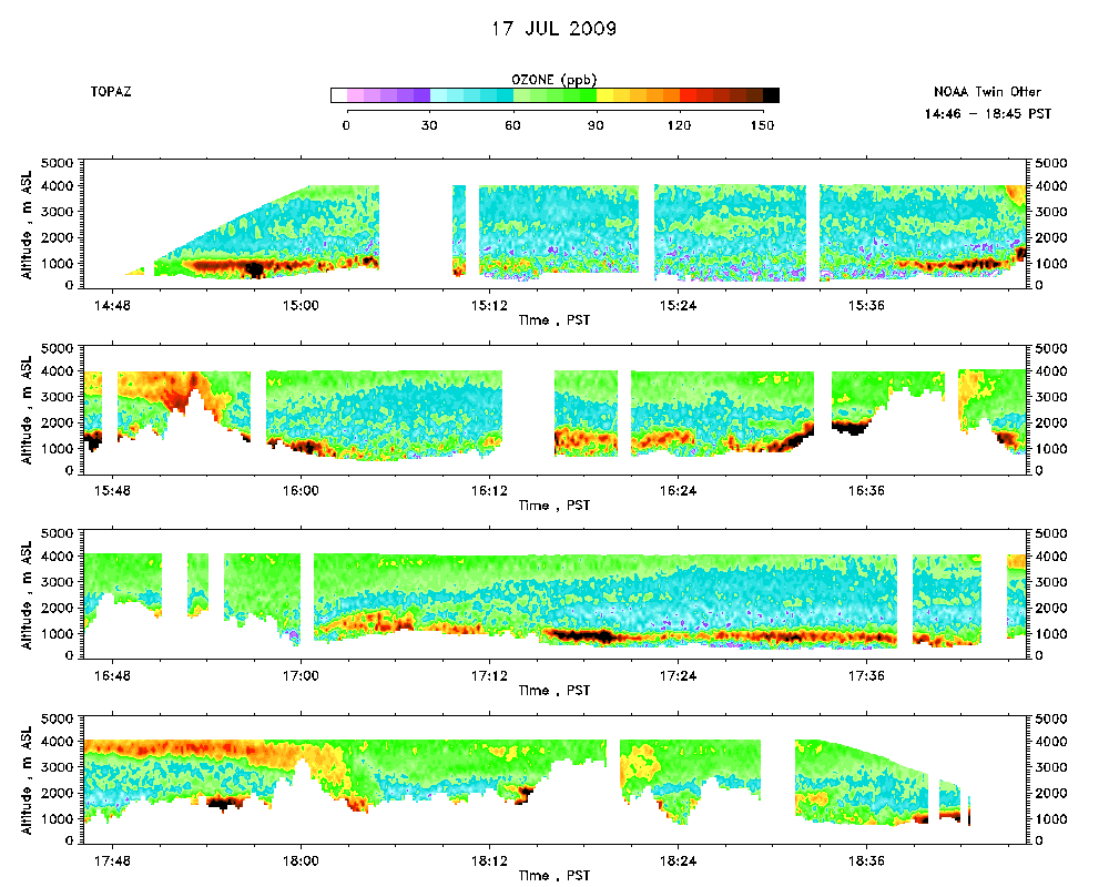 |
Aerosol Cross-section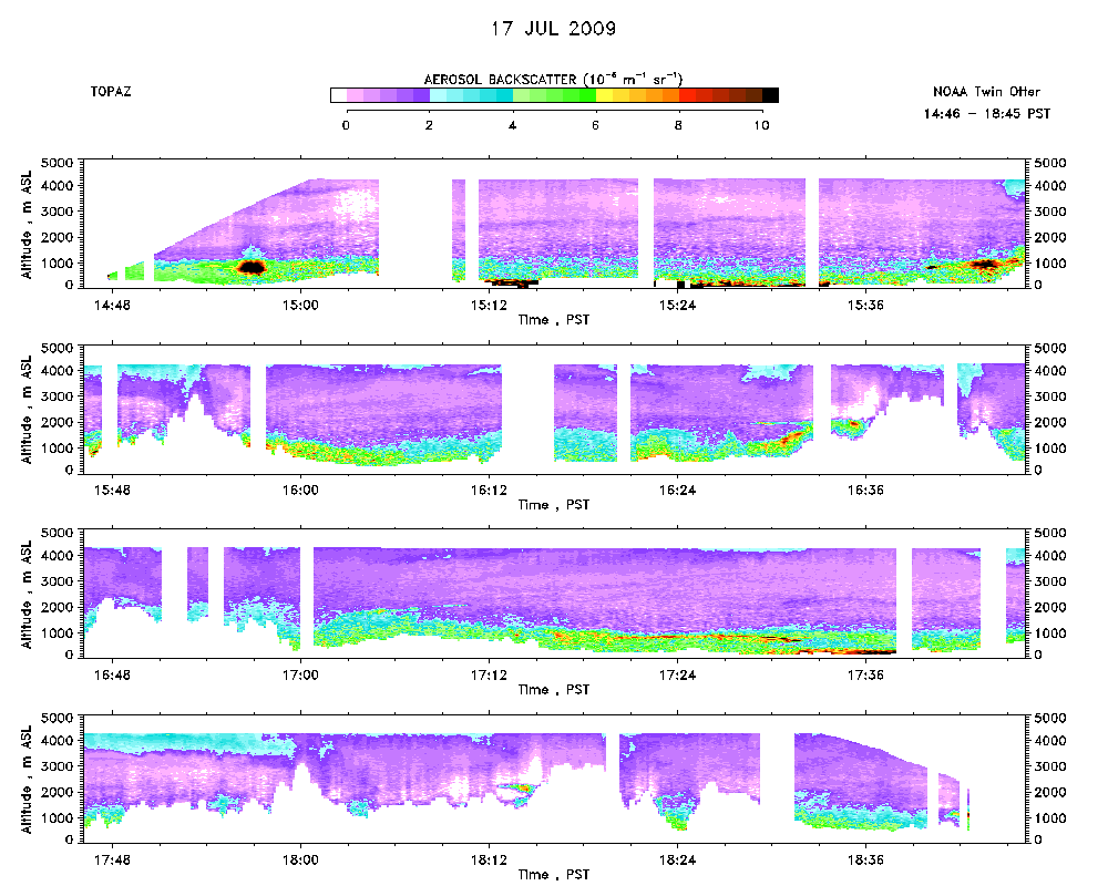 |
Ozone Map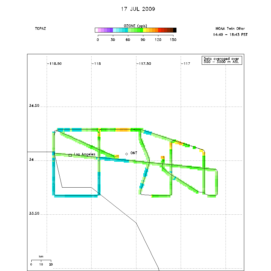 |