Pre-CalNex TOPAZ Lidar data
July 19 - Preliminary Data
| Previous Flight | Archive Calendar | Next Flight |
|---|
Flight #5 (Sunday): Los Angeles area
Flight level: 14500' & 16500', Takeoff: 14:15 PST, Duration: 4:00 h
The flight pattern on this day was similar to the previous flight, except that we added a flight leg to the east and north of the mountain ranges surronding the Los Angeles Basin. The objective was to a) investigate ozone pollution on a weekend day (Sunday) and compare to ozone levels found during the previous flight (Friday) and b) to look for transport of ozone out of the LA Basin. The weather was similar to Friday's flight - hot and generally sunny with moderate cloud buildup over the mountains. We observed somewhat lower ozone values over the LA Basin and adjacent mountains compared to Friday's flight. We found elevated ozone levels on the eastern side of the LA Basin, over the San Bernardino Mountains, as well as to the northeast (on the Mojave Desert side) of the San Bernardino mountains. Areas around Cajon and San Gorgonio Passes were rather clean, indicating that on this day pollution from the LA Basin was mostly transported over the mountains and not thru the passes.
Select an image to view full resolution
Ozone Cross-section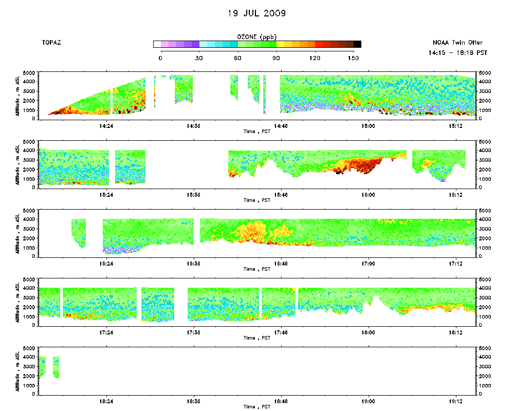 |
Aerosol Cross-section |
Ozone Map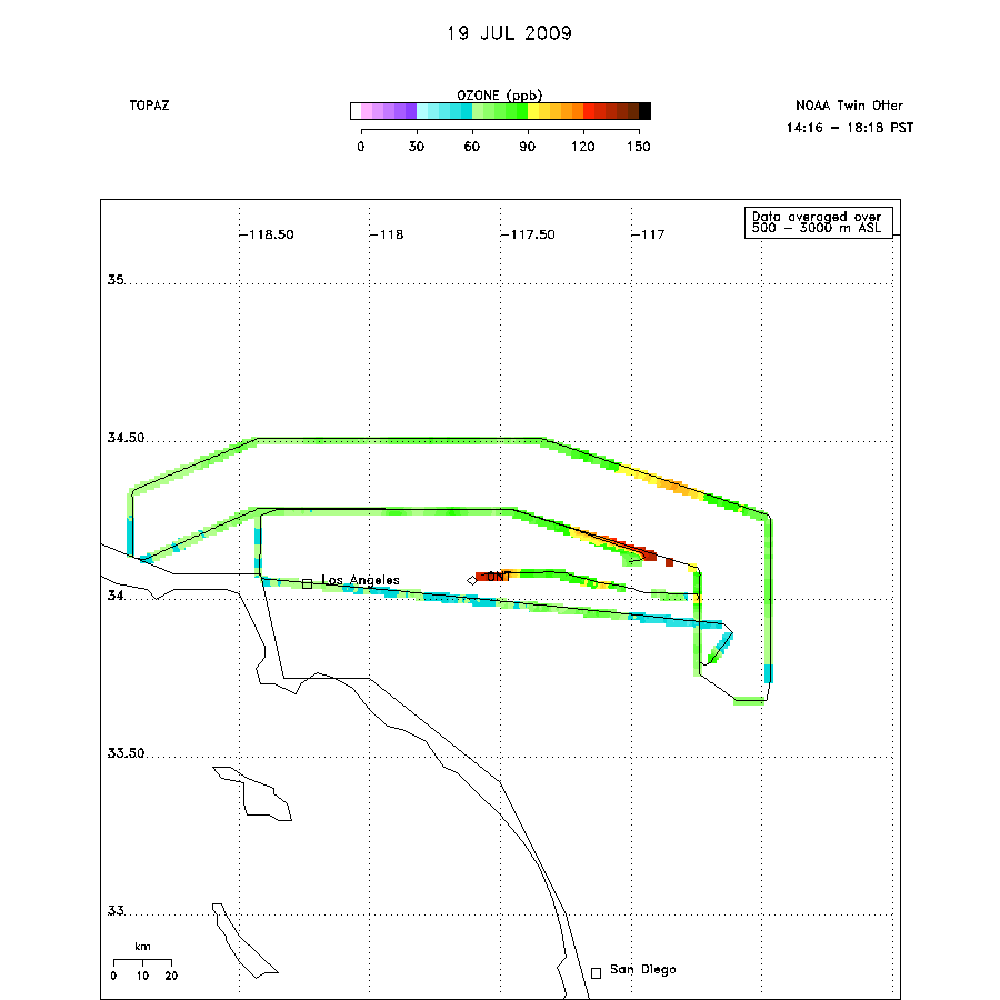 |