Saturday, July 23: CABOTS IOP2
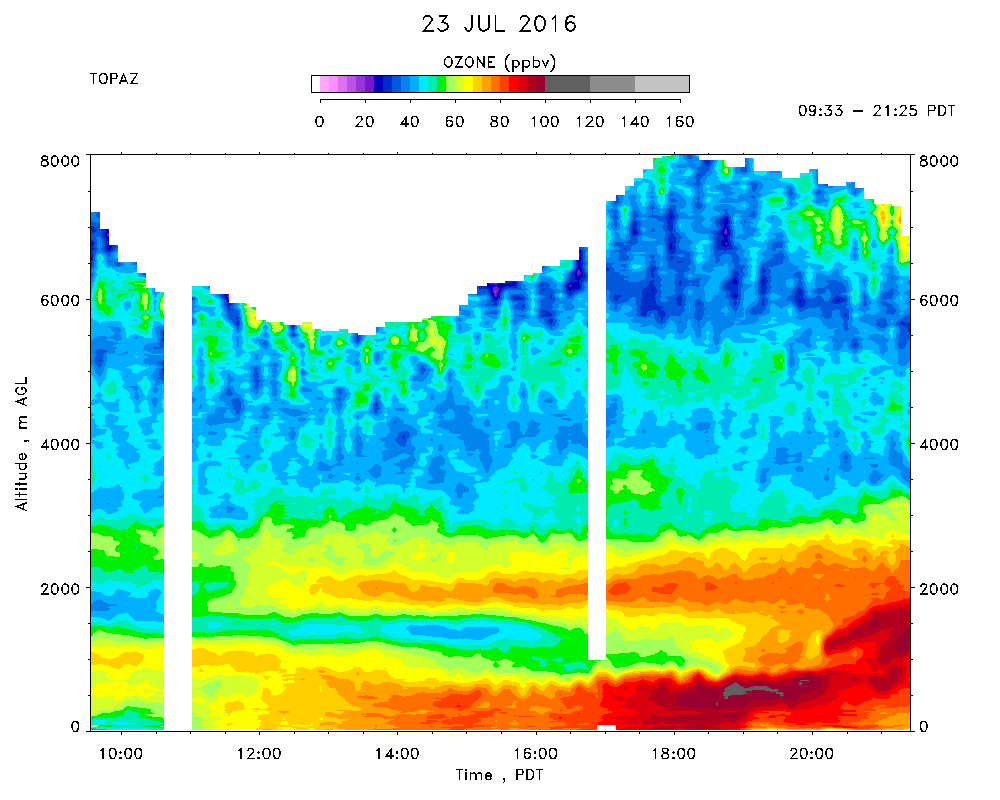
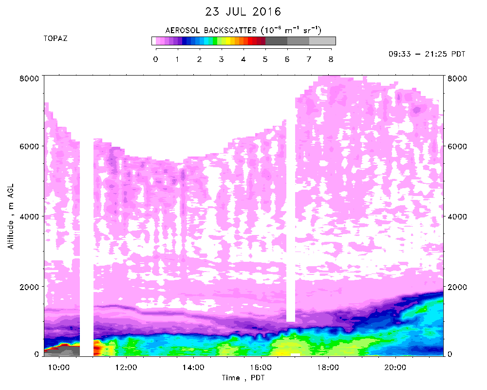
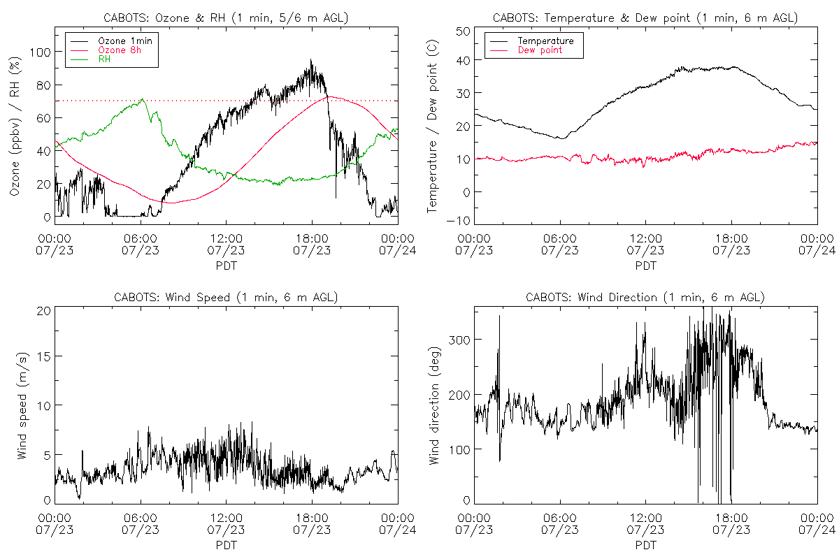
Day 6 of CABOTS IOP 2 observations. TOPAZ data were taken from 09:33 to 21:25 PDT. Clear all day with poor visibility in the morning. Improved to fair in the afternoon when the tops of the Sierra's became visible. High of about 37.5 C with southerly surface winds in the morning and northwesterlies after 1500 PDT, with a brief period of northwesterly winds around noon. The profiler winds were westerly between 200 and 800 m in the early afternoon, but northerly above 1000 m. The CBL remained shallow, less than 800 m, for most of the afternoon, but appeared to merge with an elevated ozone (but low aerosol) layer after 2000 PDT. This apparent merger may have been caused by advection and not vertical entrainment, however, since the profiler SNR shows that the CBL had largely collapsed by that time. Surface ozone peaked at about 84 ppbv* around 1800 PDT, when the lidar showed even higher concentrations. The concentrations at Lower Kaweah peaked at 92 ppbv around that time.