Tuesday, July 26: CABOTS IOP2
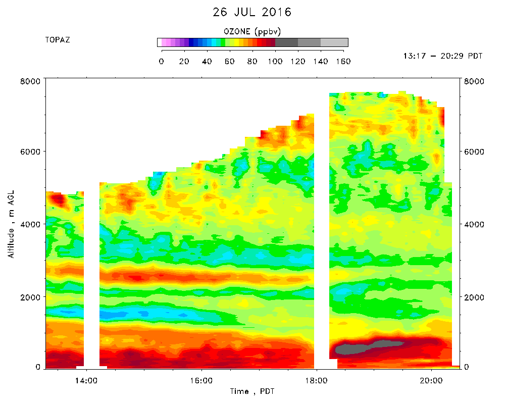
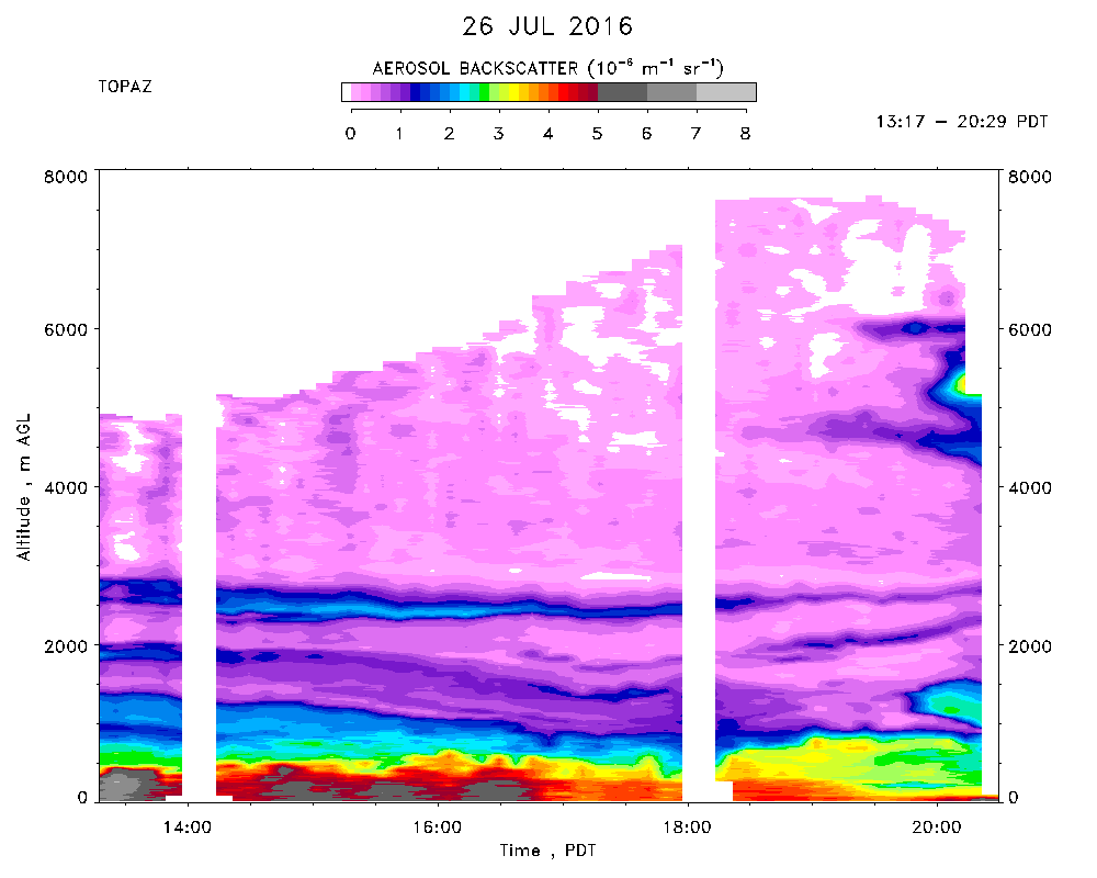
Day 9 of CABOTS IOP 2 observations. TOPAZ data were taken from 13:17 to 20:29 PDT. Start up delayed by a dead power supply in the data acquisition computer, which was replaced by a spare. The measurements overlapped with 4 missed approaches by the SA Mooney in the early afternoon and evening,with spiral profiles arond 1430 and 1930 PDT on the return legs of the both flights. Very hot again with an offical high of 40C (104F) at the airport tower around 1645 PDT. Cloud-free overhead all day, but significant FWC formed above the Sierra and spreading westward in the afternoon. Very hazy, especially in the morning due to smoke from the Sobaranes Fire. Mountains totally obscured from view all day. Typical southeasterly surface winds in the morning, veering to the northwest and becoming weaker in the afternoon. The CBL remained very shallow (about 500 m), with deeper SE-to-SW winds in the morning and west-northwesterly in the afternoon. Northerly winds above 1 km all day. Surface ozone peaked at about 85-90 ppbv* between 1300 and 1600 PDT. The lidar found very high aerosol and ozone (up to 100 ppbv) in the CBL with somewhat lower concentrations and aerosol (aged smoke?) immediately above. Very high concentrations near 500 m around 1830-1900 PDT. This air was capped by a narrow layer with much lower (about 45 ppbv) ozone and aerosol that sloped downward from about 1500 to 1000 m during the day. Satellite imagery shows much less smoke from the Sobranes Fire today, with most of that going north into the NSV. Only two thin layers with moderately higher aerosol and ozone (up to 80-90 ppbv) were detected between 2000 and 2500 m. A tenuous layer with 50-60 ppbv of ozone and low aerosol descended from 4500 to 3500 m. Apparent high ozone near 8 km at the end of the day is a cloud artifact.