Friday, July 29: CABOTS IOP2
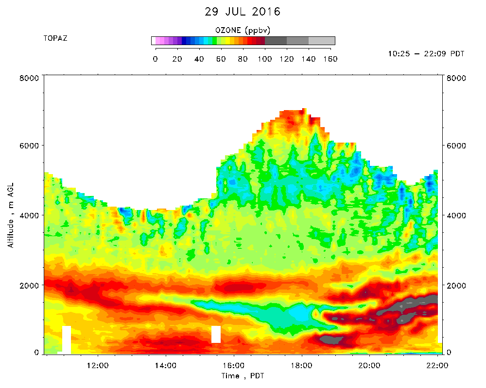
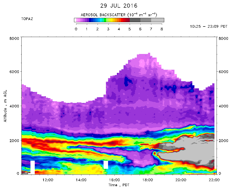
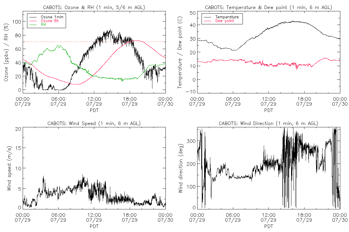
Day 12 of CABOTS IOP 2 observations. TOPAZ data were taken from 10:25 to 22:09 PDT. The measurements overlapped with the Fresno-Visalia valley flights by the SA Mooney. Very hot again with an another offical high of 41C (106F) at the airport met tower at 1525 PDT. Mostly cloud-free overhead all day with more significant Cu formation above the Sierra and tenuous contrail-cirrus in the afternoon. Very hazy. The mountains were once again totally obscured from view all day, but the visibility appeared better to the south and east in the late afternoon.
Typical wind pattern with south-southeasterly surface winds in the morning, veering to the west and becoming weaker in the afternoon. Once again, the CBL remained very shallow (about 600 m), with southwesterly flow up to about 2 km.
The late morning TOPAZ measurements showed relatively low (about 65 ppbv)ozone between the top of the BL and about 2000 m. A higher ozone/aerosol layer initially detected at 2 km appeared to split with once part apprearing to descend while the other part remained at the same altitude. The "descending" layer disappeared around 1700 PDT before it reached the top of the subsiding CBL. Multiple layers of high ozone and aerosol (smoke) appeared between 300 and 1200 m around 1845 PDT when the winds shifted to the north. Surface ozone was similar to the previous day, peaking at about 85 ppbv* near 1430 PDT.
The Mooney made a missed approach and spiral profile beginning at about 1440 PDT.