TexAQS 2006 TOPAZ Lidar data
September 1 - Final Data
| Previous Flight | Archive Calendar | Next Flight |
|---|
Flight #18
Takeoff: 14:10 CDT
Total flight time: 5.2 hours
During the morning, a west-northwesterly land breeze transported pollutants from the Houston,
Ship Channel, and Texas City areas over Galveston Bay and the Gulf of Mexico. An early onset
of the bay and sea breeze around 12:00 CDT pushed the pollutants back over the source areas
resulting in very high ozone levels. Several CAMS surface stations in the Houston metro area
registered hourly averages above 150 ppb of ozone and the Ron Brown measured up to 180 ppb of
ozone in Galveston Bay. The Twin Otter flew several N-S transects over Galveston Bay, the Ship
Channel, and areas southeast of Houston. The Twin Otter operation was restricted to these
areas due to convective clouds north of Galveston Bay and west of Houston. Generally high
ozone values were observed during the entire flight with particularly high levels approaching
200 ppb over the western portion of Galveston Bay, the Ship Channel, and in a plume southeast
of Texas City. The Twin Otter overflew the Ron Brown in the Galveston Bay shipping lane. The
boundary layer extended to about 1500 to 1800 m MSL; above it, a 1000 m deep layer with high
aerosol and moderately high ozone loading was observed.
Select an image to view full resolution
Ozone Cross-section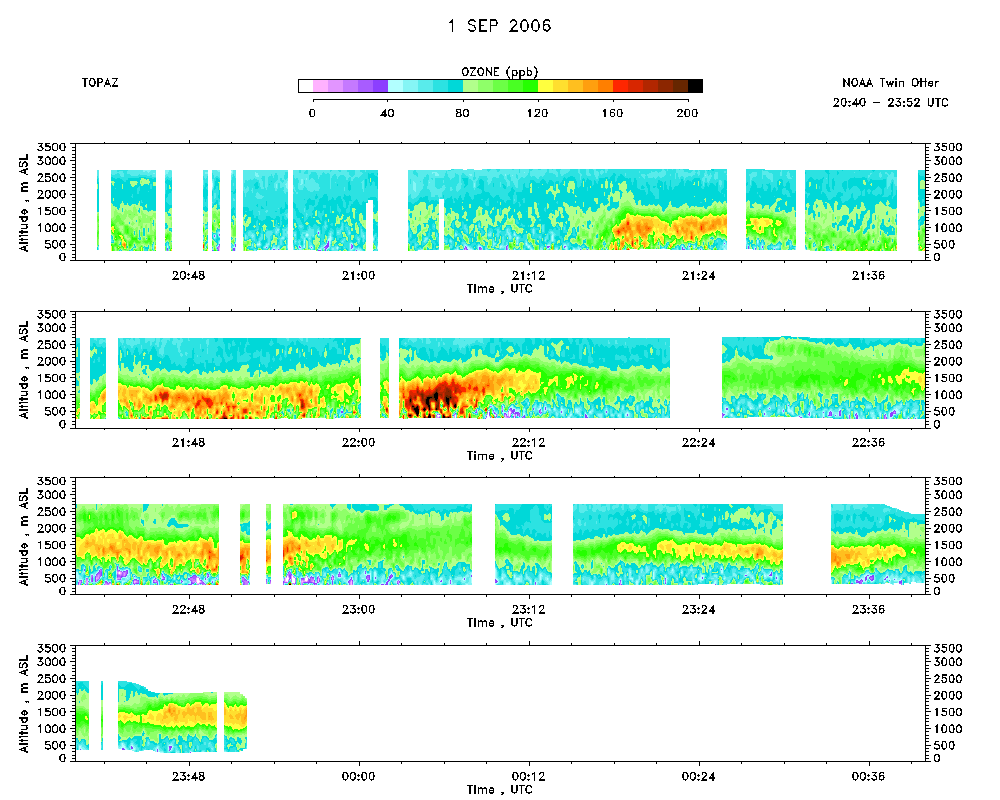 download ICARTT format data (ict file) download simple ASCII data (txt file) |
Aerosol Cross-section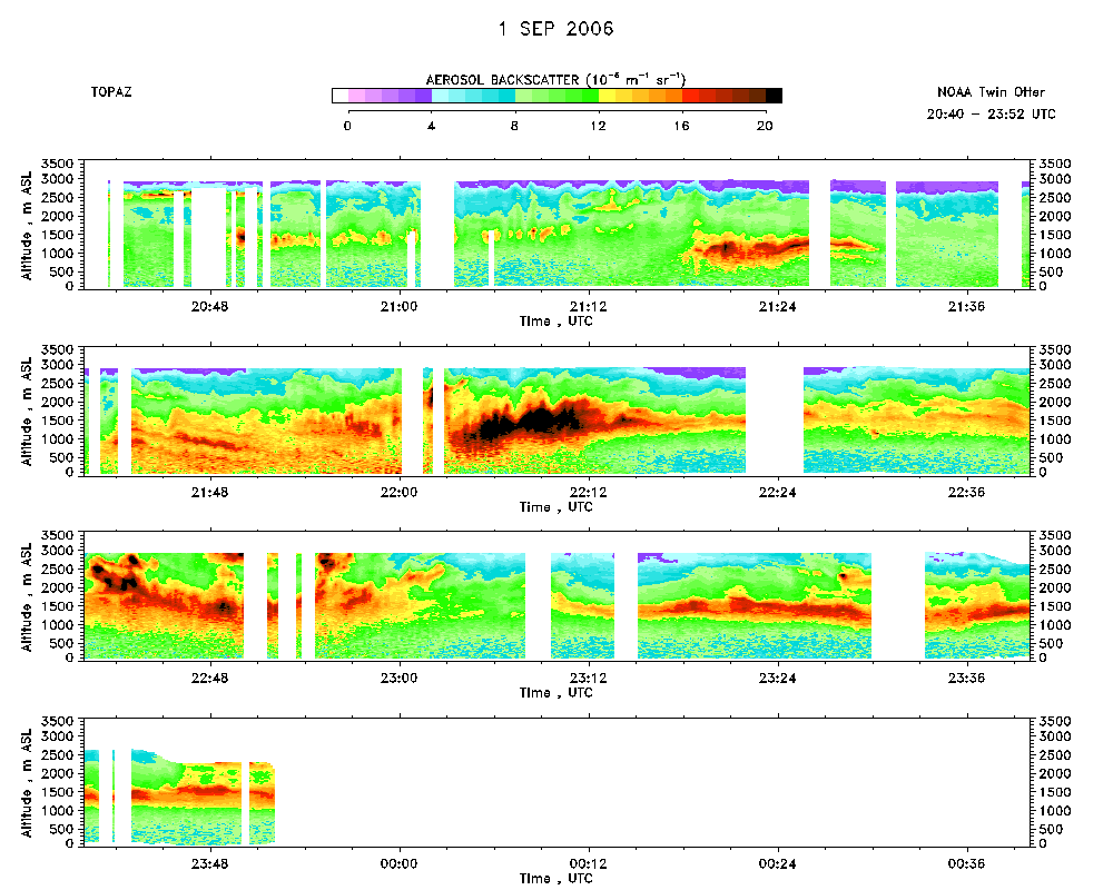 download ICARTT format data (ict file) download simple ASCII data (txt file) |
Ozone Map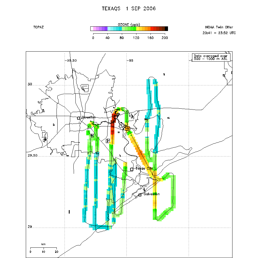 |