TexAQS 2006 TOPAZ Lidar data
August 12 - Final Data
| Previous Flight | Archive Calendar | Next Flight |
|---|
Flight #7
Takeoff: 13:40 CDT
Total flight time: 5.7 hours
The objective during the first part of the flight was to characterize the vertical structure of aerosol over the Ron Brown as the Calipso satellite was passing overhead. The Twin Otter picked up the satellite track around Smith Point flying south to rendezvous with the Ron Brown. At the time of the satellite overpass the Twin Otter flew a box pattern near the Ron Brown to characterize the aerosol variability perpendicular to the satellite track and then headed north to Smith Point on the satellite track. After the satellite overpass the Twin Otter proceeded to the northwest to a point just south of the Intercontinental Airport where it started a series of E-W flight legs that extended from west of Conroe to the Beaumont area. The northernmost transect was flown at about 10 miles north of Conroe. The Twin Otter observed ozone levels of generally 60 to 80 ppb in the Houston/Ship Channel plume against a very clean background of about 30 ppb. The data collected on this flight will be used to calculate the horizontal ozone flux and possibly the ozone production rate in the Houston/Ship Channel pollution plume.
Select an image to view full resolution
Ozone Cross-section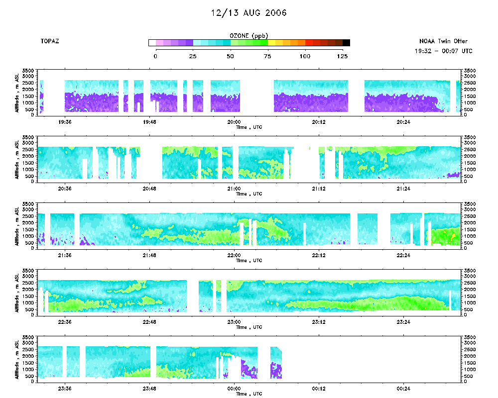 download ICARTT format data (ict file) download simple ASCII data (txt file) |
Aerosol Cross-section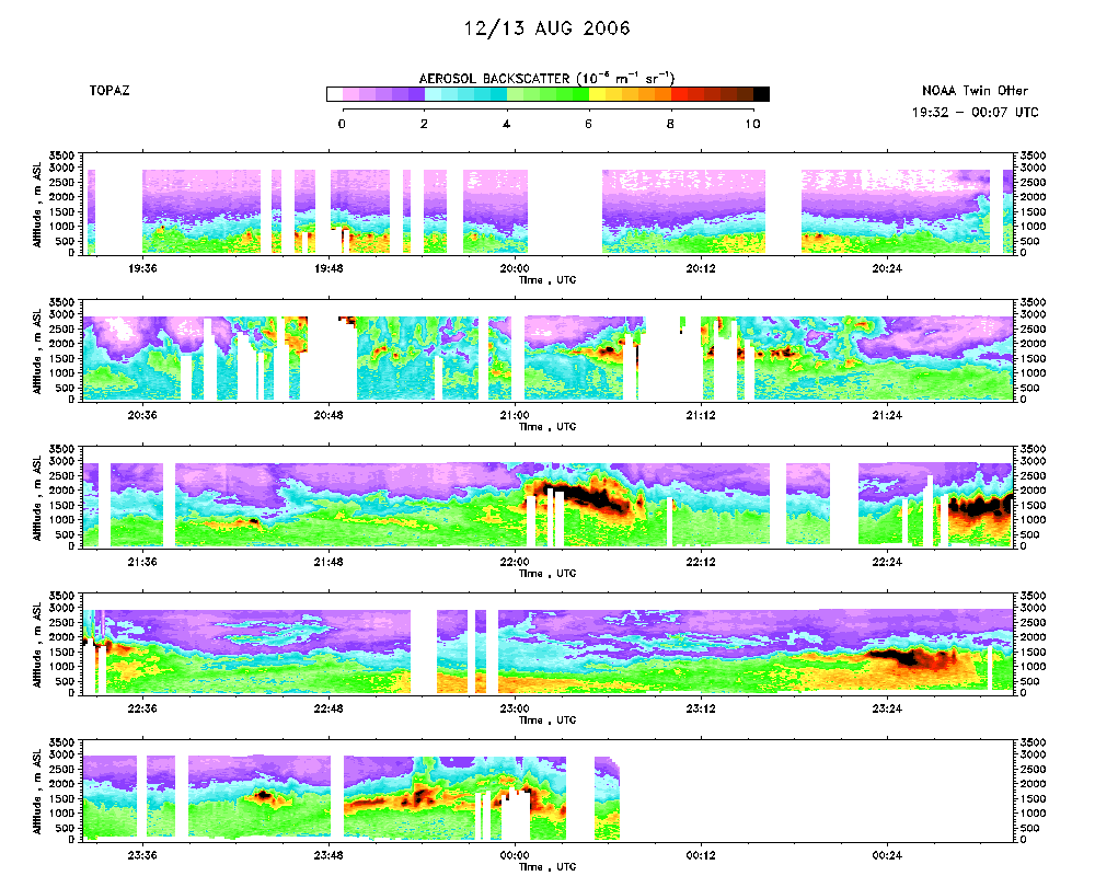 download ICARTT format data (ict file) download simple ASCII data (txt file) |
Ozone Map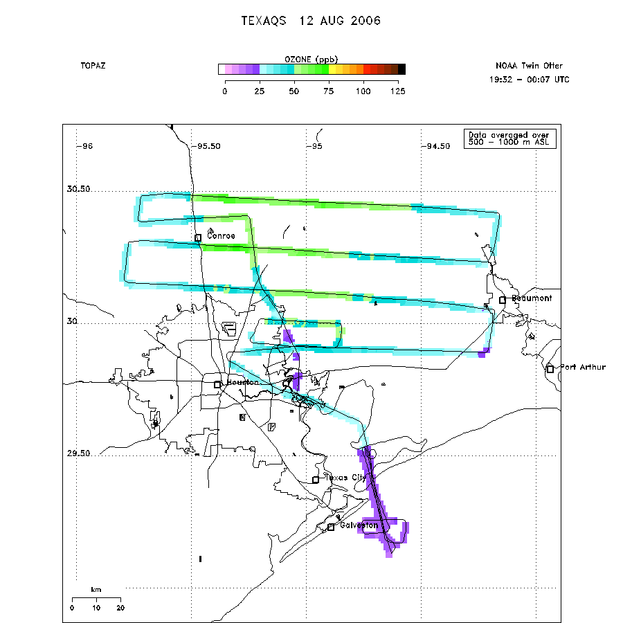 |
Mixed Layer Height Map download ICARTT format data (ict file) download simple ASCII data (txt file) |
Last updated: 15 April 2009