TexAQS 2006 TOPAZ Lidar data
August 16 - Final Data
| Previous Flight | Archive Calendar | Next Flight |
|---|
Flight #10
Takeoff: 14:06 CDT
Total flight time: 6.4 hours
Winds ESE and weak, producing conditions similar to previous day but transport to north and west of source region. Flight sampled in north south legs and found very high concentrations between Houston and Conroe, estimated at more than 160 ppb (current analysis procedure needs to be refined to calculate precise concentrations when they are this high, hence the uncertainty in how high the peak concentrations were). Region of high concentrations extended solidly upward to about 1.5 km AGL.
Select an image to view full resolution
Ozone Cross-section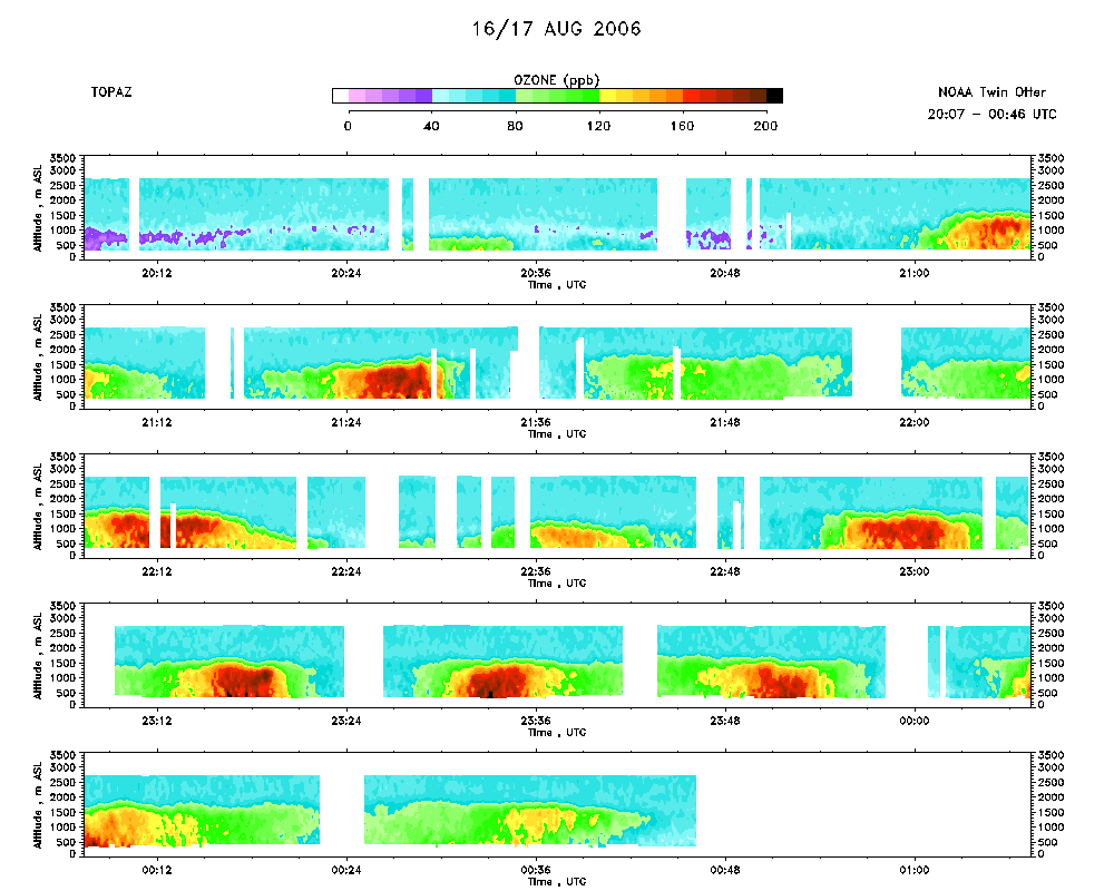 download ICARTT format data (ict file) download simple ASCII data (txt file) |
Aerosol Cross-section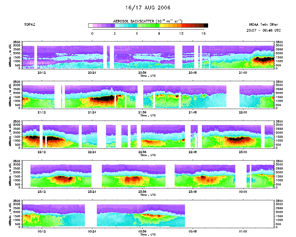 download ICARTT format data (ict file) download simple ASCII data (txt file) |
Ozone Map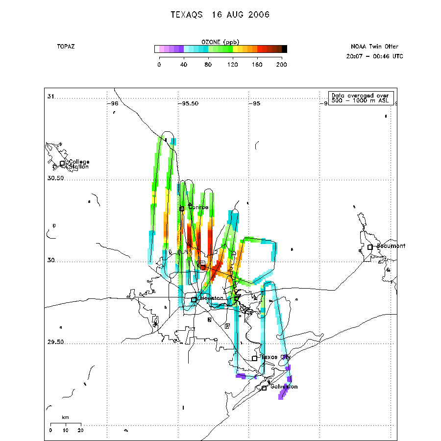 |
Mixed Layer Height Map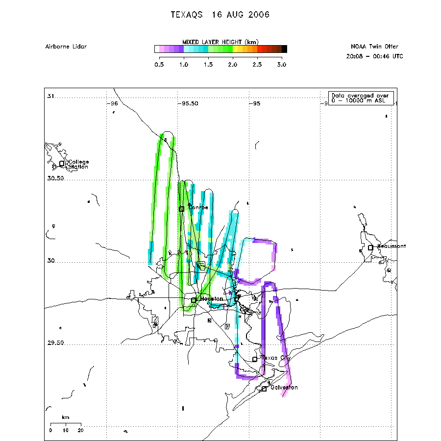 download ICARTT format data (ict file) download simple ASCII data (txt file) |