TexAQS 2006 TOPAZ Lidar data
August 15 - Final Data
| Previous Flight | Archive Calendar | Next Flight |
|---|
Flight #9
Takeoff: 14:15 CDT
Total flight time: 5.7 hours
Southerly flow was much lighter (less than 3 m/s and of variable direction during the midday period) on this day than previous days, producing ozone concentrations in excess of 150 ppb clustered near but just north of the urban/ship-channel source region. The Twin Otter sampled this with mostly north-south and diagonal flight legs across the urban and ship channel areas, repeating some legs to assess temporal changes in the ozone distribution. Visual haze and high mixed-layer depths reaching 2 km were observed in two consecutive cross sections over the urban area, compared with approx. 1.5 km BL heights elsewhere. Late-day clean, southeasterly sea-breeze flow reaching 5 m/s could be seen to undercut the polluted air columns. A Ron Brown overflight occurred at 18:26 CDT.
Select an image to view full resolution
Ozone Cross-section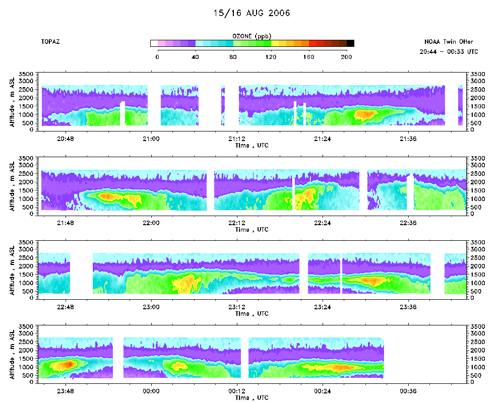 download ICARTT format data (ict file) download simple ASCII data (txt file) |
Aerosol Cross-section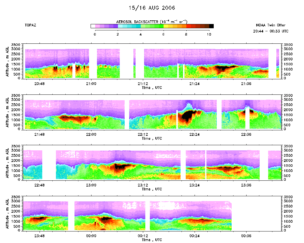 download ICARTT format data (ict file) download simple ASCII data (txt file) |
Ozone Map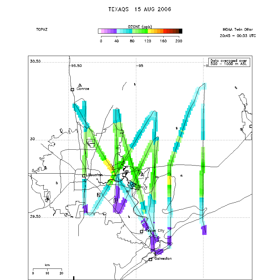 |
Mixed Layer Height Map download ICARTT format data (ict file) download simple ASCII data (txt file) |