TexAQS 2006 TOPAZ Lidar data
August 5 - Final Data
| Previous Flight | Archive Calendar | Next Flight |
|---|
Flight #4
Takeoff: 10:41 CDT
Total flight time: 3.7
This flight was designed to investigate potential stagnation of ship channel emissions over Galveston Bay and recirculation back over Houston, which frequently produces high ozone concentrations at the surface. The flight time was moved up to mid morning in an attempt to avoid cloudiness that was anticipated to increase during the day. After takeoff a line of convection was observed to the west of Galveston Bay, indicating some convergence probably associated with the Bay breeze front. The first north-south leg east of Galveston Bay showed the background level ozone concentrations. Some elevated ozone levels were observed in the region of the ship channel. Increasing clouds during the mission hampered ozone sampling west of Houston and over downtown. Although three circuits of the bow tie pattern over Houston were planned, the mission was broken off early after two circuits due to the cloud cover. Landing was at 14:06 CDT. The Twin Otter overflew the Ron Brown near Barbours Cut at 11:59 and 13:01 CDT.
Select an image to view full resolution
Ozone Cross-section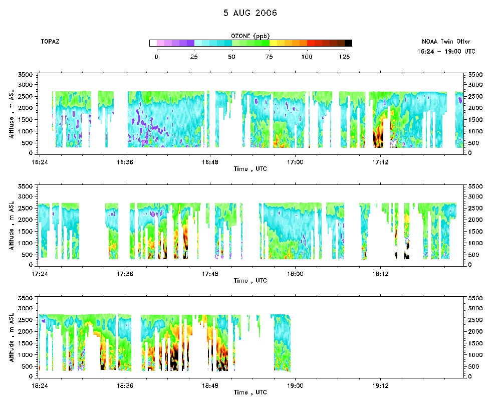 download ICARTT format data (ict file) download simple ASCII data (txt file) |
Aerosol Cross-section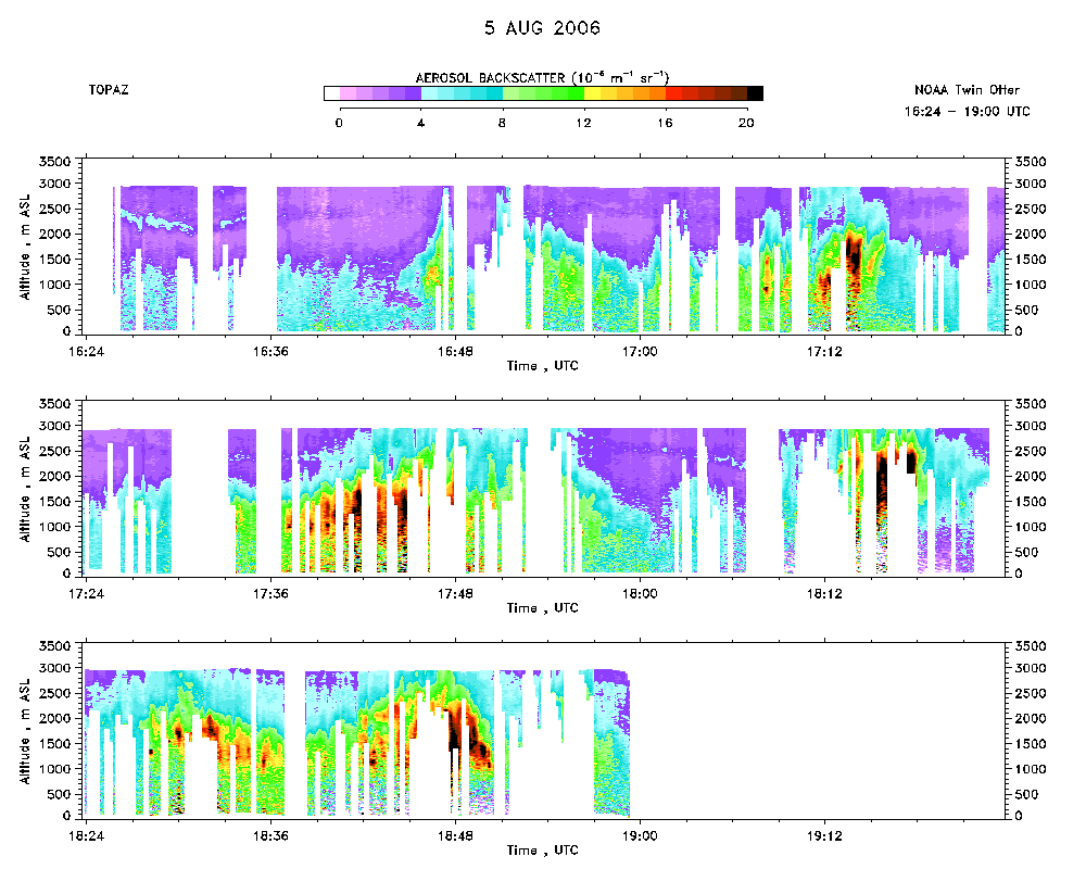 download ICARTT format data (ict file) download simple ASCII data (txt file) |
Ozone Map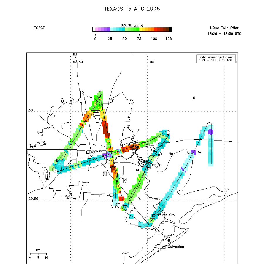 |
Mixed Layer Height Map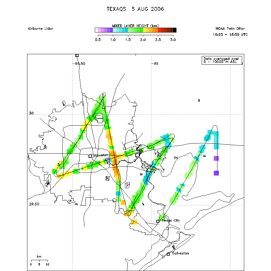 download ICARTT format data (ict file) download simple ASCII data (txt file) |