TexAQS 2006 TOPAZ Lidar data
August 8 - Final Data
| Previous Flight | Archive Calendar | Next Flight |
|---|
Flight #5
Takeoff: 14:31 CDT
Total flight time: 4.2 hours
This flight was designed to gather engineering data on the Ozone DIAL instrument by varying heater settings and photomultiplier voltages. A second objective was focused on using the sea surface for calibration of the aerosol retrieval, based on estimates of surface reflectivity versus wind speed. Several legs were flown over offshore buoys at flight levels of 10500, 6500 and 1500 ft MSL. The flight was completed successfully, ending with a pass over the Ron Brown while it was docked in Galveston.
Select an image to view full resolution
Ozone Cross-section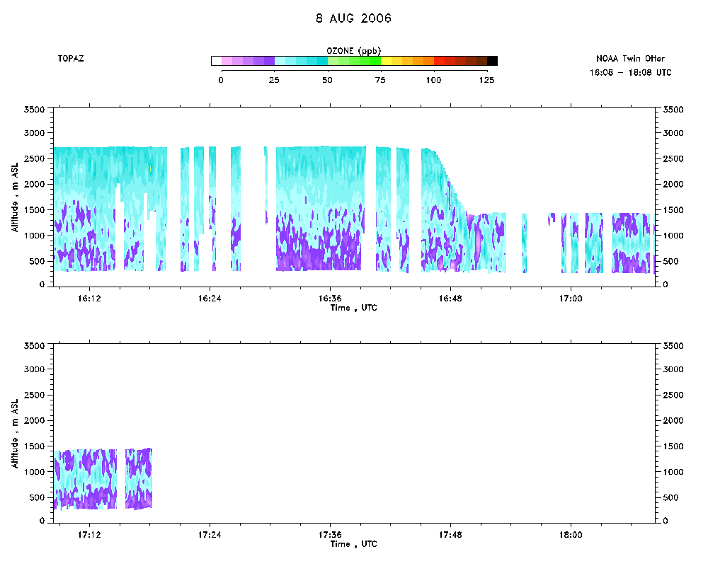 download ICARTT format data (ict file) download simple ASCII data (txt file) |
Aerosol Cross-section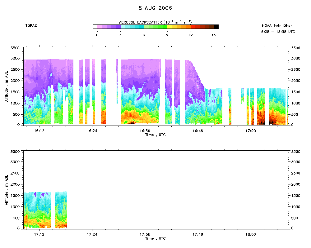 download ICARTT format data (ict file) download simple ASCII data (txt file) |
Ozone Map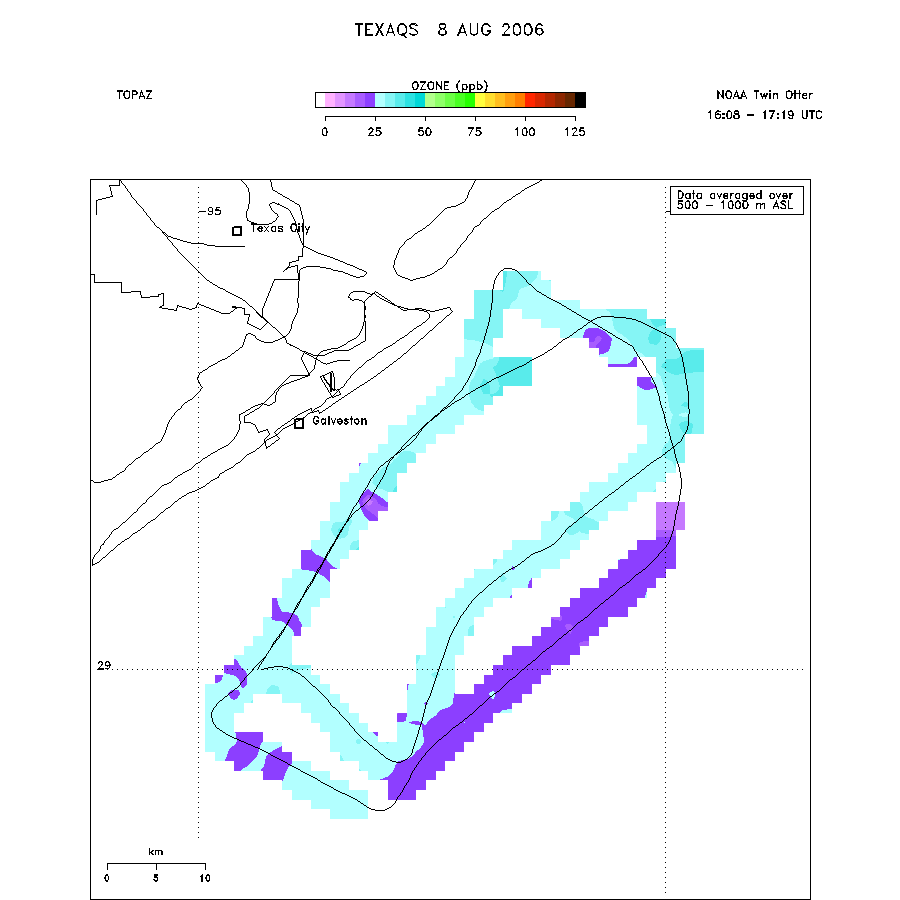 |