Postcard from the Field: From the Ground to the Air, CSL Scientists get an up close look at Dynamics and Emissions from Western Wildfires. 13 September 2022
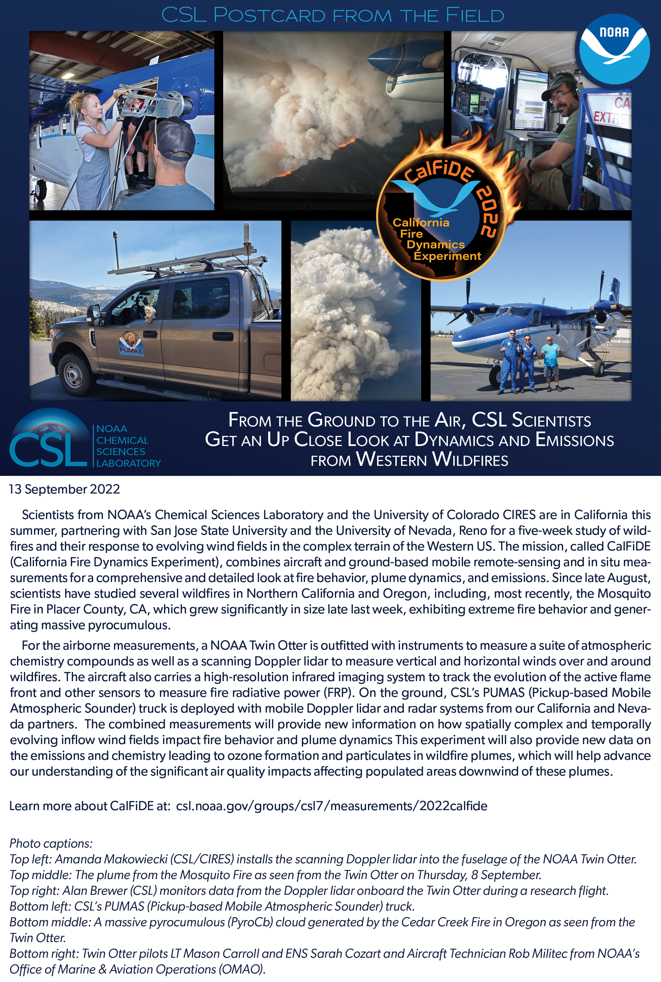
Scientists from NOAA's Chemical Sciences Laboratory and the University of Colorado CIRES are in California this summer, partnering with San Jose State University and the University of Nevada, Reno for a five-week study of wildfires and their response to evolving wind fields in the complex terrain of the Western US. The mission, called CalFiDE (California Fire Dynamics Experiment), combines aircraft and ground-based mobile remote-sensing and in situ measurements for a comprehensive and detailed look at fire behavior, plume dynamics, and emissions. Since late August, scientists have studied several wildfires in Northern California and Oregon, including, most recently, the Mosquito Fire in Placer County, CA, which grew significantly in size late last week, exhibiting extreme fire behavior and generating massive pyrocumulous.
For the airborne measurements, a NOAA Twin Otter is outfitted with instruments to measure a suite of atmospheric chemistry compounds as well as a scanning Doppler lidar to measure vertical and horizontal winds over and around wildfires. The aircraft also carries a high-resolution infrared imaging system to track the evolution of the active flame front and other sensors to measure fire radiative power (FRP). On the ground, CSL's PUMAS (Pickup-based Mobile Atmospheric Sounder) truck is deployed with mobile Doppler lidar and radar systems from our California and Nevada partners. The combined measurements will provide new information on how spatially complex and temporally evolving inflow wind fields impact fire behavior and plume dynamics This experiment will also provide new data on the emissions and chemistry leading to ozone formation and particulates in wildfire plumes, which will help advance our understanding of the significant air quality impacts affecting populated areas downwind of these plumes.
Top left: Amanda Makowiecki (NOAA/CIRES) installs the scanning Doppler lidar into the fuselage of the NOAA Twin Otter. Top middle: The plume from the Mosquito Fire as seen from the Twin Otter on Thursday, 8 September.
Top right: Alan Brewer (NOAA) monitors data from the Doppler lidar onboard the Twin Otter during a research flight. Bottom left: CSL's PUMAS (Pickup-based Mobile Atmospheric Sounder) truck.
Bottom middle: A massive pyrocumulous (PyroCb) cloud generated by the Cedar Creek Fire in Oregon as seen from the Twin Otter.
Bottom right: Twin Otter pilots LT Mason Carroll and ENS Sarah Cozart and Aircraft Technician Rob Militec from NOAA's Office of Marine & Aviation Operations (OMAO).