A .gov website belongs to an official government organization in the United States.
A lock () or https:// means you've safely connected to the .gov website. Share sensitive information only on official, secure websites.

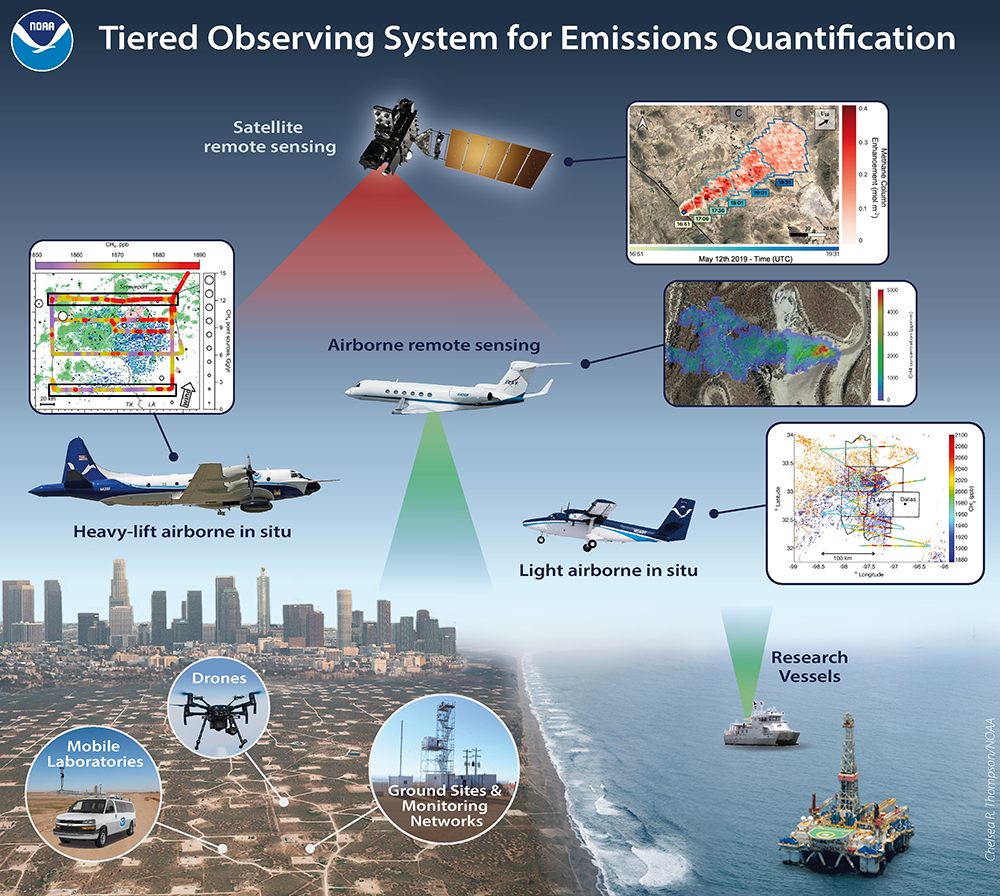
Long-term monitoring of air pollutant emissions requires a comprehensive observing system that is composed of ground monitoring systems as well as airborne and satellite remote sensing systems. The latter are powerful but nascent technologies that need rigorous verification. NOAA airborne surveys and remote sensing approaches represent the currently best-available methodology to validate and augment new remote sensing technology. OAR has developed state-of-the-art research aircraft instrumentation and has a long history in the execution of airborne campaigns. Based on this proven expertise, OAR will derive emissions using airborne surveys involving several detection and analysis methods.
Satellite observations augment ground monitoring capability and have become a viable source of information – they are the "eyes in the sky" that provide routine daily observations for long periods of time and thereby provide continuity and trends from regional to global scales. While well calibrated ground-based sensors often provide the most accurate GHG and pollutant measurements, NOAA and its partner agencies use a fleet of geostationary and polar-orbiting satellites to observe emissions from large sources as well as derive concentrations assuming a well-mixed atmosphere. In the last decade, a host of commercial and non-profit methane observing satellites have come into the fore, including GHGSat, MethaneSAT, Carbon Mapper and many others (Jacob et al., 2022). Civilian and commercial/non-profit satellite instruments serve diverse needs by observing emissions from different source sectors. However, detection and quantification depend on assumptions that require thorough validation:
Reference: McDonald, B.C., J. He, C. Harkins, J. de Gouw, N. Elguindi, R. Duren, J. Gilman, E.A. Kort, C.E. Miller, J. Peischl, G. Pétron, and C. Thompson, A Review of U.S. Oil and Gas Methane and Air Pollutant Emissions , in Environmental Magazine, Air and Waste Management Association, (2023).
Reference: Jacob, D. J., Varon, D. J., Cusworth, D. H., Dennison, P. E., Frankenberg, C., Gautam, R., Guanter, L., Kelley, J., McKeever, J., Ott, L. E., Poulter, B., Qu, Z., Thorpe, A. K., Worden, J. R., and Duren, R. M.: Quantifying methane emissions from the global scale down to point sources using satellite observations of atmospheric methane, Atmospheric Chemistry and Physics, doi:10.5194/acp-22-9617-2022, 2022.