Weather Forecasts
Daily Weather Summary
June 27, 1999:
Current 500 mb shortwave is moving away, and in its wake, there will be some drying across middle TN for a while this afternoon, bringing some breaks in the clouds. However, the air mass is still quite moist and unstable, and as a mesoscale boundary approaches from the SW, a few showers/thunderstorms may develop and move across TN this afternoon. High: 86 Low: 73 Mixing Hgt.: ~1200 meters. There is also some wind shear in the PBL, with winds at 850 mb from the W 20-25 kts.
Tomorrow's Forecast
June 28, 1999:
Lots of moisture still in the atmosphere on Monday. Another 500 mb shortwave shown by the ETA model racing toward TN on Monday, so expect mostly cloudy skies, with some rain and thunderstorms to once again move through on Monday. 850 mb winds WNWly, still around 25 kts. High: 83 Low: 72
Day after Tomorrow Forecast
June 29, 1999:
No significant drying even by Tuesday. Another 500 mb shortwave may approach Tuesday afternoon, so given this, along with the moisture, expect at least some cloudiness and scattered, mainly afternoon and evening showers/thunderstorms. High: 89 Low: 72
Outlook
MRF model still tries to dry us out as we go into Wed. and Thu., as the upper-level westerlies retreat to the north. However, given the recent continuous parade of 500 mb troughs, not so sure of this, since the MRF has been trying to do this before. In any event, expect chances for mainly afternoon and evening thunderstorms into the end of the week, but rain chances may drop off as we get past Tuesday. Highs: near 90. Lows: 70 to 75
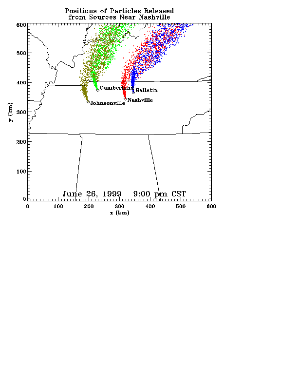
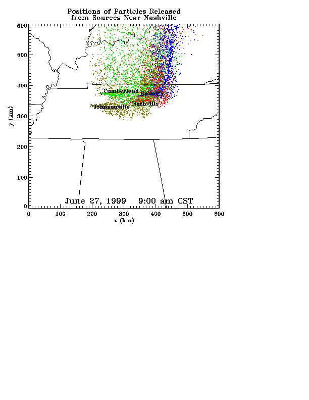
Profiler Plume Depiction
The following shows a depiction of plume locations as predicted by the profiler winds assimilated into a one-dimensional boundary layer model. The top image shows particle positions as of the previous evening. The lower image shows particle positions as of the following morning for particles released beginning the previous noon.
Forecast Plumes
The following gives a depiction of plume locations using a Lagranagian Particle Model coupled to the Regional Spectral Model. The RSM is run daily in a forecast mode at TVA Muscle Shoals, Alabama.
Plume based on 00z initial fields (mpg file optimized for QuickTime)
Plume based on 12z initial fields (mpg file optimized for QuickTime)
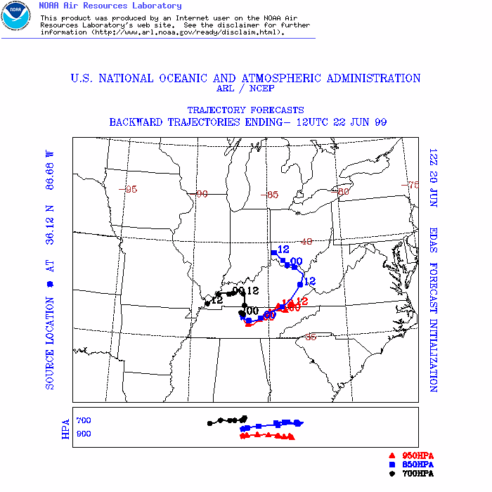
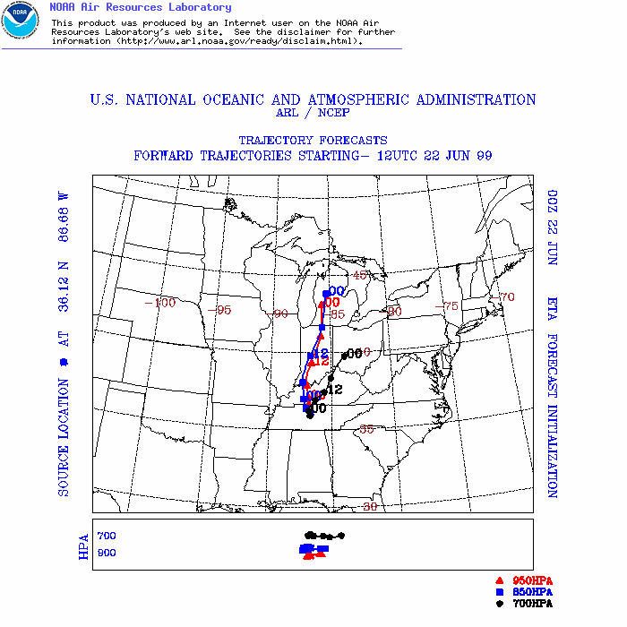
ARL Hysplit Trajectories
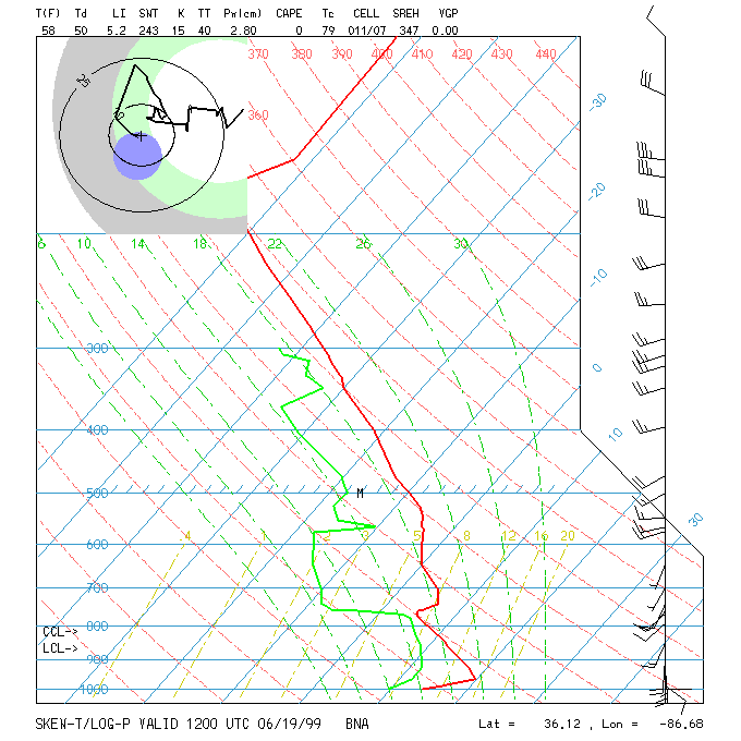
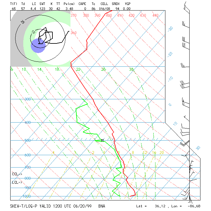
Nashville Soundings