Weather Forecasts
Daily Weather Summary
July 5, 1999:
Surface/850 mb high centered just to our SE, and this high drifts slowly west the next 48 hours. So, expect very light winds today, mainly SWly. The air mass from 950 mb up is a little drier today, so expect less Cu, and little if any chance of isolated thunderstorms. High: 95 Low: 73
Mixing Hgt. 2200 m MSL.Tomorrow's Forecast
July 6, 1999:
High moves to our west, so expect NWly winds at 850 mb, 5-10 kts. Scattered Cu during the afternoon, with maybe an isolated thunderstorm at 1 or 2 spots around Tennessee. High: 94 Low: 72
Day after Tomorrow Forecast
July 7, 1999:
Looks like weak frontal boundary will pass through Tennessee on Wednesday, but with limited moisture, expect only chances for showers as the front moves through. High: 92. Low: 69. Front brings drier air in for a little while.
Outlook
Flow becomes more southerly as we approach the weekend, so after a dry day on Friday, scattered afternoon/evening thunderstorms may return over the weekend, but the weather still looks good overall. Highs: 88-92. Lows: 68-72.
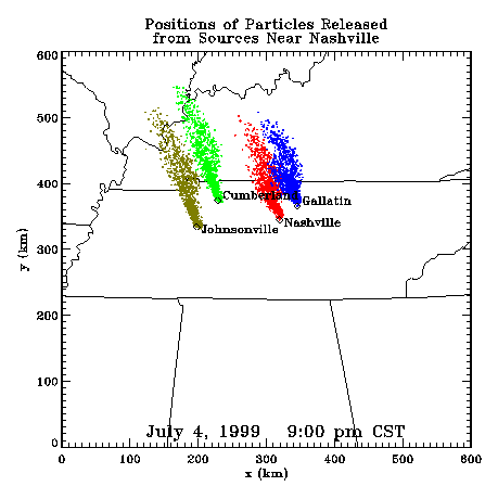
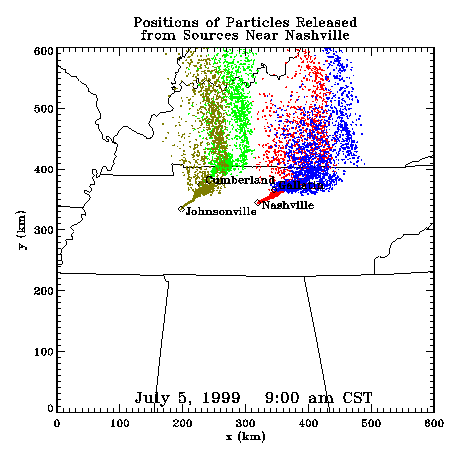
Profiler Plume Depiction
The following shows a depiction of plume locations as predicted by the profiler winds assimilated into a one-dimensional boundary layer model. The top image shows particle positions as of the previous evening. The lower image shows particle positions as of the following morning for particles released beginning the previous noon.
Forecast Plumes
The following gives a depiction of plume locations using a Lagranagian Particle Model coupled to the Regional Spectral Model. The RSM is run daily in a forecast mode at TVA Muscle Shoals, Alabama.
Plume based on 00z initial fields (mpg file optimized for QuickTime)
Plume based on 12z initial fields (mpg file optimized for QuickTime)
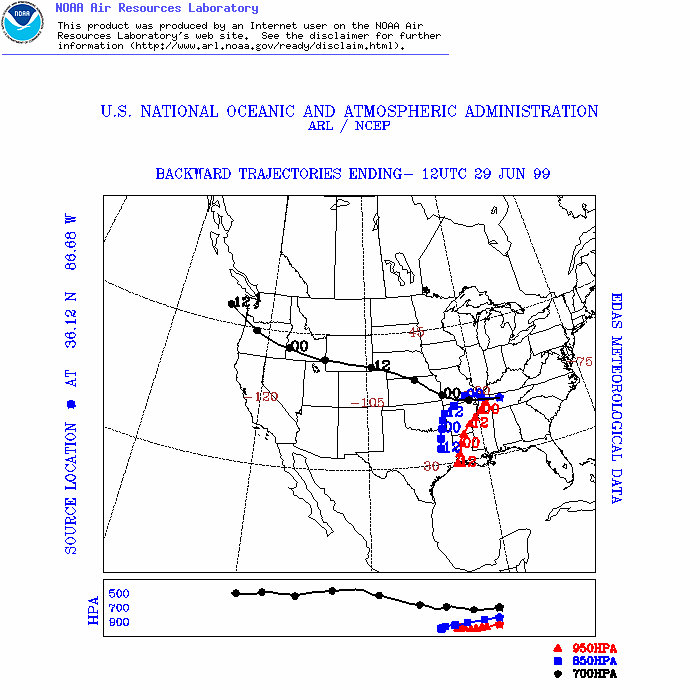
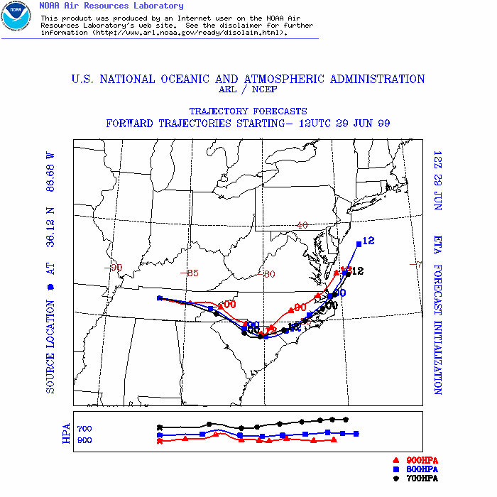
ARL Hysplit Trajectories
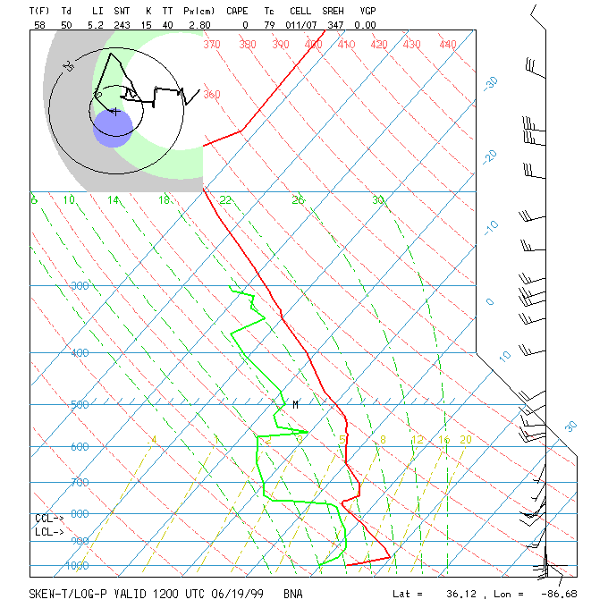
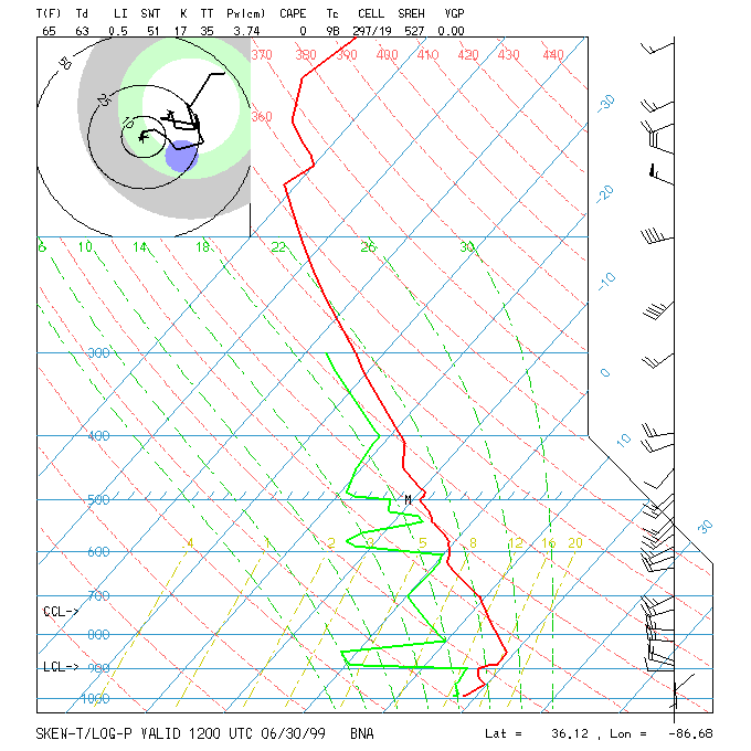
Nashville Soundings