Weather Forecasts
Daily Weather Summary
July 15, 1999:
Most of the low morning St clouds and fog have burned off now, but on satellite a zone of mesoscale convergence can be seen over middle Tennessee, basically from BNA on to the W and S. In this zone, the Cu clouds are greatly enhanced, and a few showers are developing, as seen on OHX 88D radar. With further heating, a few more showers, and maybe some isolated thunderstorms, will develop in this band. The band was moving little. Otherwise, expect Cu clouds. High: 87. Low: 70. Mixing Hgt.: around 2100 m MSL. 850 mb flow will be generally out of the S or SW, around 10 kts.
Tomorrow's Forecast
July 16, 1999:
Weak little surface trough may allow additional scattered thunder storms to develop tomorrow, in the moist air mass across Tennessee. Still no big deal, with most of the day being dry. High: 86 Low: 71.
Day after Tomorrow Forecast
July 17, 1999:
Partly cloudy skies with scattered showers/thundershowers. No big change. High: 87. Low: 72.
Outlook
For Sunday and Monday, expect the Bermuda high to be in control, bringing partly cloudy skies, isolated afternoon/evening thunderstorms. Highs: 89-93. Lows: 70-73.
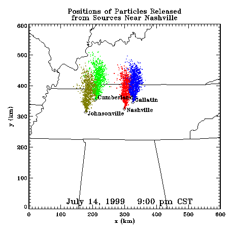
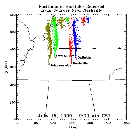
Profiler Plume Depiction
The following shows a depiction of plume locations as predicted by the profiler winds assimilated into a one-dimensional boundary layer model. The top image shows particle positions as of the previous evening. The lower image shows particle positions as of the following morning for particles released beginning the previous noon.
Forecast Plumes
The following gives a depiction of plume locations using a Lagranagian Particle Model coupled to the Regional Spectral Model. The RSM is run daily in a forecast mode at TVA Muscle Shoals, Alabama.
Plume based on 00z initial fields (mpg file optimized for QuickTime)
Plume based on 12z initial fields (mpg file optimized for QuickTime)
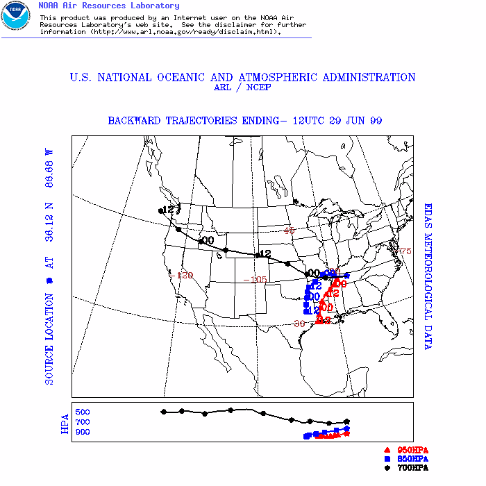
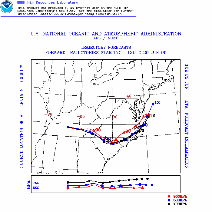
ARL Hysplit Trajectories
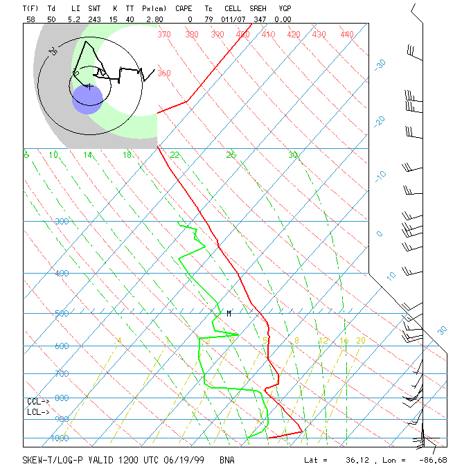
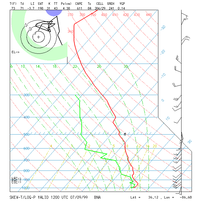
Nashville Soundings