A .gov website belongs to an official government organization in the United States.
A lock () or https:// means you've safely connected to the .gov website. Share sensitive information only on official, secure websites.
5 October 2012

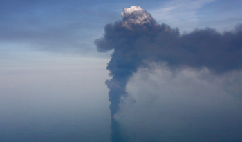
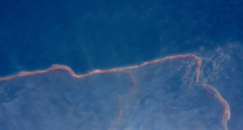
In April 2010, an explosion and subsequent fire destroyed the BP Deepwater Horizon (DWH) offshore drilling unit, and vast amounts of crude oil began gushing into the Gulf of Mexico.
Sixteen hundred miles away, NOAA and CIRES researchers from CSD were hard at work in California, using the NOAA WP-3D research airplane outfitted as a "flying chemical laboratory" to investigate climate and air quality issues in California.
Quick thinking and a lot of cooperation would lead to a convergence of the two situations. As the oil spill crisis continued, CSD scientists and colleagues interrupted their California work to go to the Gulf, where they made atmospheric measurements of many different kinds of gases and particles in the air near the spill and the surrounding area. Those measurements answered urgent questions about the air quality in the Gulf region – and even about oil spill itself. Later this month, Colorado Governor John Hickenlooper will recognize this work of the NOAA / CIRES Deepwater Horizon Atmospheric Science Team – 34 CSD researchers in all – with the Governor's Award for High-Impact Research.

Air Quality Concerns: As the DWH disaster unfolded, many concerns centered on the potential health impacts from exposure to airborne chemicals from the oil itself, as well as dispersants being used, the byproducts of the controlled burns, and the atmospheric degradation of all the contaminants. Some of the earliest measurements at the scene had revealed toxic organic compounds in air samples collected in the vicinity of the oil slick, lending a sense of urgency and highlighting the need to bring new capabilities to bear in assessing the risks. The Team measured a wide array of organic and other pollutants in the Gulf air – more air pollutants, at more sensitive levels, and over a broader region than covered by any other efforts in the Gulf. Combining the measurements and air quality models, the Team assessed how the pollution was being transformed and transported to a broader region. The project was coordinated with other agencies on the scene (the Environmental Protection Agency and the Occupational Safety and Health Administration) by sharing data, comparing analyses, and utilizing the other agencies' complementary measurements. Within 24 hours of their first flight, the Team relayed the news that the levels of toxics and other air pollutants were within acceptable limits for workers and the public downwind. Within about a month, the Team had conducted the Gulf measurements, issued a more comprehensive preliminary report of findings, and even returned to California to complete their original mission—a phenomenal and exhausting round-the-clock effort of collecting and processing the data.

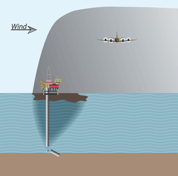
A Surprising and Invaluable New Technique: In addition to the air quality-related findings, the Team's efforts yielded an unexpected new technique to address other urgent questions arising form the oil spill (How much oil was leaking? Where was it going?). In the early days of the DWH disaster, uncertainties about these questions made it hard for the responders to assess potential impacts and develop appropriate response plans. The leak was among the largest ever recorded and was especially challenging because the point of release was into the deep ocean, about a mile beneath the sea surface. The Team showed that measurements they were making in the air – hundreds of feet above the site of the oil spill – could be used to estimate the rate of the oil leak deep below the ocean surface. Hydrocarbons in the air from the evaporating oil gave the telltale signature of the oil leak below. The Team estimated the leak rate by combining the airborne hydrocarbon measurements with data on the chemical makeup of the leaking gas and oil. The estimate did not differ greatly from the estimates that had been made using other approaches, such as underwater footage of the leaking pipe. The atmospheric hydrocarbon patterns also enabled the researchers to estimate where the gas and oil was going in the environment (the species that dissolved; the species that evaporated; the species that remained undissolved). This novel work gives an entirely new, and independent, way to assess oil spills from airborne platforms—an approach that could be valuable for future oil spills, especially those in remote, hard-to-access regions or in the very deep ocean. In fact, the technique has already been successfully applied to assess another oil spill, in the North Sea in March 2012.

The NOAA and CIRES research team will receive the Governor's Award on October 25th in a ceremony at the University of Colorado (2012 Governor's Award for High-Impact Research Awards Ceremony & Reception). But the story is far from finished, as the researchers continue to "mine" the very rich data set from their mission to the Gulf – and scientists and emergency planners from the U.S. and other countries consider using this powerful new approach to assess future oil spills.
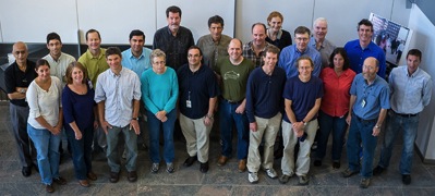
The Team of 34 NOAA and CIRES scientists being honored with the Governor's Award for High-Impact Research: Kenneth C. Aikin, Ravan Ahmadov, Wayne M. Angevine, Roya Bahreini, Jerome Brioude, Charles A. Brock, Joost A. de Gouw, Barbara Ervens, David W. Fahey, Fred C. Fehsenfeld, Gregory J. Frost, Ru-Shan Gao, John S. Holloway, Daniel A. Lack, Justin M. Langridge, Stuart A. McKeen, James F. Meagher, Ann M. Middlebrook, Daniel M. Murphy, J. Andrew Neuman, John B. Nowak, David D. Parrish, Jeffrey Peischl, Anne E. Perring, Ilana B. Pollack, A.R. Ravishankara, James M. Roberts, Thomas B. Ryerson, Joshua P. Schwarz, Ryan Spackman, Harald Stark, Michael Trainer, Carsten Warneke, and Laurel A. Watts.