A .gov website belongs to an official government organization in the United States.
Secure .gov websites use HTTPS
A lock () or https:// means you've safely connected to the .gov website. Share sensitive information only on official, secure websites.
2021 News & Events
Instrument installed on Commerce building to track weather and greenhouse gas emissions
19 April 2021 adapted from the story by NOAA Communications
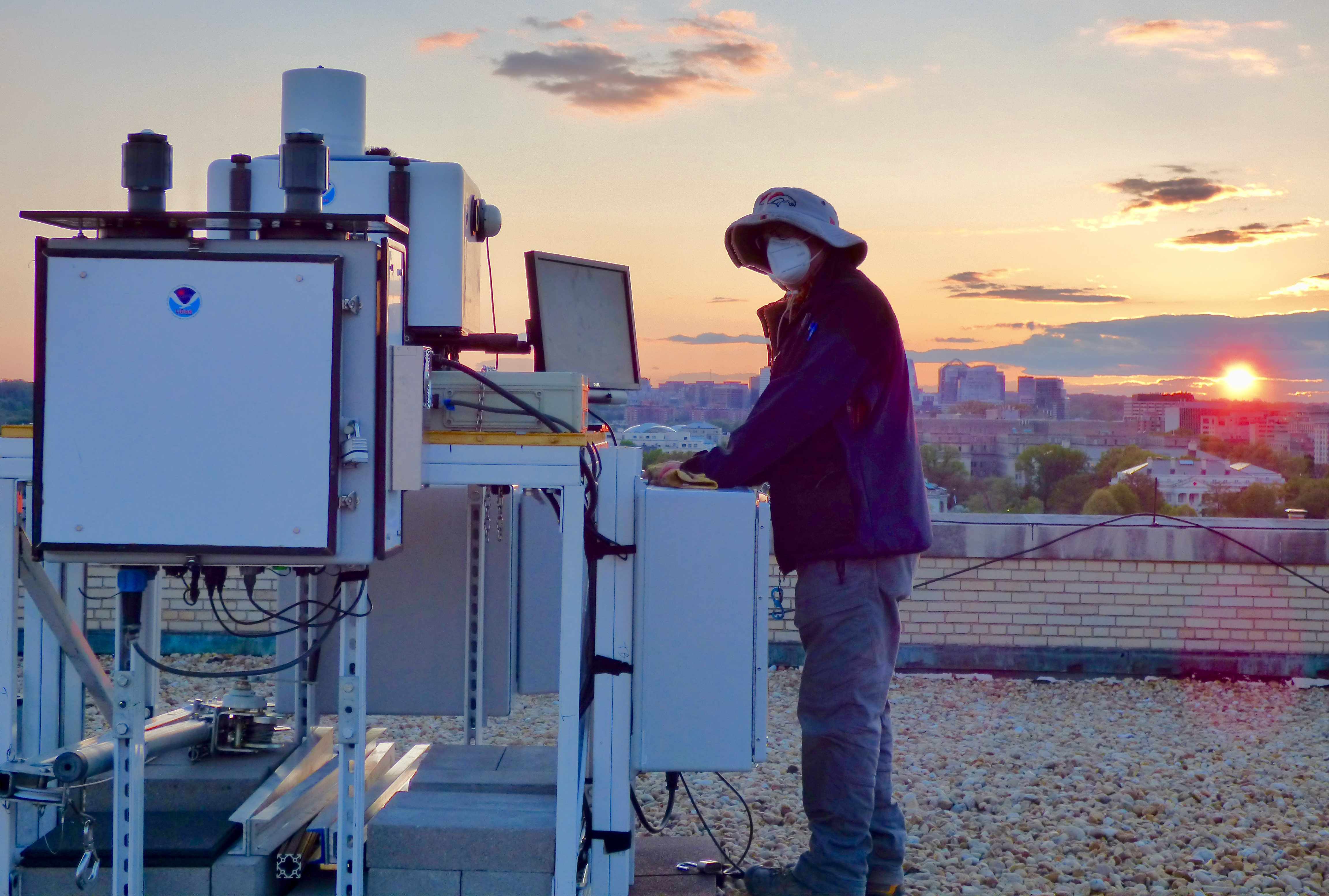
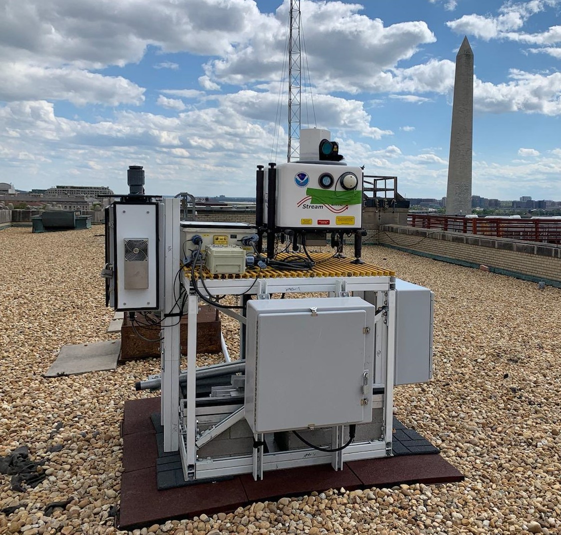
Measuring greenhouse gases. NOAA and NIST installed a Doppler lidar instrument on top of the Department of Commerce's Herbert C. Hoover Building in Washington, D.C. for a research project studying urban greenhouse gas emissions. Photos: Scott Sandberg, NOAA and Tyler Boyle, NIST
NOAA and NIST have installed a Doppler lidar instrument to an existing weather station on top of the Department of Commerce's Herbert Clark Hoover Building in Washington, D.C. to measure wind flow and turbulence in the lowest part of the atmosphere for a research project studying greenhouse gas emissions in the Capitol area.
Lidar, which stands for Light Detection and Ranging, is a remote sensing method that uses the light from a pulsed laser reflected off distant objects to make measurements of the atmosphere, similar to how radar uses radio waves to gather information on thunderstorms. Scanning Doppler lidars can make high-resolution measurements of horizontal winds, and resolve turbulent processes in the atmosphere to generate data required by sophisticated atmospheric transport models.
"This collaboration between NOAA and NIST will increase our understanding of urban wind, weather, greenhouse gas emissions and other pollution, which will help us improve weather and climate models, and support our national security," said Craig McLean, assistant administrator for NOAA Research.
The Doppler lidar, which will be operated by NOAA's Chemical Sciences Laboratory, was added to an existing weather station called DCNet that was built by NOAA's Air Resources Laboratory after September 11, 2001, to provide a highly localized ability to track the dispersion of pollutants or hazardous substances in the urban landscape. Installation of the lidar was completed on April 16th by NOAA and NIST engineers Scott Sandberg and Tyler Boyle.
The D.C. installation will contribute data to NIST's Northeast Corridor Urban Test Bed project, which measures anthropogenic greenhouse gas emissions and other pollutants in urban areas along the U.S. East Coast. The Air Resources Laboratory also uses the DCNet data to help the intelligence community understand how potentially hazardous gases and/or particles could be dispersed into urban areas.
The project is a follow-on of a similar collaboration between NOAA and NIST in Indianapolis. The Indiana Flux Experiment, the first NIST urban greenhouse measurements testbed, develops and evaluates methods for measuring and modeling changes in greenhouse gas emissions in an urban setting.
"Working with NOAA will greatly improve NIST's measurement science research efforts in developing measurement tools mapping greenhouse gas emissions at the city scale," said James Whetstone, Director of NIST's Greenhouse Gas Measurements Program. "The atmospheric data provided by this lidar will be used to improve performance of numerical weather models that are vital to emissions research."
Since 2003, NOAA has maintained DCNet to collect meteorological data, such as wind speed and direction and air turbulence at frequent intervals to refine NOAA's atmospheric transport models for urban areas and as a resource to help define areas of risk from potential hazardous material releases. NOAA collects similar data at Dulles International and Reagan National airports. The central D.C. location fills a gap in the network and provides a better view of the Capitol region's meteorology and atmospheric dynamics.