May 29, 2017
< Previous Day | Archive Calendar | Next Day >
Daily Summary:
Monday, May 29
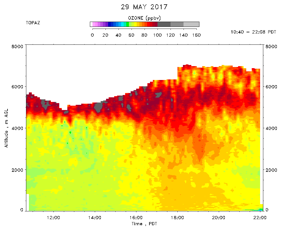
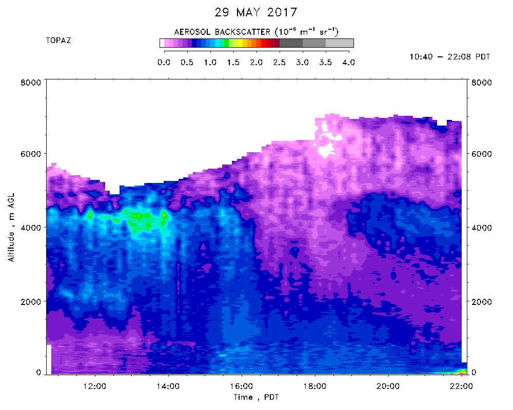
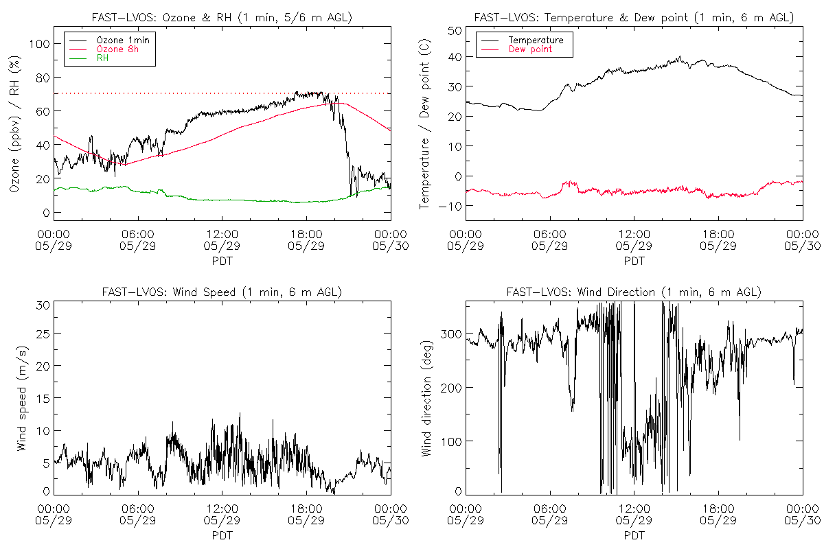
TOPAZ data were taken from 10:40 - 22:08 PDT. Hot (39 C max), light winds, isolated Cu clouds over the nearby mountains. Cirrus shield associated with the West Coast trough was moving in from the SW. The BL rose to just over 4 km AGL in the afternoon, as evidenced by the MicroDop lidar and the afternoon sounding at McCarren Airport. The deep BL entrained the bottom part of the high ozone layer (80-90 ppbv), that had been observed by TOPAZ between 4 and 7 km AGL for several days in a row. The air in this layer was very dry, so the high ozone likely originated in the UTLS. The entrained ozone mixed down to surface resulting in a several-ppbv jump in ozone concentration.