Instruments

PlatformMeasurementPILocation
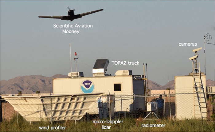
TOPAZ lidarozone and aerosol backscatter profilesNOAA ESRL CSDNLVA
mircoDop lidarmixed layer depth and vertical entrainmentNOAA ESRL CSDNLVA
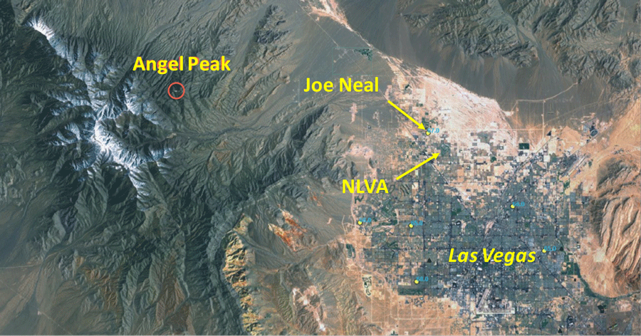
mobile sampling labCO, N2O, H2O, NO, NO2, NOy, O3NOAA ESRL CSDAngel Peak
ozonesondesvertical profiles into the stratosphereNOAA ESRL GMDJoe Neal
Mooney research aircraftCO2, CH4, O3, and NOx,
horizontal wind, temperature and humidity
Scientific AviationNLVA
NASA AJAX research aircraftO3, H2O, CH4, and CO2NASA ARCNASA ARC
field location map
Las Vegas area map identifying FAST-LVOS research locations.
ground site aerial
Operations at the Clark County ground site on Angel Peak. Image: Andy Langford, NOAA.
ground site
Instruments identified at the North Las Vegas Airport (NLVA) ground site during a Scientific Aviation Mooney flyover. Image: Andy Langford, NOAA.