FAST-LVOS 2017 TOPAZ Data
June 4, 2017
< Previous Day | Archive Calendar | Next Day >
Daily Summary:
Sunday, June 4
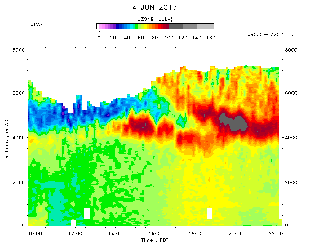
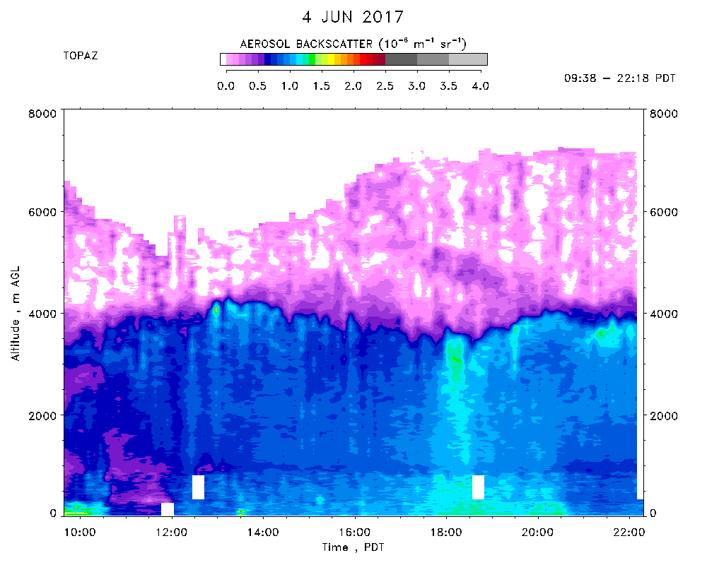
TOPAZ data were recorded from 9:38 - 22:18 PDT.
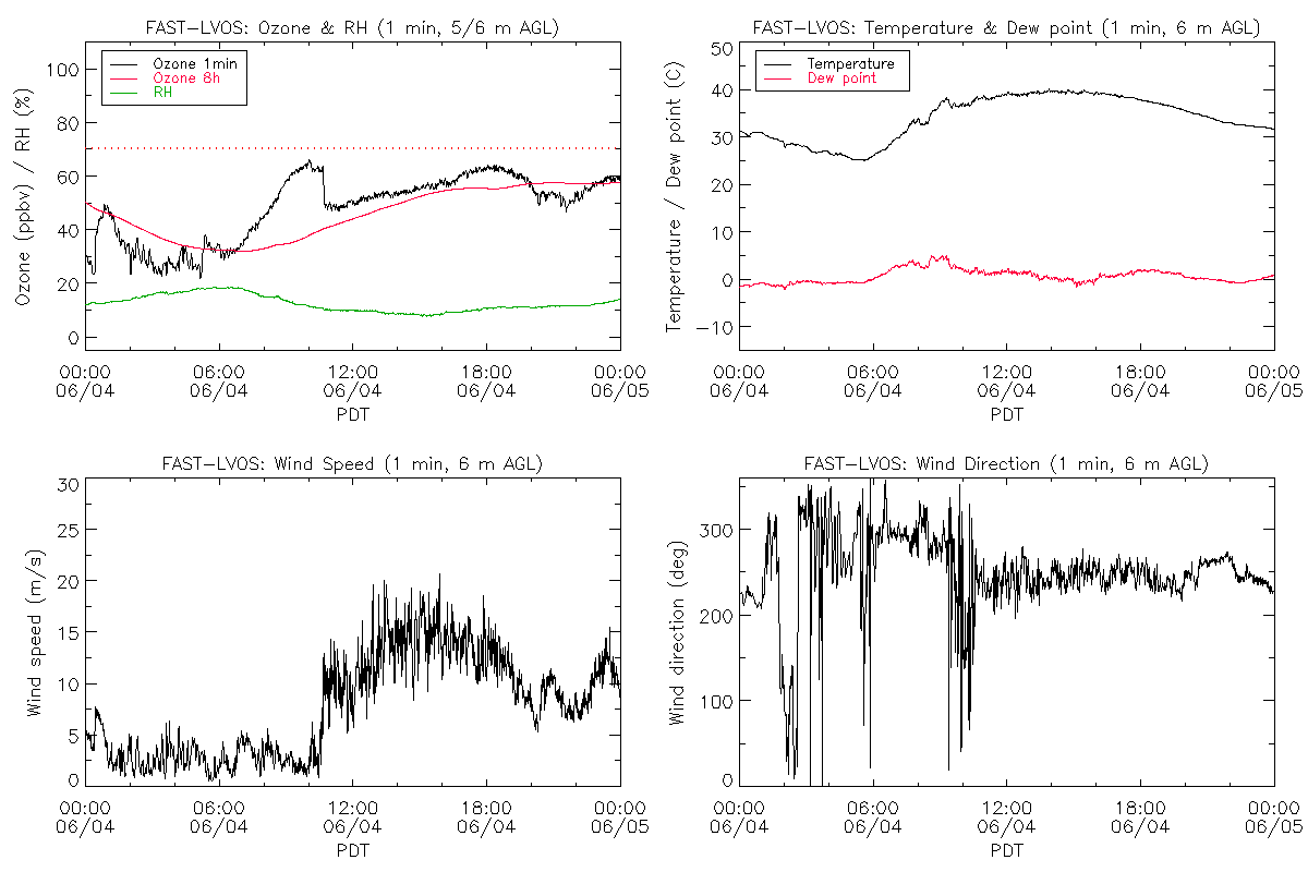
Very hot again with an offical max of 102F at the NLVA NWS station. Clear skies with a few scattered Cu over the mountains. Very light northwesterly winds in the early morning that shifted abruptly to strong (15 m/s mean) southwesterly winds associated with a trough moving into the PNW after 1030 PDT. Surface ozone at the NLVA rose quickly to about 65 ppbv before the wind shift, then fell to less than 50 ppbv, after which it slowly ramped back up to 65 ppbv. The strong wind kept a constant dust layer in motion near the surface, and contributed to very deep mixing to more than 4 km. The ozone concentrations were 50-60 ppbv up to about 4 km agl in the morning, with less than 40 ppbv between 4.5 and 5.5 km agl. A high ozone layer corresponding to a dry air streamer in the GOES WV imagery became prominent around 4 km asl at 1400 PDT, and was slowly nibbled from below by the deep mixed layer. A second layer with more than 100 pbv of ozone(and more aerosol) descended and merged with the first layer around 1900 PDT. Both the surface winds and ozone subsided briefly between 1900 and 2000 PDT, but then shifted to the west and increased again. The turbulent mixing aloft continued until after 2100 PDT.