FAST-LVOS 2017 TOPAZ Data
June 20, 2017
< Previous Day | Archive Calendar | Next Day >
Daily Summary:
Tuesday, June 20
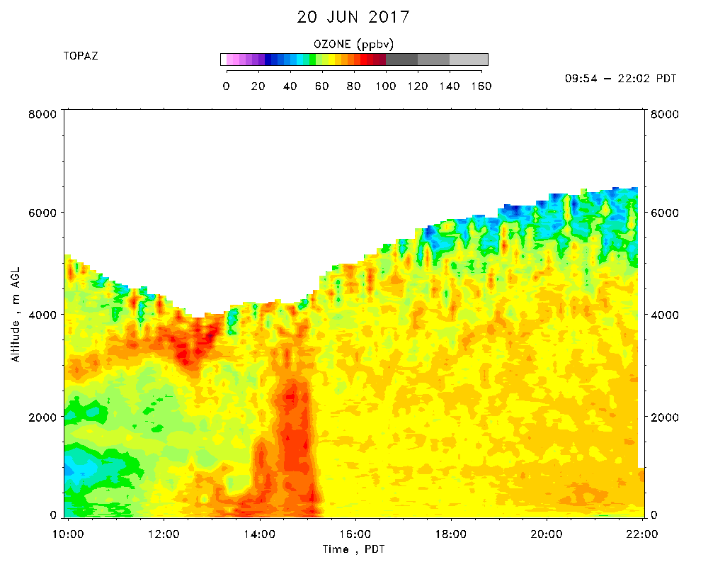
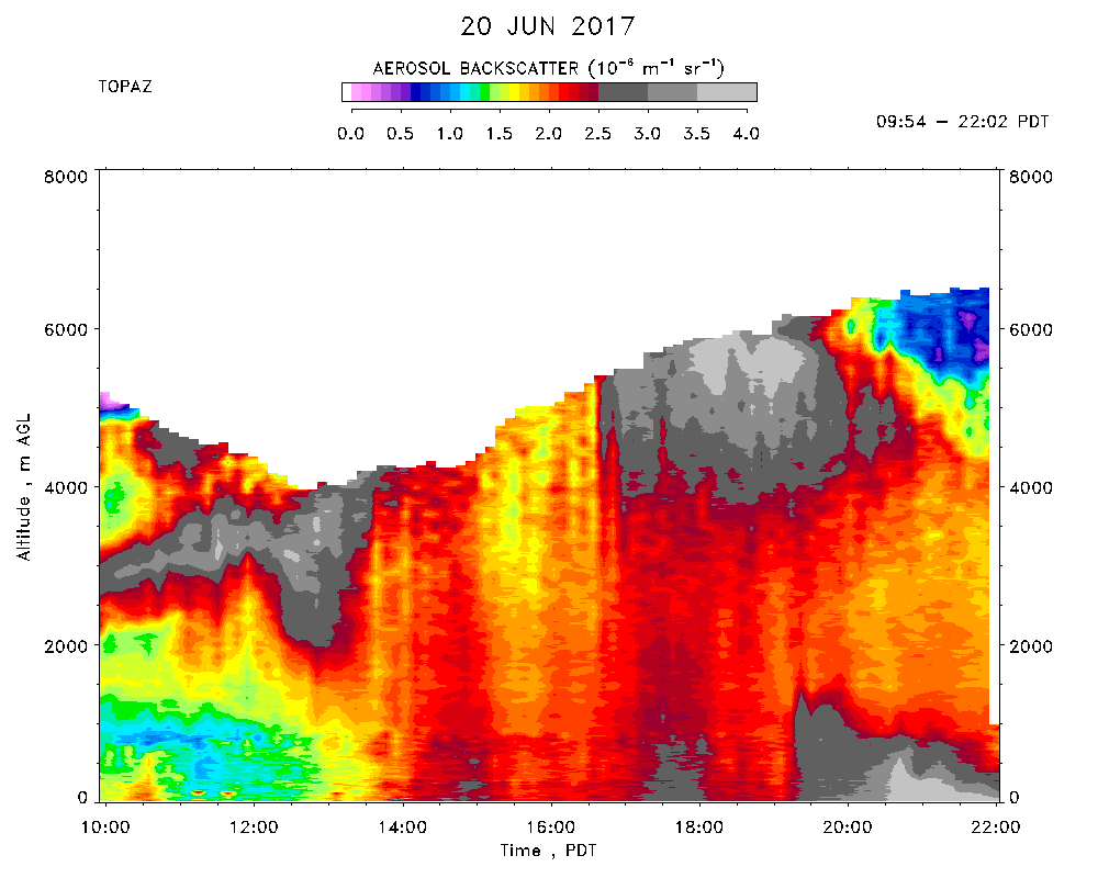
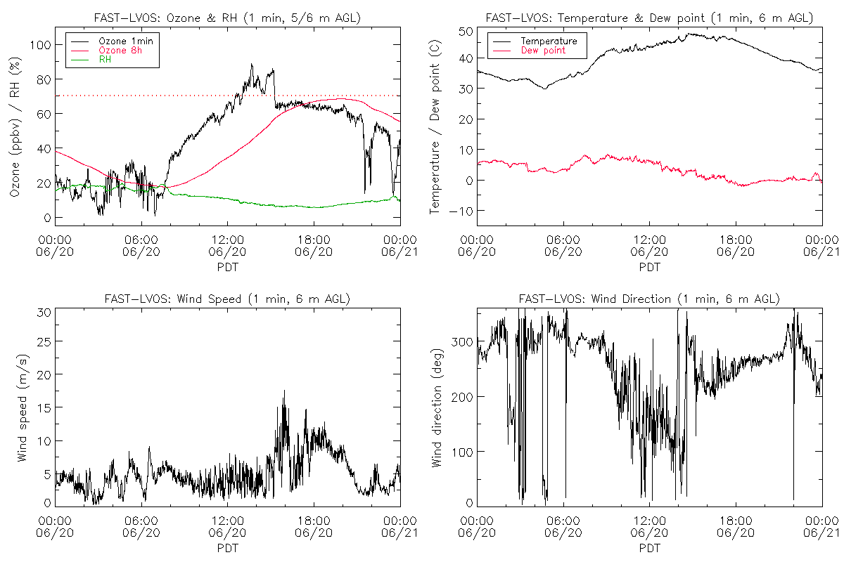
TOPAZ data were recorded from 09:54 - 22:02 PDT. Extremely hot again (max. of 48 C at the lidar site) with the all time Las Vegas record of 117 F tied at McCarran Intl Airport. Scattered fair weather cumulus clouds formed over the nearby mountain ranges with a few drifting over the Las Vegas Valley in the late afternoon. Very light NW winds in the early morning that rotated CCW to the east between 0900 and 1500 PDT. Surface ozone at NLVA increased rapidly during this time and reaching 84 ppbv around 1300 PDT; the 1 h mean at Walter Johnson peaked at 78 ppbv between 1300 and 1400 PDT. The mixed layer grew explosively to more than 5 km deep around 1500 PDT and the surface winds abruptly increased to nearly 15 m/s, rotating first to the NW and then to the SW. This caused the surface ozone concentrations to drop to about 65 ppbv where they remained with very little variation into the early evening. The SW winds blew the ozone towards Apex, which measured hourly concentrations of 75 to 76 ppbv during the late afternoon. The initial TOPAZ measurements showed the high aerosol/ozone layer attributed to the AZ and MEX fires and seen the day before near 3.5 km asl, but with higher aerosol loadings and 70-80 ppbv of ozone. This layer was apparently entrained as the ML deepened after 1400 PDT, but the resulting dilution, mixing, and venting decreased and homogenized the concentrations to an average value of around 64 ppbv. The 00 UT (17 PDT) VEF sounding put the top of the ML at more than 6 km asl (about 5.5 km agl), in good agreement with the afternoon TOPAZ ozone measurements. The ML did not begin subsiding until after 2200 PDT.