FAST-LVOS 2017 TOPAZ Data
June 29, 2017
< Previous Day | Archive Calendar | Next Day >
Daily Summary:
Thursday, June 29
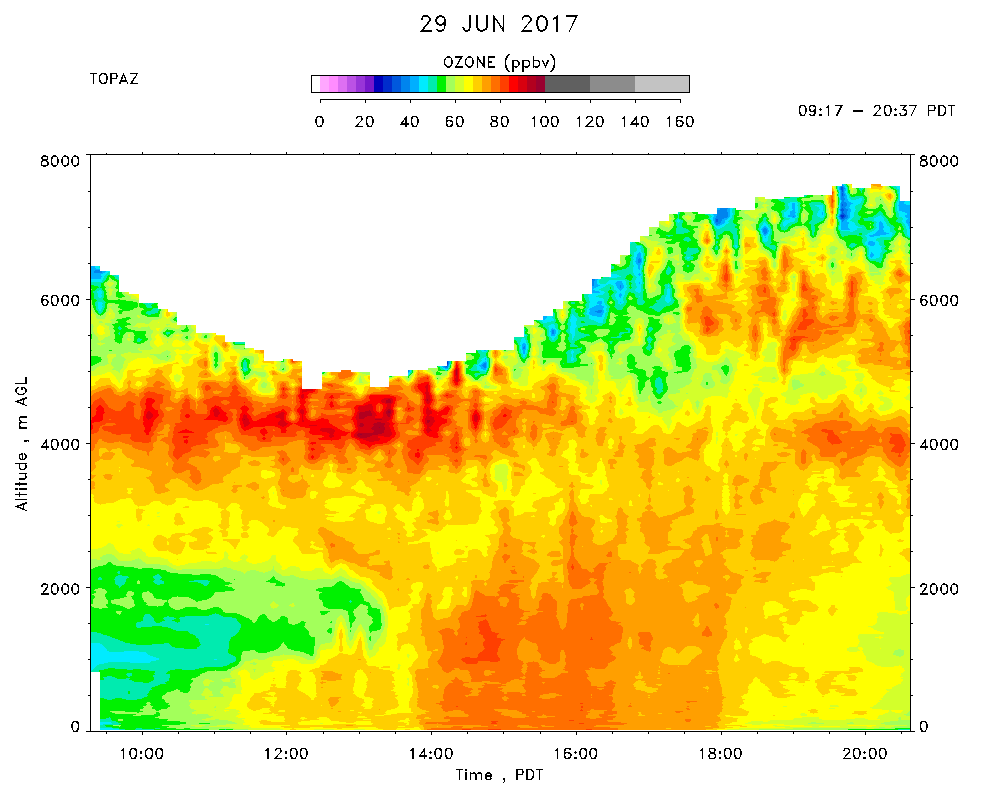
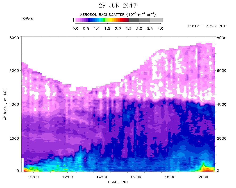
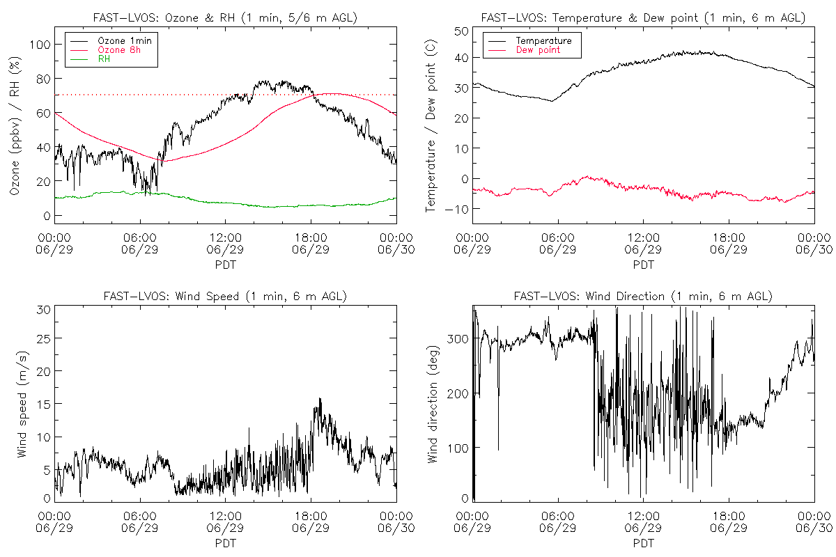
TOPAZ data were recorded from 09:17 - 20:37 PDT.
High-normal temperatures today (max. of 42 C at the lidar site) and 106 F at the NLVA NWS tower. Clear skies all day. The winds followed the usual pattern of morning northwesterlies,and week mid-day southwesterlies, but with 10-15 m/s ESE winds in the late afternoon and evening. Thick haze/smoke near the surface in the morning. HYSPLIT suggests this haze may have come from fires in northwestern Nevada or Northern California. Possible smoke from Arizona or the Brian Head fire in Utah after ESE winds of 10-15 m/s kicked up at 1800 PDT. The elevated UT/LS layer advected from the Pacific Ocean was still present above 4 km asl, but was thicker and more diffuse with 80-90 ppbv of ozone. A probable Asian pollution layer with lower ozone, but higher aerosol lay just beneath it. This lower layer was mostly entrained and the upper layer partially entrained by the mixed layer, which grew to about 3.2 km. The surface concentrations at NLVA peaked at 75-80 ppbv, and the nearby Joe Neal monitor recorded a peak hourly concentrations of 77 and MDA8 of 70 ppbv.