FAST-LVOS 2017 TOPAZ Data
June 19, 2017
< Previous Day | Archive Calendar | Next Day >
Daily Summary:
Monday, June 19
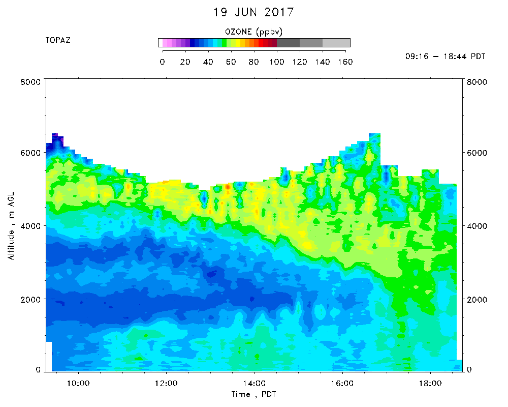
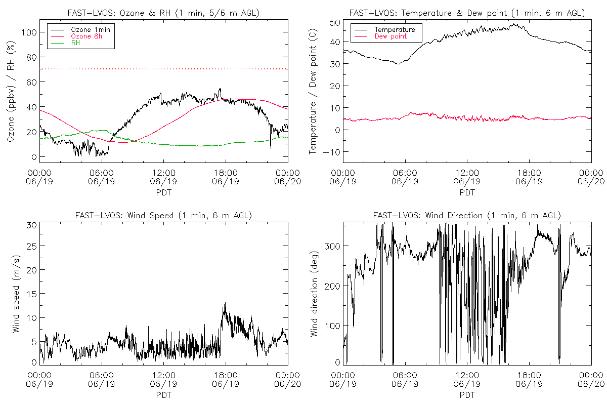
TOPAZ data were recorded from 09:16 - 18:44 PDT. Extremely hot (max. of 47 C at the lidar site). Generally light winds that followed the diurnal flow pattern. Cumulus clouds and isolated t-storms over the nearby mountain ranges. A few clouds drifted over the Las Vegas Valley in the late afternoon. The clean marine air from the previous day with lower tropospheric ozone concentrations of less than 40 ppbv was still in place. TOPAZ observed a layer with moderate to high aerosol concentrations and 55-60 ppbv ozone above 4 km AGL. This layer descended to 2.5 km AGL by late afternoon and was partially entrained into the boundary layer. Back trajectory calculations suggest that this layer may be associated with fires in Arizona. Surface ozone peaked at 55 ppbv around 1730 PDT.