FAST-LVOS 2017 TOPAZ Data
June 21, 2017
< Previous Day | Archive Calendar | Next Day >
Daily Summary:
Wednesday, June 21
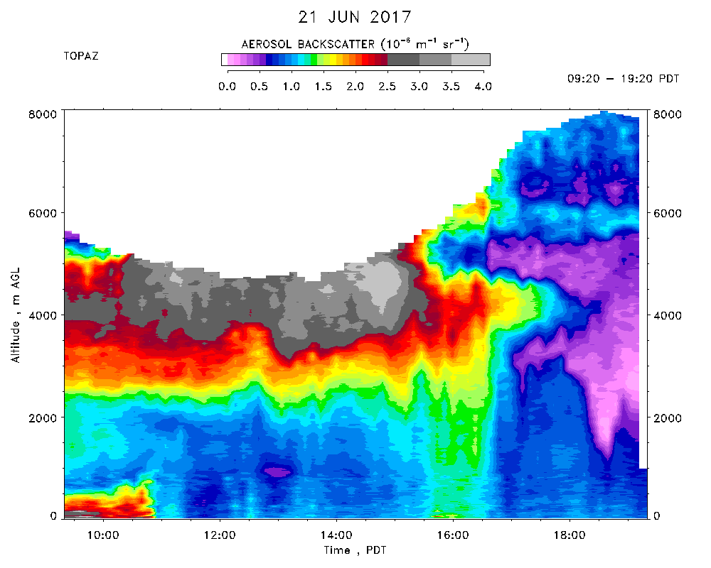
TOPAZ data were recorded from 09:20 - 19:20 PDT. Another extremely hot day (max. of 45 C at the lidar site) and 113 F at the NLVA NWS tower. Very clear with only a few FWC over the mountains. The elevated smoke layer from AZ and Mexico was visible to the eye and prominent in the TOPAZ aerosol backscatter between 3 and 5 km agl. There was very little ozone enhancement in the smoke layer, however, and modest entrainment of the smoke by the mixed layer, which reached a depth of 'only' about 4 km. The ML subsided around 1700 PDT. The winds were weak and NW in the early morning, but rotated to the S and increased to 10-15 m/s around 1000 PDT. Surface ozone also increased to about 65 ppbv, but then decreased to 55-60 ppbv as the winds rotated to the SW. TOPAZ measured similar concentrations up to about 5 km agl. There was no sign of smoke from the Holcomb Fire near San Bernardino.