A .gov website belongs to an official government organization in the United States.
Secure .gov websites use HTTPS
A lock () or https:// means you've safely connected to the .gov website. Share sensitive information only on official, secure websites.
Air (Ine)quality in New York City
A pilot project to map surface ozone and PM2.5 in underserved boroughs in New York City during heat wave events and to engage with their communities in Summer 2023.
This pilot study was conducted in collaboration with The City College of New York (CCNY) to demonstrate the connection between detailed ground level observations, where pollution directly impacts human health, and the broader aircraft and satellite observations deployed under AEROMMA.
Investigators
Audrey Gaudel, Principle Investigator (PI), Cooperative Institute for Research in Environmental Sciences (CIRES) Research Scientist, University of Colorado, Boulder, and National Oceanic and Atmospheric Administration (NOAA) Chemical Sciences Laboratory (CSL)
Kathryn Goldfarb, Co-Investigator, Assistant Professor of Anthropology, University of Colorado, Boulder
Prathap Ramamurthy, Co-Investigator, Associate Professor, Department of Mechanical Engineering, The City College of New York (CCNY) and Earth and Environmental Sciences, The City University of New York (CUNY) Graduate Center; Faculty Affiliate at NOAA Cooperative Science Center for Earth System Sciences and Remote Sensing Technologies (CESSRST)
Collaborators
Harold Gamarro, PhD student, The City College of New York (CCNY) / NOAA Cooperative Science Center for Earth System Sciences and Remote Sensing Technologies (CESSRST) / NOAA Chemical Sciences Laboratory (CSL)
Jorge Gonzalez-Cruz, University at Albany, NY / NOAA Cooperative Science Center for Earth System Sciences and Remote Sensing Technologies (CESSRST)
Fred Moshary, NOAA Cooperative Science Center for Earth System Sciences and Remote Sensing Technologies (CESSRST), The City College of New York (CCNY) / Department of Electrical Engineering, The City College of New York (CCNY)
Sunil Baidar, Cooperative Institute for Research in Environmental Sciences (CIRES) University of Colorado Boulder / NOAA Chemical Sciences Laboratory (CSL)
Alexandre Baron, Cooperative Institute for Research in Environmental Sciences (CIRES) University of Colorado Boulder / NOAA Chemical Sciences Laboratory (CSL)
Caroline Womack, Cooperative Institute for Research in Environmental Sciences (CIRES) University of Colorado Boulder / NOAA Chemical Sciences Laboratory (CSL)
Kenneth Aikin, Cooperative Institute for Research in Environmental Sciences (CIRES) University of Colorado Boulder / NOAA Chemical Sciences Laboratory (CSL)
Arielle Milkman, Department of Anthropology, University of Colorado Boulder
Owen Cooper, Cooperative Institute for Research in Environmental Sciences (CIRES) University of Colorado Boulder / NOAA Chemical Sciences Laboratory (CSL)
Brian McDonald, NOAA Chemical Sciences Laboratory (CSL)
Research Goals
Quantify ozone and PM2.5 variability across selected areas of NYC with differing land-use and building density (e.g, commercial/residential streets versus recreation parks).
Quantify ozone and PM2.5 variability with respect to heat wave events (focused both on the diurnal cycle and weekday/weekend variability).
Evaluate the ability of an urbanized mesoscale forecast model to predict air pollution at granular scale.
Develop additional research questions of interest to community members, and formulate research methods to answer these questions.
Measurements
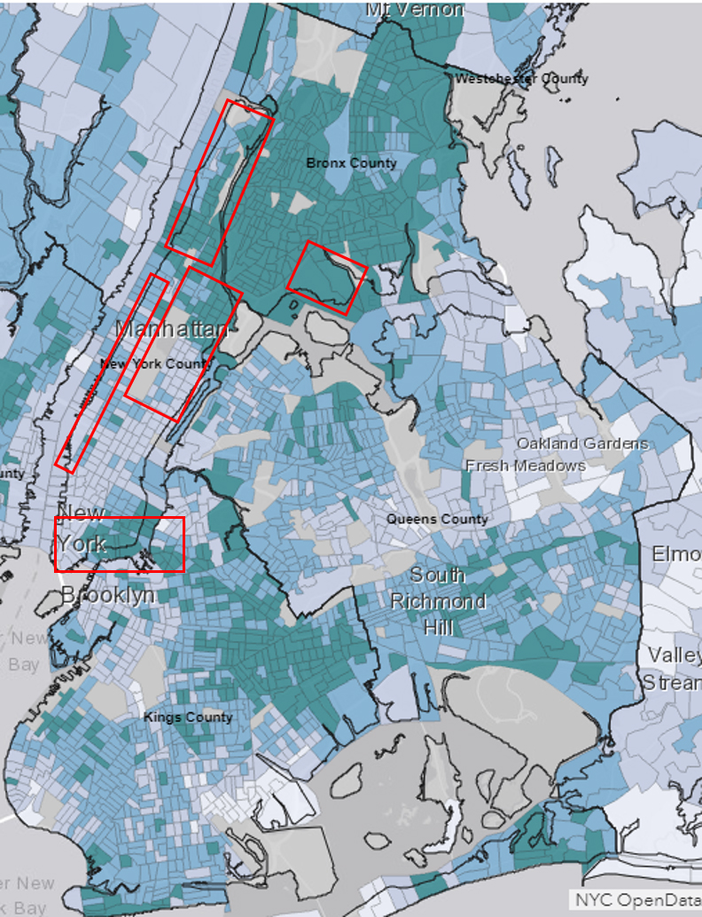
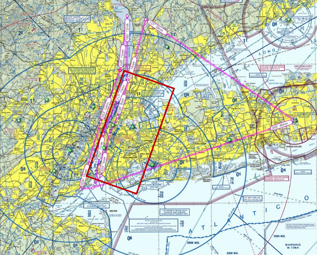
Map of the areas (red contours) where the POPS, PAM, POM were deployed in 2023. These regions included North, Central and Southeast of Manhattan, East of Brooklyn, Southeast of the Bronx.
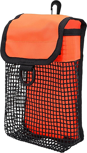
Students at CCNY and affiliated with the NOAA Hollings Program carried the Portable Ozone Monitor (POM) [Andersen et al., 2010] and the Personal Air Monitor (PAM) developed at 2B Tech (Boulder, Colorado), concurrently with the Portable Optical Particle Spectrometer (POPS) [Gao et al., 2016] developed by NOAA CSL, in mesh bags attached to a backpack through NYC. The PI was in the field and engaged with the students and the CCNY scientists in order to monitor emerging scientific questions. We were aware that we tasked healthy individuals with exposing themselves to poor air quality and perhaps for extended periods in a way that is outside their normal envelope of exposure. Mitigation options were pursued such as providing N95 masks for participants and limits in exposure time.
As a starting point, routes were planned to be mainly between Inwood and Times Square in NYC, with repetitive walks in Inwood Hill Park, Fort Tryon Park, Highbridge Park and Central Park where maximum ozone levels and minimum PM2.5 levels are expected. In contrast, sampled routes included Broadway, St Nicholas Avenue, Sherman Avenue, George Washington Bridge and Times Square, where minimum ozone levels and maximum PM2.5 levels were expected due to high nitrogen oxide emissions, from car exhaust and other sources, which destroy ozone. We also included playgrounds and outdoor recreation facilities. Planned routes covered South Bronx and lower Manhattan as well and the sampled routes evolved to meet the community's interests.
The deployment relied on three air quality forecast models (RAP-Chem, WRF-Chem, RAQMS) to inform our deployment so that they occur before, during and after a heat wave event. We planned on 3 weeks of deployment (21 days that includes 21 July - 18 August 2023) coordinated with the CUPiDS campaign research flights that occurred around the same timeframe (15 July - 15 August 2023).
Instruments
The POPS (NOAA CSL) measuring particulate matter, PAM (2B Tech) measuring particulate matter, POM (2B Tech) measuring ozone, and the mesh bag (to carry the instruments on a backpack) to be deployed for three weeks, every day, three times a day to capture the diurnal cycle.Example of a CUPiDS flight plan that can be coordinated with the deployment of the personal monitors. Flight tracks cover the west side of, over, the east side of the Hudson River and over Central Park.
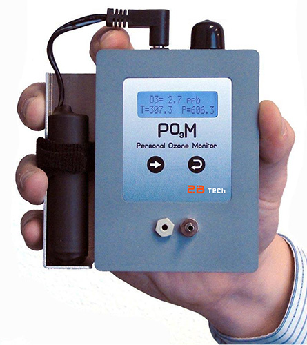
The POM uses the UV absorption at 254 nm technique to measure ozone. Its precision and its accuracy are greater than 1.5 ppb or 2% of the reading. The detection limit is 3 ppbv and the measurement interval is 10 s. It weighs 360 g without the battery and 450 g with the battery. Before being deployed, the POMs will be calibrated against NOAA CSL calibration units.
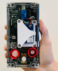
The PAM measures PM2.5 (fine particulate matter - tiny particles or droplets in the air - that are two and one half microns or less in diameter) using Plantower PMS7003 (laser scattering). The particle size range is 0.3-10 µm. The mass concentration range is 0-999 µm m-3. The count accuracy is 50% at 0.3 µm and 98% at 0.5 µm and above. The response time is less than 10 s. The PAM weighs 440 g.
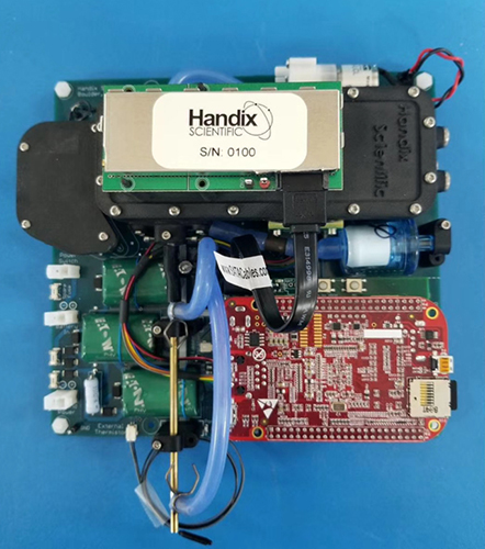
The POPS is an optical particle sizer that uses a 405 nm diode laser to count and size particles between 0.14-3 µm of diameter. The counting efficiency above 140 nm is greater than 80% with a 1 s temporal resolution. It weighs ~800 g and has a limited power consumption (5W).