Postcard from the Field: Summer Field Campaigns Take a Detailed Look at Air Quality formo Street-Level to Space. September 2023
The largest urban air quality research field campaign to date recently concluded and now the process of analyzing the mountain of data obtained is underway. The AGES+ partnership brought together scientists from NOAA, NASA, and 21 universities from three countries to deploy state-of-the-art instruments to investigate how air pollution sources in major urban cities have shifted over recent decades.
Using multiple satellites, six research aircraft, vehicles, dozens of stationary installations - even instrumented backpacks - scientists conducted detailed observations from street-level to space of air pollutants from sources including transportation, industrial facilities, agriculture, wildfires, and consumer products such as paint, pesticides, and perfumes.
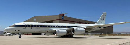
The NOAA Chemical Sciences Laboratory (CSL) took the lead on three of the research projects. The largest, AEROMMA, outfitted NASA's DC-8 flying laboratory with specialized, custom-built instruments designed for measuring trace gases and particles and flew repeated, low altitude survey flights over highly populated cities, including New York City, Chicago, Detroit, Toronto, Indianapolis, and Los Angeles. Prior to the urban flights, the AEROMMA researchers spent two weeks flying over the eastern Pacific Ocean to investigate oceanic emissions that form climate-relevant sulfate aerosols and impact marine clouds.
In conjunction with AEROMMA, NASA's STAQS project deployed two Gulfstream research aircraft carrying downward-looking atmospheric composition instruments analogous to the recently launched TEMPO satellite instrument. The NOAA Twin Otter joined the other aircraft around NYC for the CUPiDS project, which focused on the boundary layer dynamics and transport that contribute to poor air quality episodes on the East Coast.
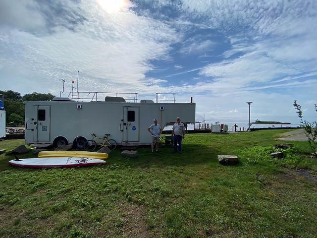
Other coordinating field projects included: joint observations by NOAA's Air Resources Laboratory and the University of Maryland of greenhouse gas and air pollution emissions in the Northeast corridor from DC to NYC; street-level measurements of ozone and PM2.5 in Manhattan aimed at investigating air pollution exposure in economically disparate neighborhoods; and a network of ground sites around NYC, Long Island, Chicago, and Toronto to provide the surface measurements that the aircraft can't reach. Major funding for the NYC-area ground sites was provided by NOAA's Climate Program Office Atmospheric Chemistry, Carbon Cycle, and Climate (AC4) program.
The data obtained this summer will go towards improving air pollution forecasts and informing decisions about the most effective ways to reduce air pollution. The data will also be used to evaluate the first observations made by NASA's TEMPO instrument, the first geostationary space-borne sensor to continuously measure air pollution across North America. Lessons learned will aid the development of NOAA's planned GeoXO satellite constellation. NOAA NESDIS was a major funding partner supporting the AEROMMA measurements and their application to these satellite capabilities.
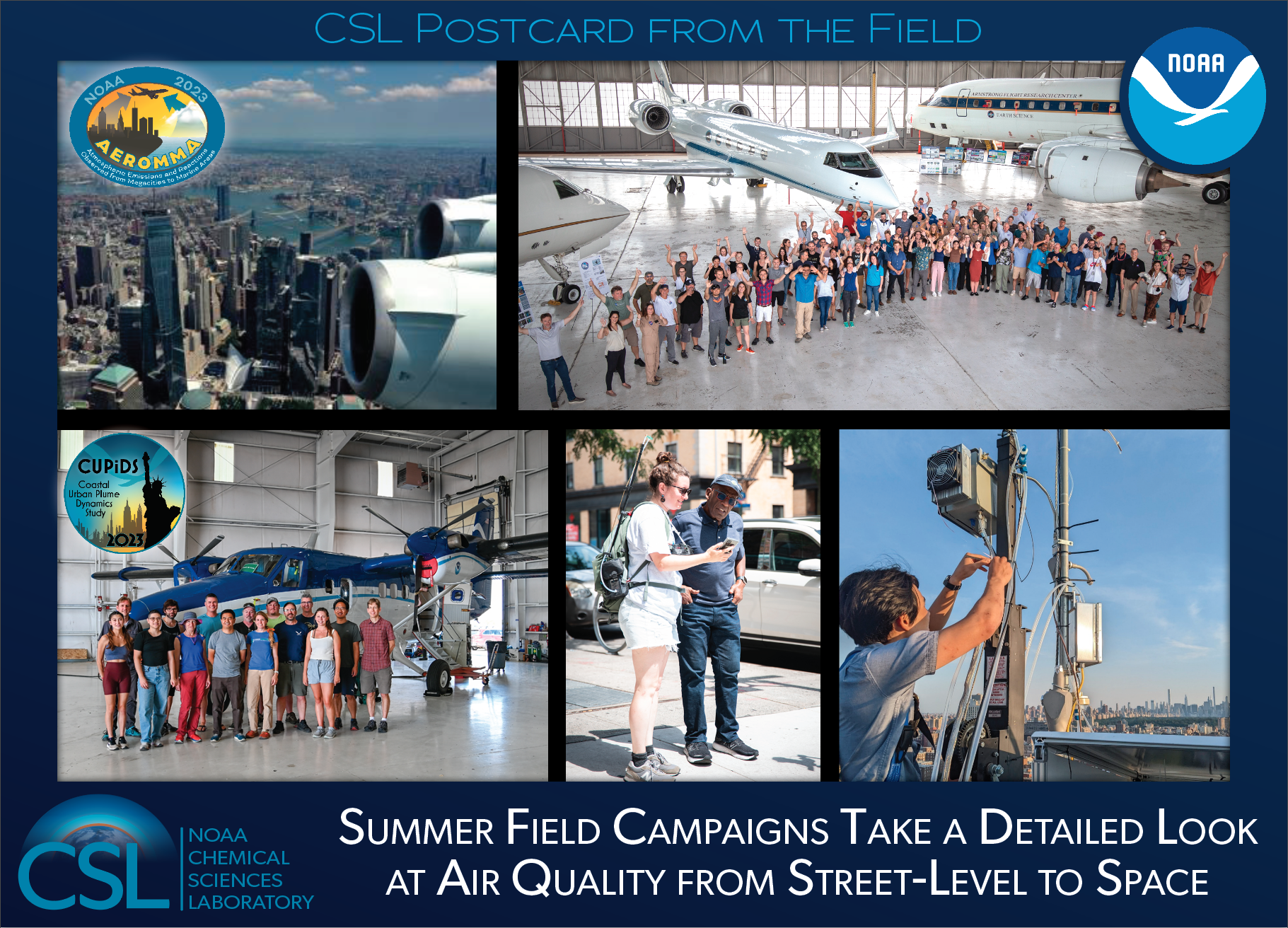
Top left: View of New York City from on-board the NASA DC-8 during NOAA's AEROMMA campaign.
Top right: Group photo of the AEROMMA and STAQS campaign participants in front of the NASA DC-8 (AEROMMA) and the two NASA Gulfstreams (STAQS) taken while on deployment at Wright-Patterson Air Force Base, Dayton, Ohio.
Bottom left: Group photo of the NOAA CUPiDS participants in front of the NOAA Twin Otter during instrument installation in Broomfield, Colorado.
Bottom middle: NOAA CSL/CIRES research scientist Audrey Gaudel explains her street-level air quality measurements to NBC's Al Roker in downtown New York City.
Bottom right: An AGES+ collaborator works on instruments at a building-top ground site at City University of New York (CUNY) in Manhattan.
Photos & Video
A walk through the NASA DC-8 in June 2023 from Palmdale, CA. Video: Chelsea Thompson, NOAA


