A .gov website belongs to an official government organization in the United States.
Secure .gov websites use HTTPS
A lock () or https:// means you've safely connected to the .gov website. Share sensitive information only on official, secure websites.
Platform: NOAA Lidars
To support the overall AEROMMA science objectives related to urban emissions as affected by coastal meteorology, the NOAA TOPAZ ozone and aerosol lidar, along with an autonomous Doppler wind lidar, will deploy to Guilford, CT (NYC Yale Coastal Site) for the Coastal Urban Plume Dynamics Study (CUPiDS) in the summer of 2023. The TOPAZ and Doppler lidar ground-based observations will help address several key science questions that are central to these campaigns:
Characterize the distribution and formation rate of ozone (O3) in the urban outflow downwind of New York City (NYC).
Assess the contributions of local production versus regional and continental transport to surface ozone levels in the NYC area.
Document the effect of complex local flow regimes, including the land sea breeze circulation, and different properties of the atmospheric boundary layer (ABL) over land and water on the distribution and evolution of O3 concentrations.
Evaluate the capabilities of high-resolution air quality models to replicate observed O3 concentrations in and downwind of the NYC area.
Validate O3 observations from the geostationary satellite-based TEMPO instrument. In particular, assess the accuracy of the 0-2 km AGL O3 column product and how well it correlates with observed surface O3 concentrations, and study O3 horizontal variability within individual TEMPO ground pixels.
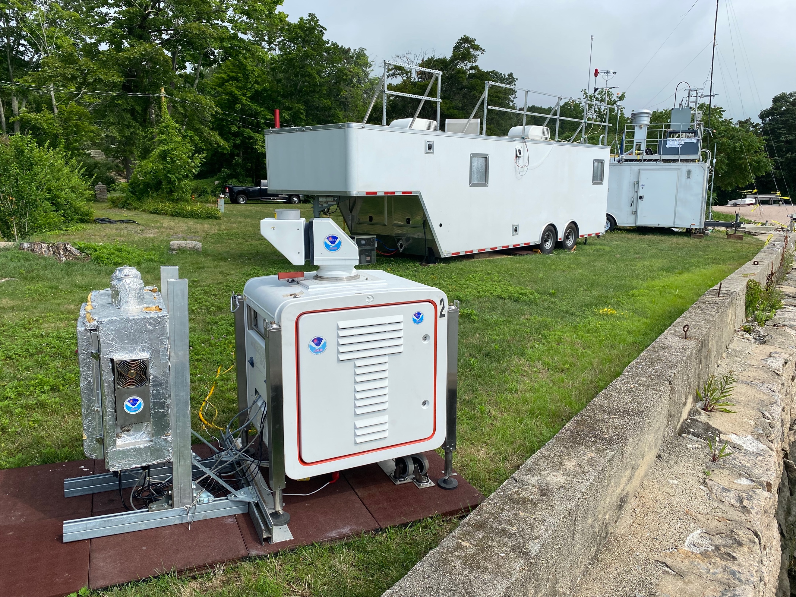
NOAA Doppler lidar and TOPAZ trailer at the Yale Coastal Field Station (University of Michigan in situ sampling trailer in the background). Photo: Christoph Senff, NOAA / CIRES
TOPAZ and the Doppler wind lidar deploy to the Yale Coastal Field Station (YCFS) in south central Connecticut (CT) located at the shore of the Long Island Sound (LIS) from 3 July thru 15 August 2023. YCFS lies about 120 km ENE of NYC. With predominantly southwesterly flow in the summer months, the NYC pollution plume often is transported to the CT shore, including the area near YCFS.
Because of its unique scanning capability, the TOPAZ lidar is ideally suited to observe the O3 and aerosol structure in the NYC pollution plume as it impinges on the CT shore. We will use a TOPAZ scan pattern that includes a zenith measurement followed by a set of slant path observations at shallow elevations angles with the laser beam pointed in a southerly direction over the LIS, followed by a similar elevation angle scan sequence to the north over land. This will allow us to map out the O3 and aerosol structure within a few kilometers of either side of the shoreline.
The co-located, autonomous Doppler lidar will continuously repeat a scan sequence consisting of vertical stares to observe atmospheric turbulence and sets of conical, vertical slice, and sector scans to measure horizontal wind speed and direction profiles.
The combination of these TOPAZ and Doppler wind lidar observations will facilitate the investigation of different flow and ABL turbulence regimes on O3 and aerosol levels. TOPAZ will be co-deployed with three other Tropospheric Ozone Lidar Network (TOLNet) O3 lidars. The observations from this regional O3 lidar network will make critically important contributions to addressing the above science goals, including goal #5, which is one of the core TOLNet objectives.