Atmospheric Remote Sensing: Instruments

Commercial scanning Doppler lidar (HALO)

HALO instrument on the HCH rooftop
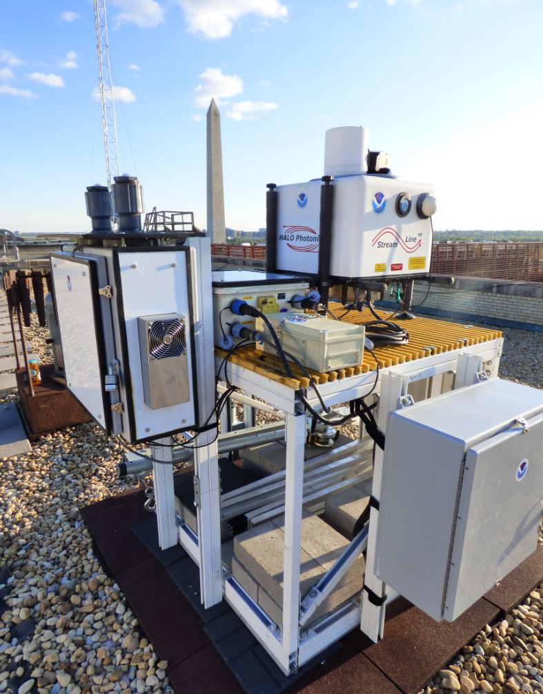
HALO instrument installed for DCFlux. Photo: Scott Sandberg, NOAA

HALO is a commercial scanning Doppler lidar (StreamLine XR) from HALO Photonics. They are capable of measuring and mapping atmospheric velocity and backscatter with high precision and sampling rate necessary for boundary layer studies important to understanding weather, climate and air quality. They are suitable for long term unattended measurements. Research applications include:

  • High spatial temporal and velocity resolution wind profiles
  • Boundary layer turbulence and entrainment zone studies
  • Flux measurements
  • LES model initialization and validation

Basic Parameters Measured

  • Range resolved line-of-sight velocity profiles
  • Range resolved backscatter intensity

Typical Measurement Scan

  • Scan Duration: 15-20 minutes
  • PPI scans: 1, 5, 15, 35, 75 degrees
  • RHI scans: at 1-2 azimuths
  • Vertical Stare: for the remainder of scan duration

Typical Specifications

Wavelength1.5 µm (fully eye-safe)
Pulse energy~80 µJ
Pulse rate10 kHz
Pulse duration (FWHM)350 ns
Telescope diameter75 mm
Range Resolution48 m
Time Resolution2 Hz (5000 pulse averages)
Velocity Precision~5 cm/s
Minimum range96 m
Maximum range10 km (typically 3 km)
Platformsground

Field Projects

Project NameDateLocation
DCFluxWashington D.C. Flux Study202104April 2021 - 2024Washington D.C.
INFluxIndiana Flux Study201304April 2013 - June 2015, January 2016 - March 2019Indianapolis, Indiana

References

Bonin, T.A., B. Carrol, R.M. Hardesty, W.A. Brewer, K. Hajny, O. Salmon, and P. Shepson, Doppler lidar observations of the mixing height in Indianapolis using an automated composite fuzzy logic approach, Journal of Atmospheric and Oceanic Technology, doi:10.1175/JTECH-D-17-0159.1, 2018.