Tuesday, August 9: SCOOP
Day 1 of SCOOP observations. No TOPAZ data were taken.
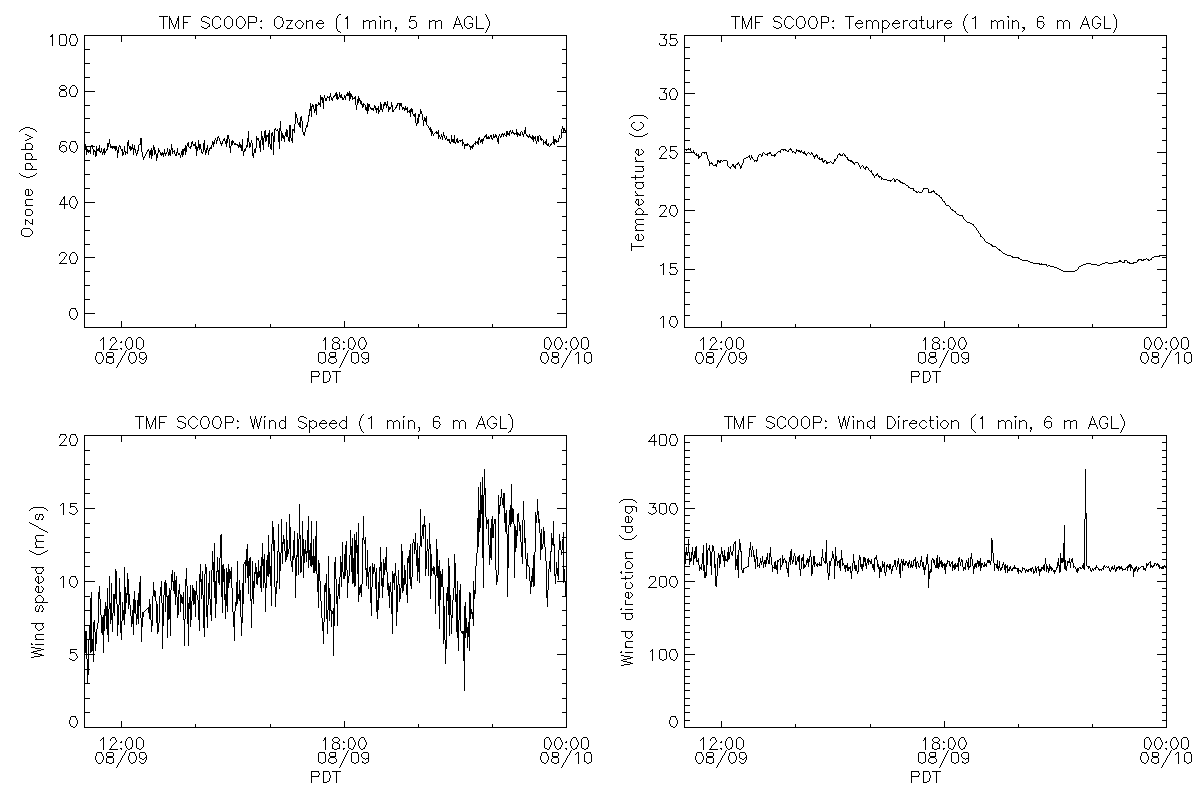
Clear skies. Maximum temperature of 25 C. Winds from the southwest at 5 to 15 m/s. Surface ozone* ranged from about 60 to 80 ppbv, with the maximum ozone concentrations occurring around 18:00 PDT. The PILOT fire was burning near Silverwood Lake, 40 km east of TMF. Smoke advected north into the Mojave Desert.
TOPAZ setup at TM-2 next to AMOLITE and LMOL. Synching between TOPAZ and AMOLITE did not work due to AC noise on the triggers. Tipped TOPAZ truck up to 1.7 deg away from AMOLITE beam, but AMOLITE signal was still visible in TOPAZ data. Moved TOPAZ about 50 m away from AMOLITE and tipped TOPAZ 1 deg away from AMOLITE beam. AMOLITE signal was still interfering with TOPAZ data. LMOL (about 25 m away) signal was also visible in TOPAZ data stream.
*Note: The collocated in situ ozone concentrations are known to be about 6% low.