Wednesday, August 10: SCOOP
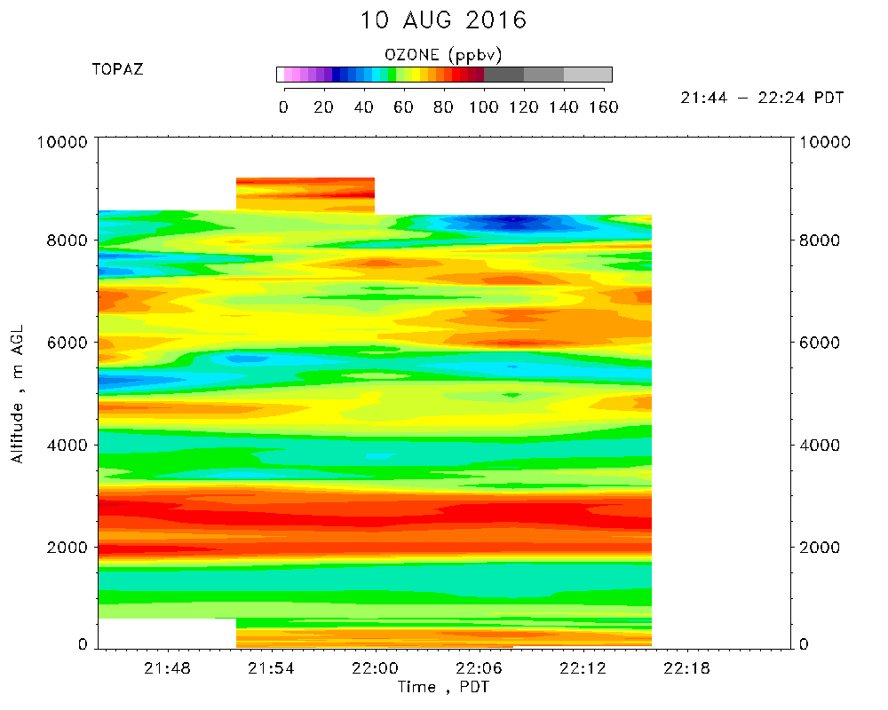
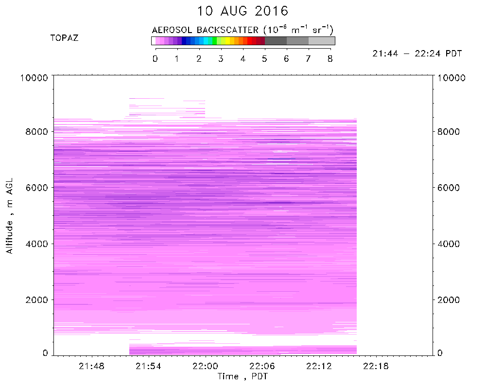
Day 2 of SCOOP observations. TOPAZ data were taken from 21:44 to 22:24 PDT.
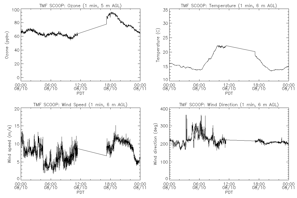
Clear skies. Maximum temperature of 22 C. Winds from the south/southwest at 3 to 13 m/s. Surface ozone* ranged from about 60 to 95 ppbv, with the maximum ozone concentrations occurring around 18:00 PDT. The PILOT fire was burning near Silverwood Lake, 40 km east of TMF. Smoke advected north into the Mojave Desert.
Moved TOPAZ to TM-21 next to TROPOZ and JPL lidars. Provided trigger pulses to TROPOZ. Still some AC noise on trigger pulses, but useable. Fixed broken trigger box power supply. Tested synchronization between TOPAZ, TROPOZ, and JPL lidars. Took some test data with all 3 lidars synched.
*Note: The collocated in situ ozone concentrations are known to be about 6% low.