Saturday, August 13: SCOOP
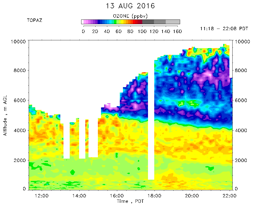
Day 5 of SCOOP observations. TOPAZ data were taken from 03:54 to 12:10 PDT.
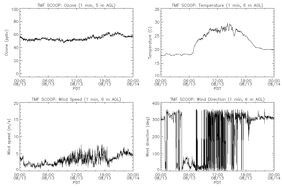
Partly cloudy skies. Shallow Cu after 11:00 PDT. Maximum temperature of 29 C. Surface winds from a northwesterly to northeasterly direction with speeds between 2 and 6 m/s. Surface ozone* ranged from about 50 to 63 ppbv, with little diurnal variation. The PILOT fire (~8100 acres, 96% contained) was burning near Silverwood Lake, 40 km east of TMF. TOPAZ observed a layer with ozone concentrations ranging from about 65 to 75 ppbv between 2 and 4-5 km AGL. Above that was a very clean layer (generally 20 - 40 ppbv of ozone) that extended to 9 km AGL.
*Note: The collocated in situ ozone concentrations are known to be about 6% low.