CalNex TOPAZ Lidar data
July 18 - Preliminary Data
| Previous Flight | Archive Calendar | Next Flight |
|---|
Flight #46: Map pollution over San Diego, transport of pollution into Mexico
Flight level: 6500 - 10500 MSL
Takeoff : 08:30 PST
Duration : 3:30 h
Objective : Characterize cross-border transport of pollution from California into Mexico and map pollution in the San Diego area.
Select an image to view full resolution
Ozone in Google Earth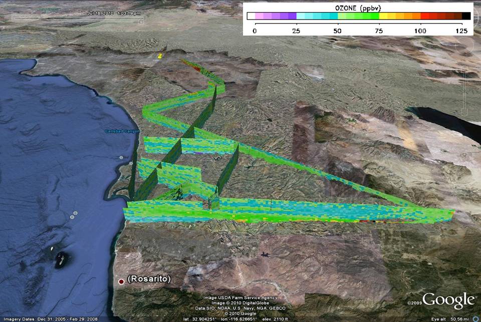 Get the Google Earth kml file |
Ozone Cross-section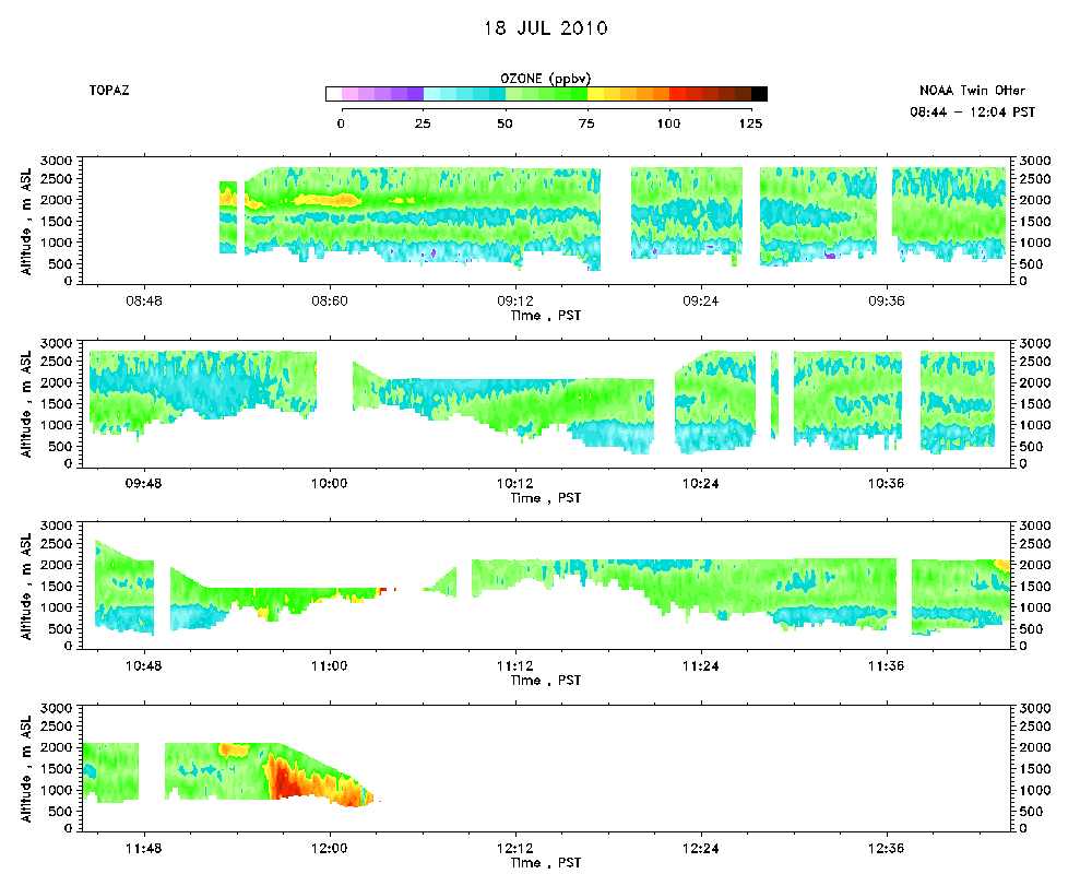 Download the ASCII file |
|---|