CalNex TOPAZ Lidar data
June 1 - Preliminary Data
| Previous Flight | Archive Calendar | Next Flight |
|---|
Flight #8: Los Angeles Basin, Mojave Desert
Flight level: 5500 - 11500 MSL
Takeoff : 12:15 PST
Duration : 3:15 h
Objective : AMAX-DOAS comparison with OMI NO2 satellite measurements, characterize outflow of pollution from the LA Basin to the Mojave Desert.
Select an image to view full resolution
Ozone in Google Earth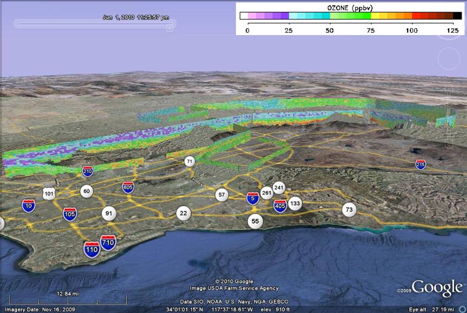 Get the Google Earth kml file |
Ozone Cross-section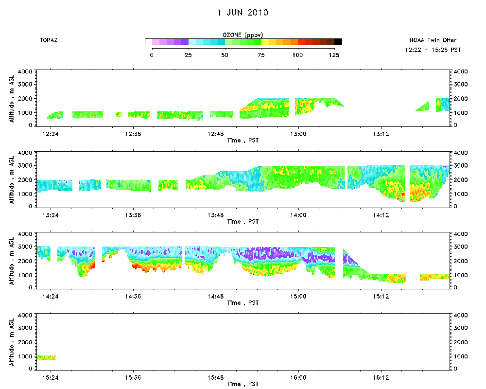 Download the ASCII file |
|---|