CalNex TOPAZ Lidar data
June 18 - Flight B - Preliminary Data
| Previous Flight | Archive Calendar | Next Flight |
|---|
Flight #18: San Joaquin Valley
Flight level: 9500 - 15500 MSL
Takeoff : 15:45 PST
Duration : 3:15 h
Objective : Comparison with NOAA P-3, DOE G-1, and NASA B200 between Fresno and Bakersfield, survey pollution in San Joaquin Valley and foothills of Sierra Nevada
Select an image to view full resolution
Ozone in Google Earth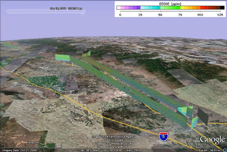 Get the Google Earth kml file |
Ozone Cross-section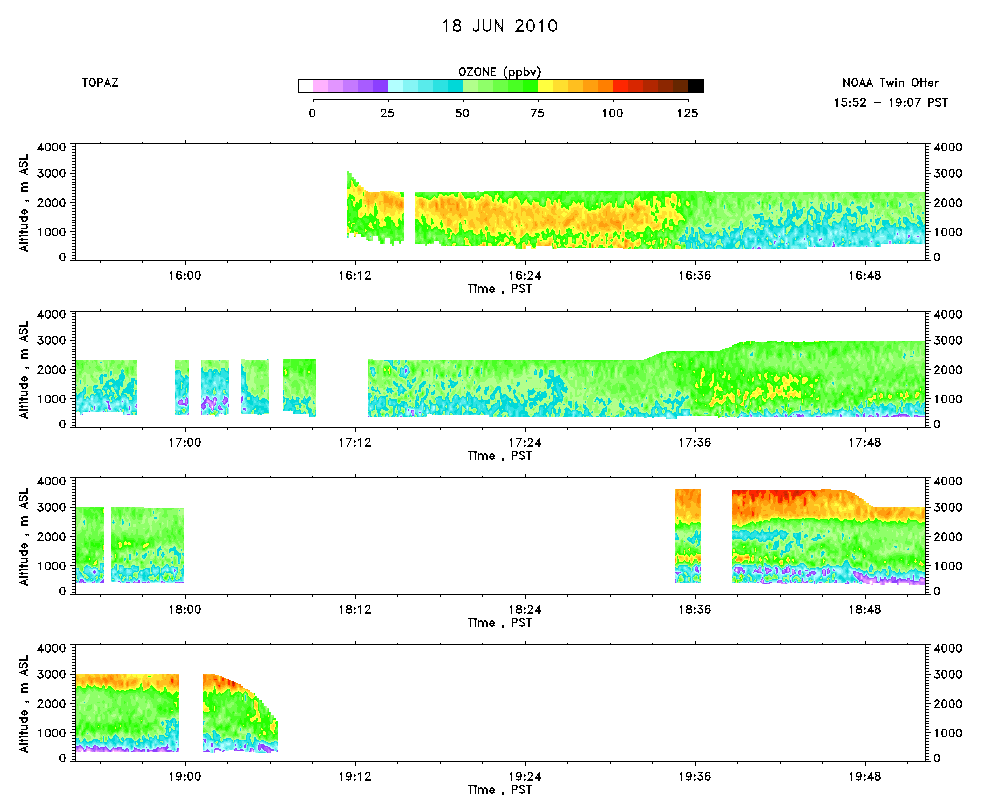 Download the ASCII file |
|---|