CalNex TOPAZ Lidar data
June 27 - Flight A - Preliminary Data
| Previous Flight | Archive Calendar | Next Flight |
|---|
Flight #27: Sacramento, Sacramento and upper SJV to foothills
Flight level: 6000 - 10500 MSL
Takeoff : 8:37 PST
Duration : 3:55 h
Objective : Survey pollution near Sacramento. Look at ozone production under high temperatures (102 deg F) and high pressure.
Select an image to view full resolution
Ozone in Google Earth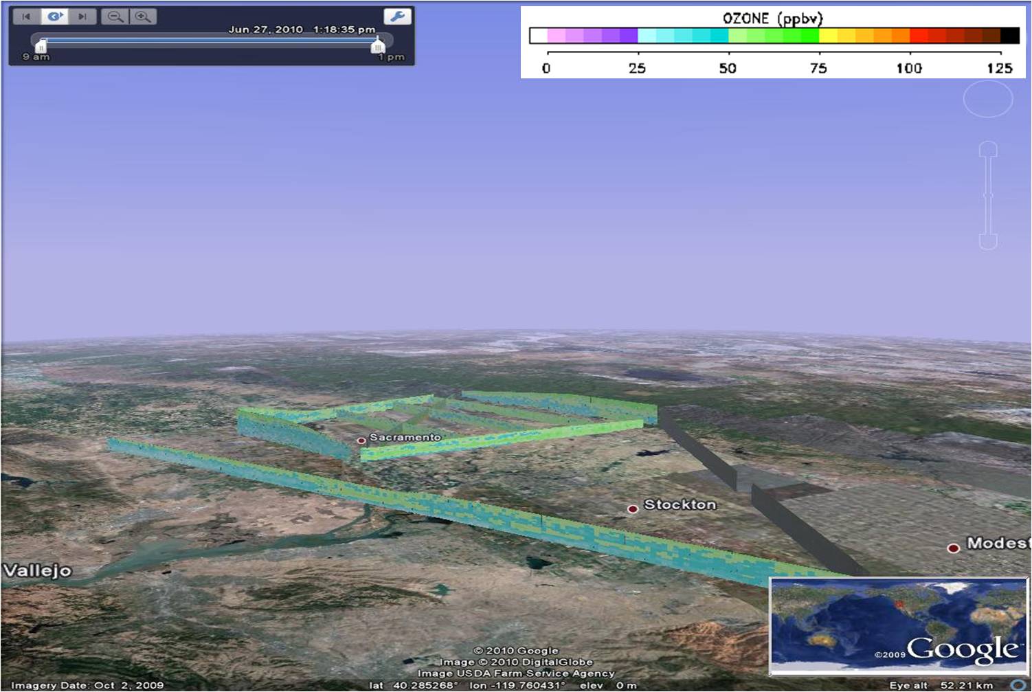 Get the Google Earth kml file |
Ozone Cross-section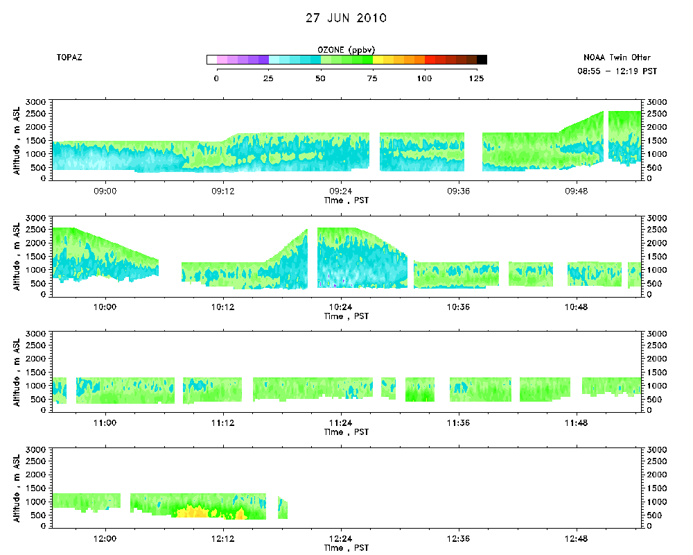 Download the ASCII file |
|---|