CalNex TOPAZ Lidar data
June 28 - Preliminary Data
| Previous Flight | Archive Calendar | Next Flight |
|---|
Flight #29: Sacramento, Sacramento area and upper SJV
Flight level: 6500 MSL
Takeoff : 9:15 PST
Duration : 3:51 h
Objective : Survey pollution near Sacramento. Look at ozone production after 3 days of high temperatures (>100 deg F) and high pressure.
Select an image to view full resolution
Ozone in Google Earth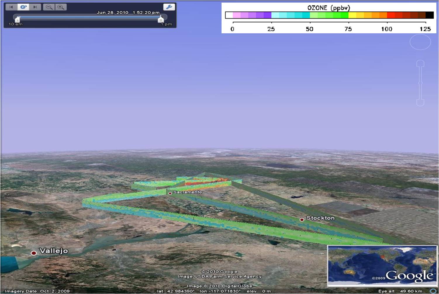 Get the Google Earth kml file |
Ozone Cross-section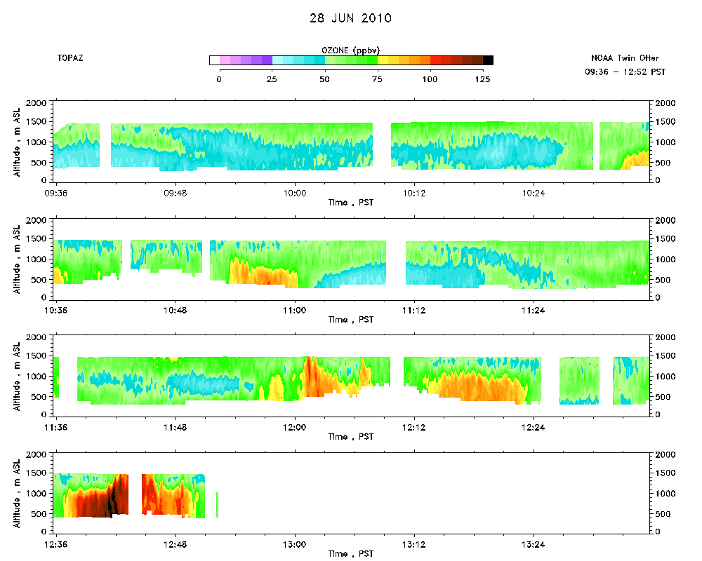 Download the ASCII file |
|---|