CalNex 2010 TOPAZ Lidar data
May 25 - Flight A - Preliminary Data
| Previous Flight | Archive Calendar | Next Flight |
|---|
Flight #3: Los Angeles Basin
Flight level: 200 AGL - 6500 MSL
Takeoff : 08:30 PST
Duration : 4:00 h
Objective : Characterize pollutant distribution in LA Basin with AMAX-DOAS. Flight consisted of level flight legs
just above and numerous profiles within the boundary layer.
Select an image to view full resolution
Ozone in Google Earth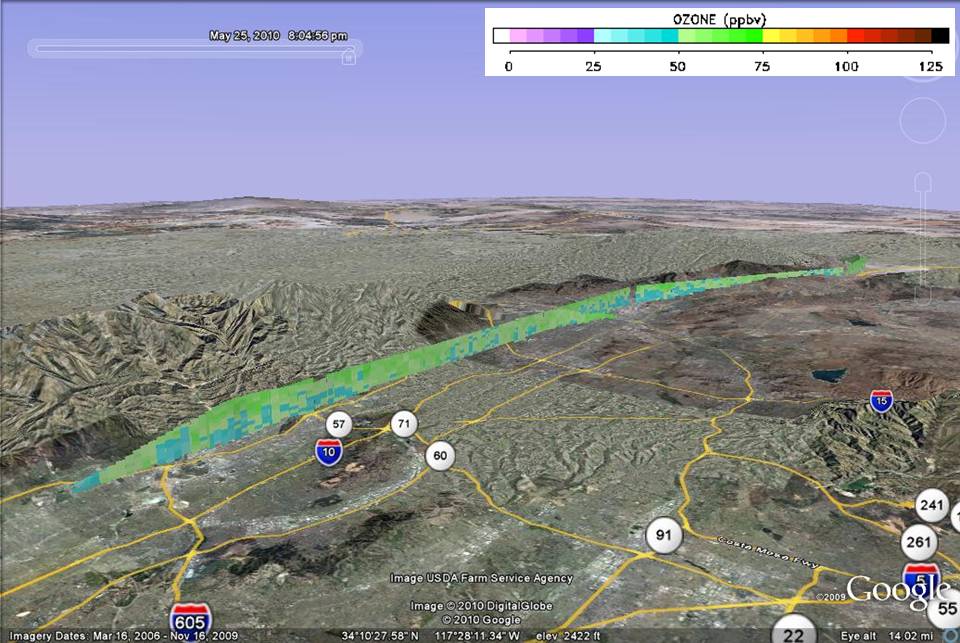 Get the Google Earth kml file |
Ozone Cross-section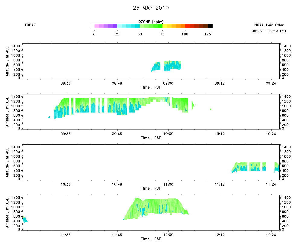 Download the ASCII file |
|---|