CalNex TOPAZ Lidar data
May 29 - Flight B - Preliminary Data
| Previous Flight | Archive Calendar | Next Flight |
|---|
Flight #6: Los Angeles Basin
Flight level: 12500 MSL
Takeoff : 18:15 PST
Duration : 3:30 h
Objective : Survey pollution in the LA Basin and offshore in coordination with the NOAA P3.
Select an image to view full resolution
Ozone in Google Earth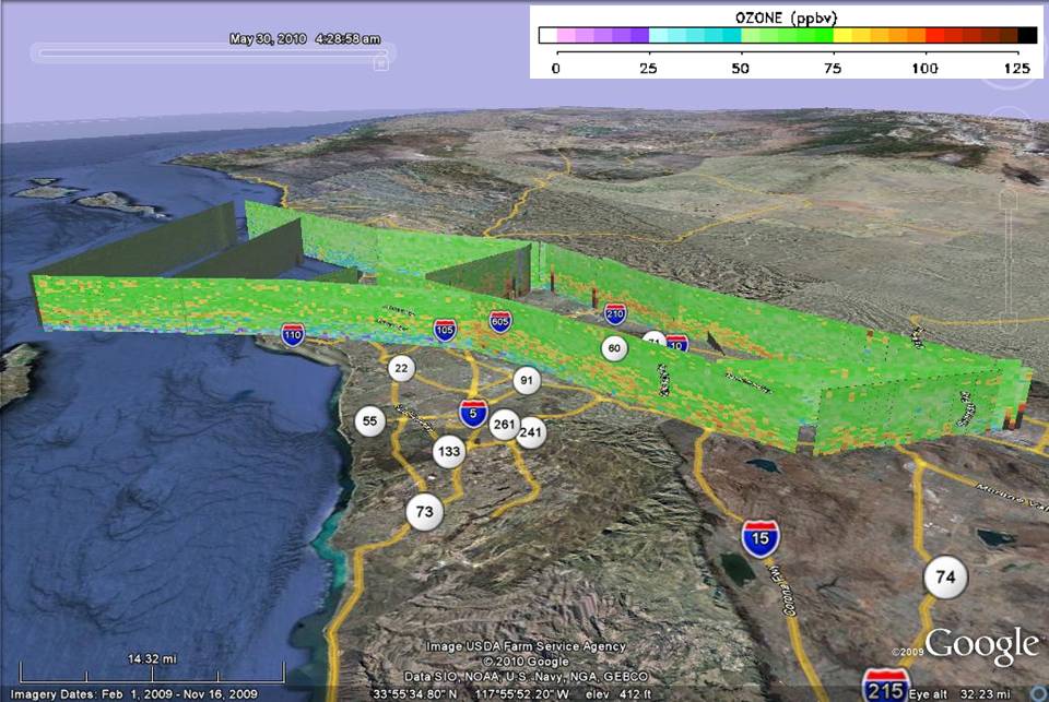 Get the Google Earth kml file |
Ozone Cross-section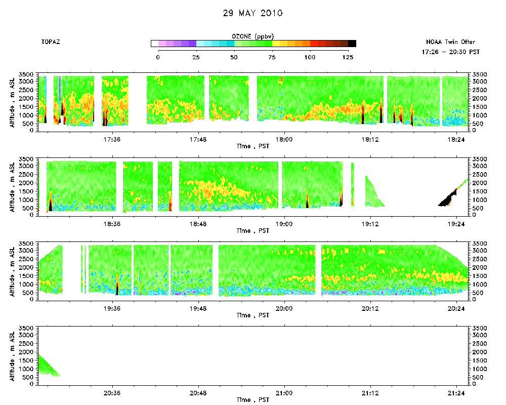 Download the ASCII file |
|---|