Chebogue Point Ground Site
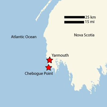
Chebogue Point, Nova Scotia, Canada is a ground-based measurement site of the NEAQS-ITCT 2004 project. This ground site is one of the ICARTT 2004 Surface Network sites joined to address the following science issues:
Characterization of composition of aerosols and gas-phase species transported across the Gulf of Maine
- How do aerosols, oxidants and their precursors evolve during transport from the emission sources on the eastern coast of the U.S.?
- What are the heterogeneous and homogeneous mechanisms responsible for this evolution?
- Is there evidence for a significant role played by fog in aerosol and /or gas-phase species processing?
- What can we say regarding the sources of these species (anthropogenic vs. biogenic, tests on emission inventories, etc.)?
Transport and mixing
- Characterization of transport above the marine boundary layer. How prevalent are elevated layers of transported emissions?
- How well do models capture these transport layers?