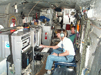
Remote Sensing Aircraft Platform Info
 In addition to the NOAA WP-3D aircraft, the 2004 experiment will feature a second aircraft focused on the application of differential absorption lidar (DIAL) techniques for remote sensing of local and regional ozone and aerosol. This aircraft is one of the ICARTT 2004 Mobile Platform sites. Previous field studies have benefited greatly from airborne measurements of ozone and aerosol profiles to characterize the 3-dimensional structure of pollution plumes and measure variability in mixing layer height. Airborne remote sensing enables tracking of plumes from urban areas and point sources, identification of isolated regions and layers of high ozone concentration, observations of atmospheric layering as characterized by aerosol structure, and investigation of local meteorological effects such as sea breezes and orographic lifting on pollution transport and mixing.
Inclusion of a remote sensing aircraft also provides information on the 3-dimensional representativeness of in situ observations made on the WP-3D aircraft during those periods when the flight tracks of the two aircraft sample the same region.
The specific aircraft platform to be used for the lidar and other sensors will be determined in early 2004 after a formal procurement process. Past experiments have incorporated a CASA 212, a de Havilland Caribou, and a Douglas DC-3 to transport the lidar. The ETL remote sensing aircraft will tentatively be based at Pease International Tradeport and will fly at approximately 3-4 km altitude for missions extending over several hours. Primary requirements for the aircraft are:
- Capability to fly slowly (less than 75 m s-1)
- Capability to provide a nadir port for lidar installation
- Sufficient power and load capability for lidar and other sensors
- Over-water capability
- Mission duration greater than 6 hours
The aircraft will fly above the boundary layer at 3-4 km altitude to enable complete characterization of low level aerosol and ozone structure. Mission durations are expected to be on the order of 6 hours, depending on the aircraft selected for the experiment. As in previous experiments, daily flight tracks and mission objectives will be determined in collaboration with other experimenters on the day prior to the flight.

