Products in support of Winter Storms 2004
Satellite Image Loops
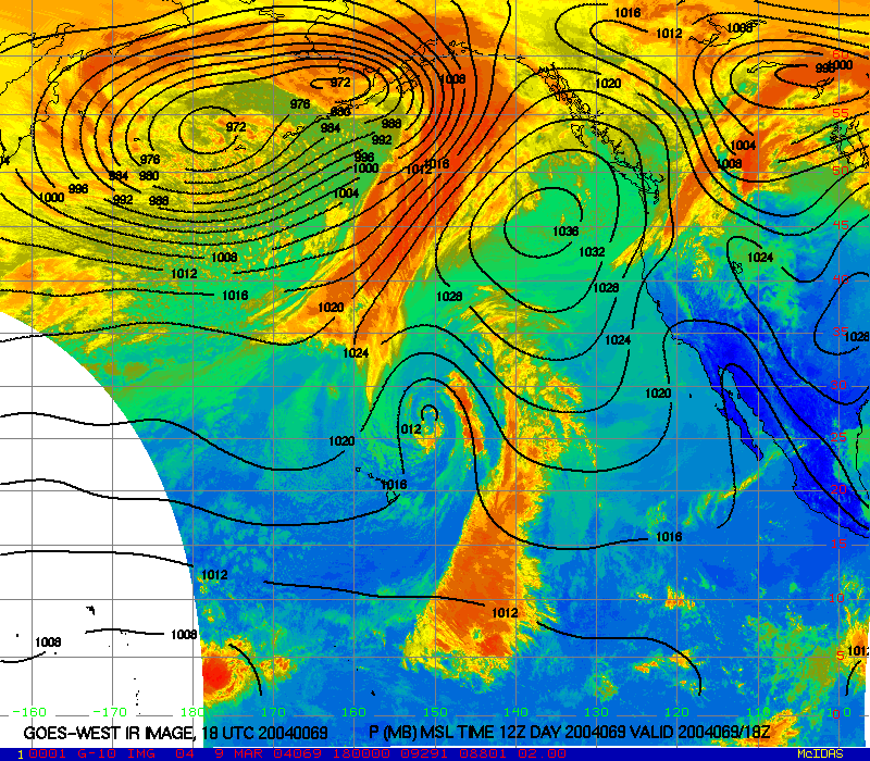
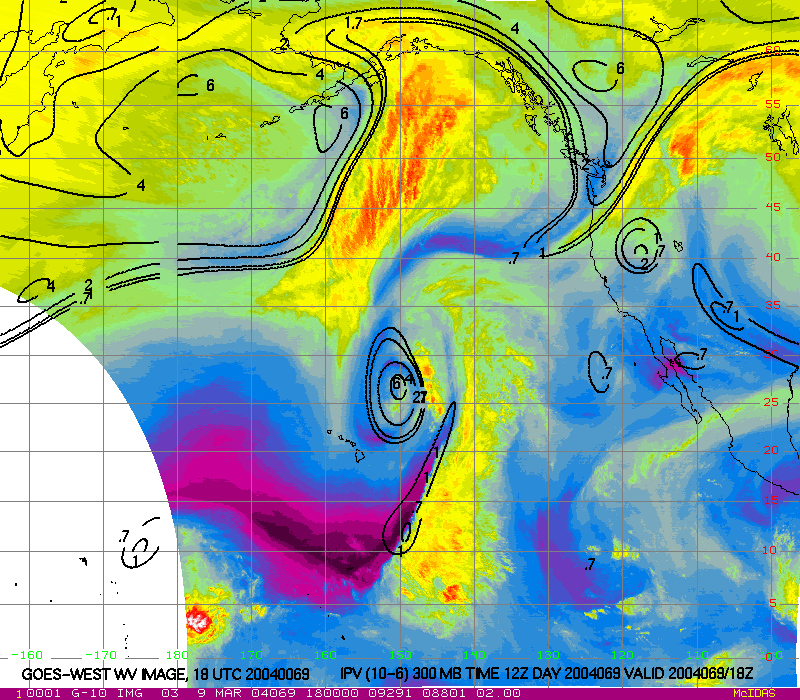
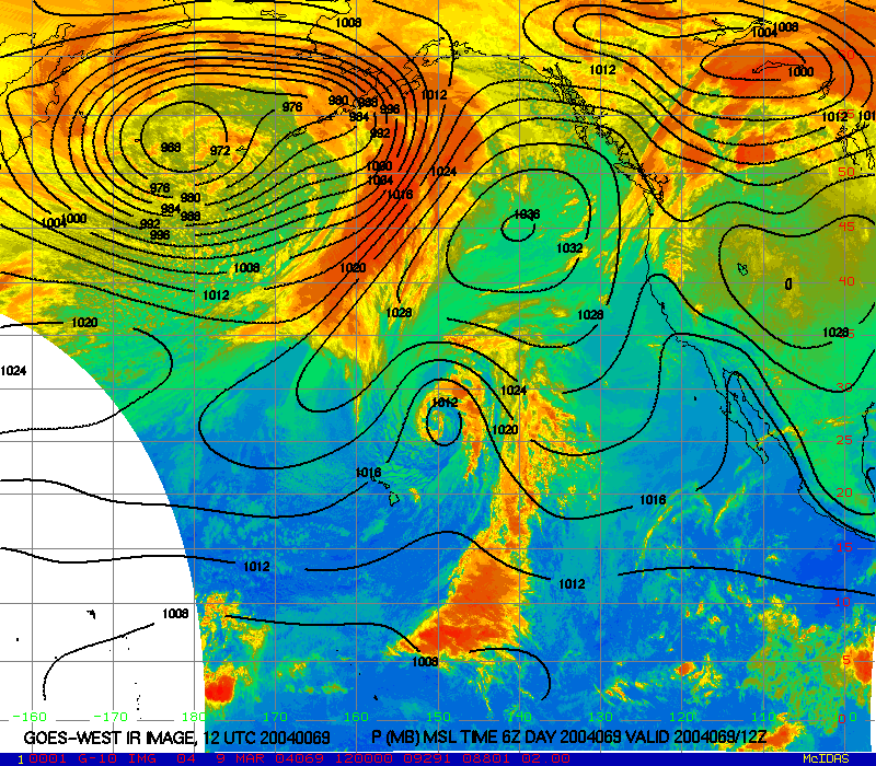
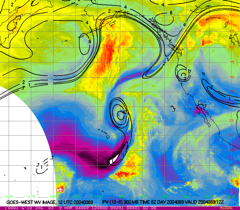
View GOES-WEST image loops. Theses images were updated regularly during this campaign.
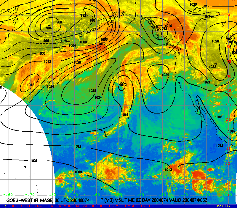
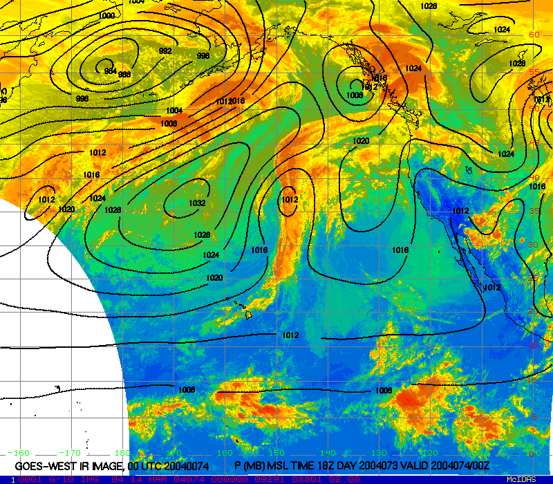
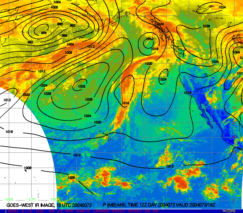
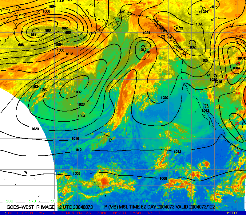
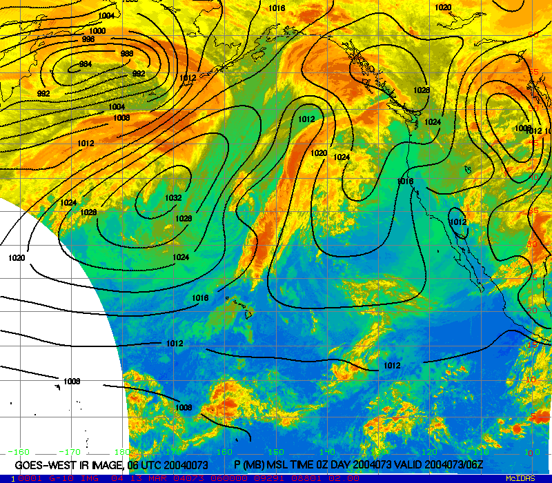
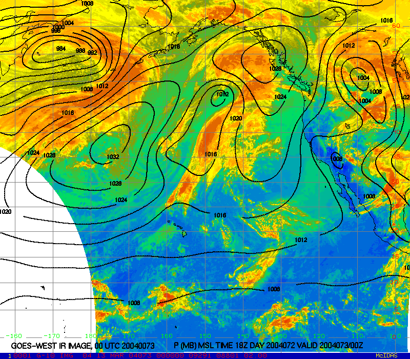
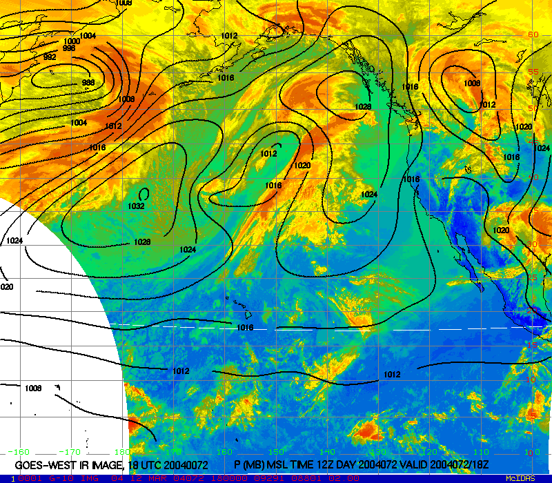
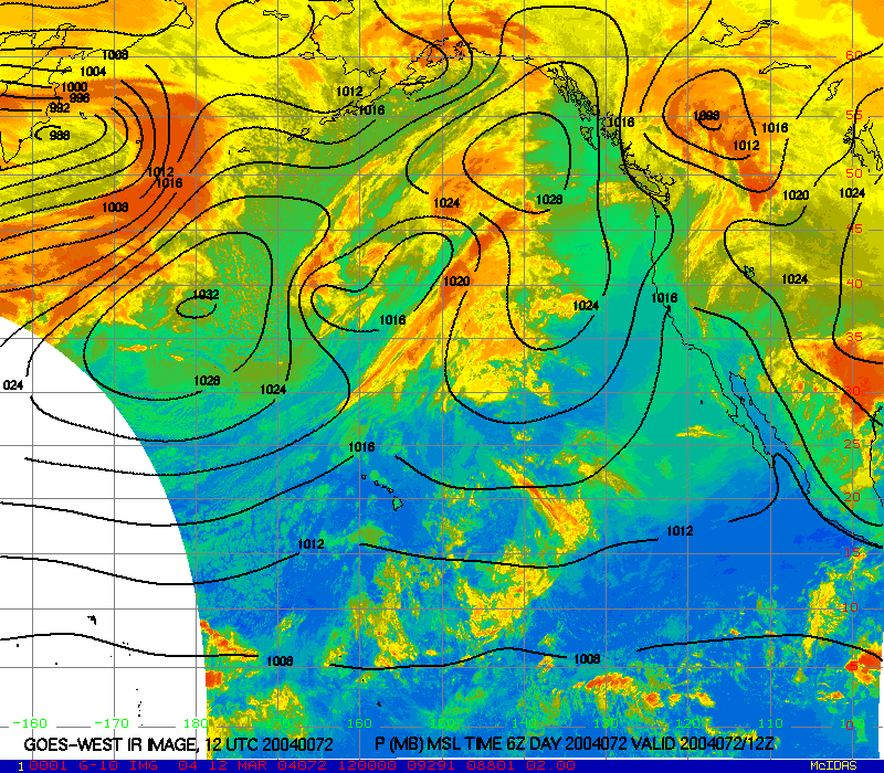
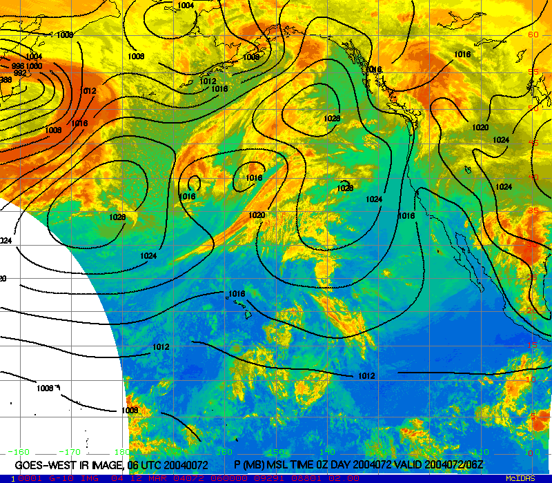
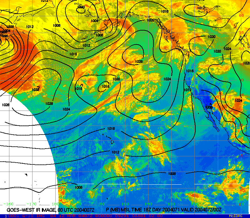
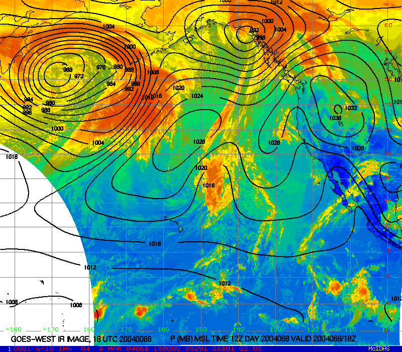
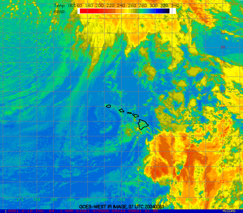
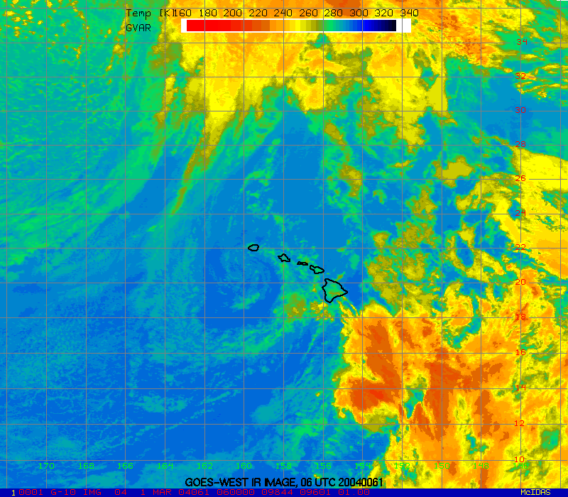
- 6-day infra-red loop These images are available every 6-hours. Contours are MSL pressure. Yellows and reds indicate higher cloud tops. Greens and blues indicate lower level clouds and the surface of the Earth.
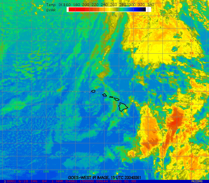
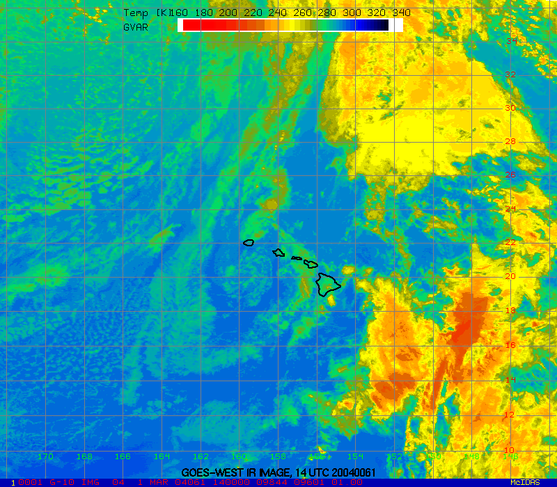
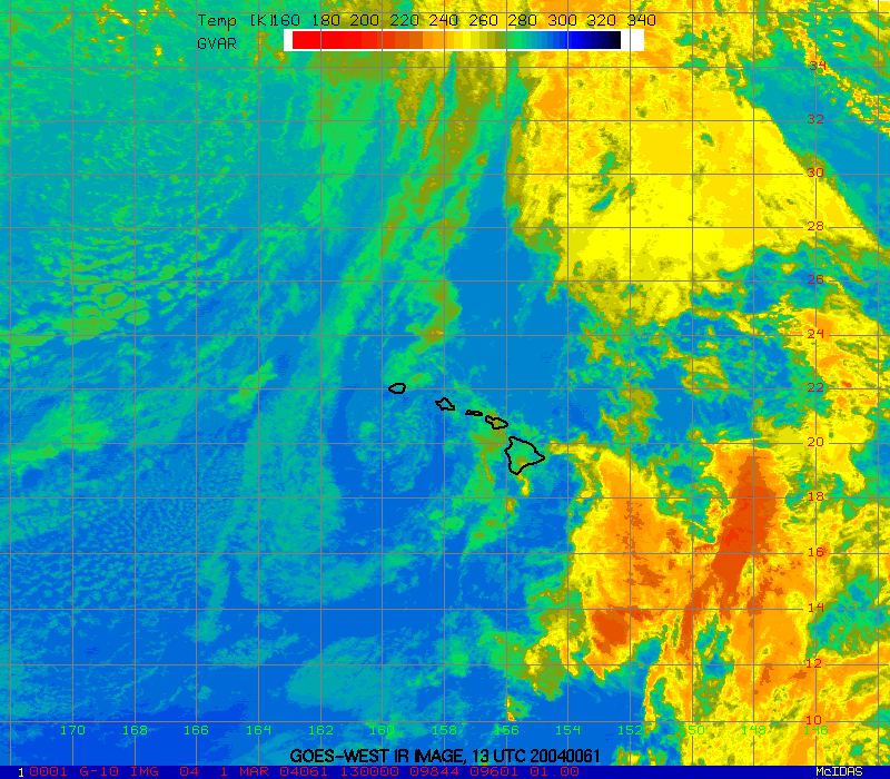
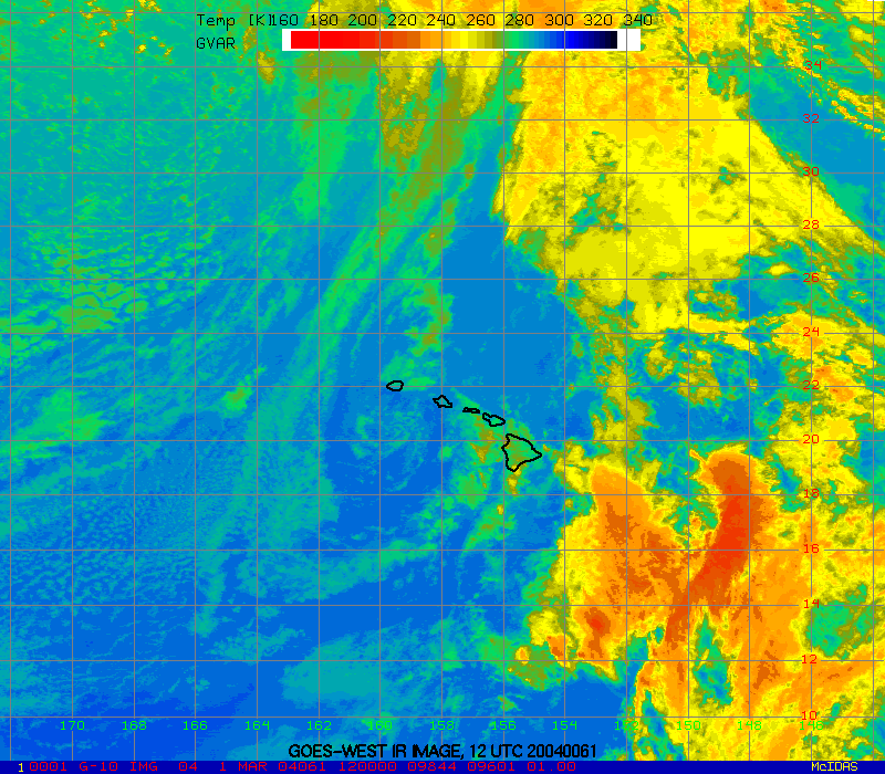
- 24-hour infra-red loop These images are available every hour. Yellows and reds indicate higher cloud tops. Greens and blues indicate lower level clouds and the surface of the Earth.
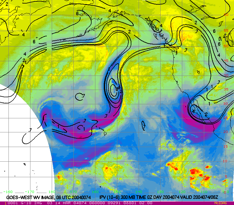
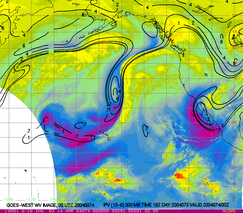
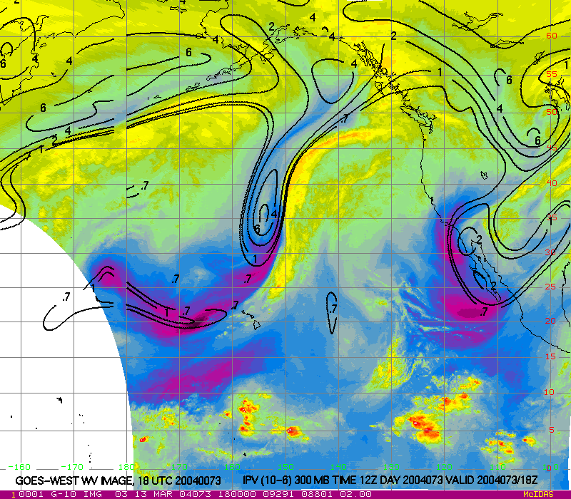
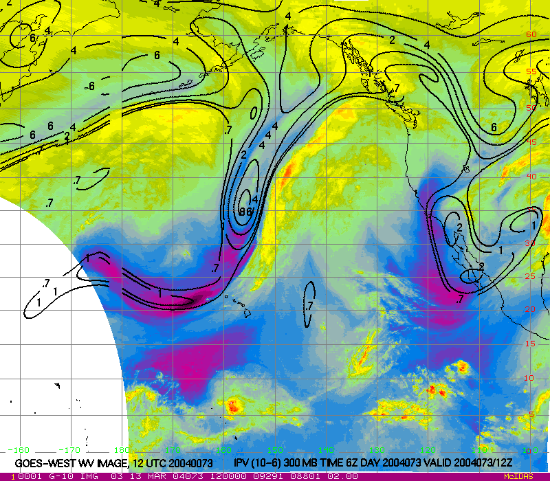
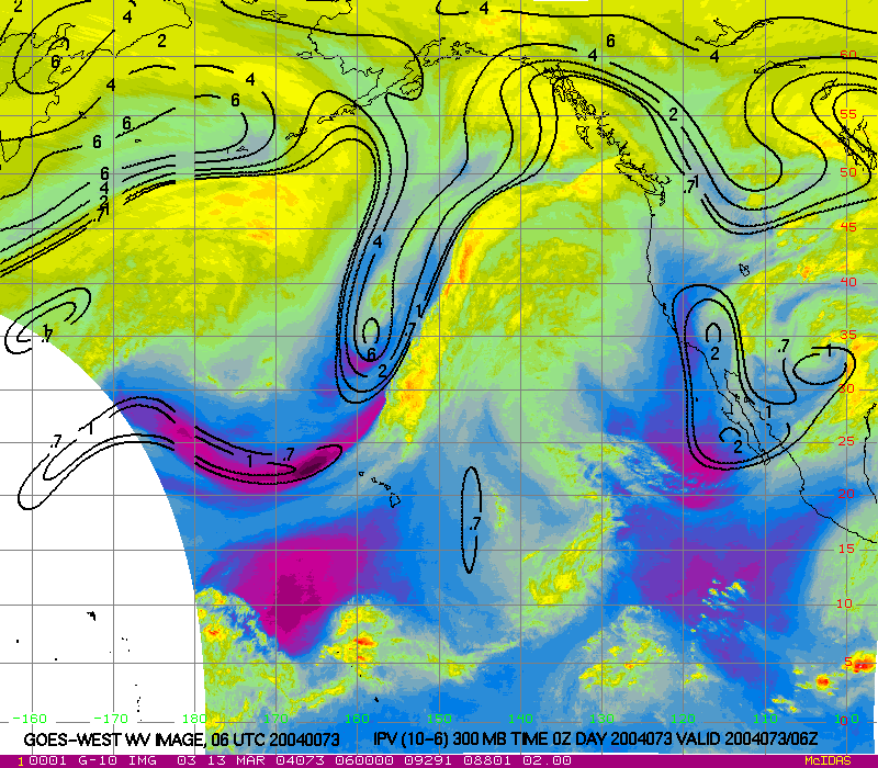
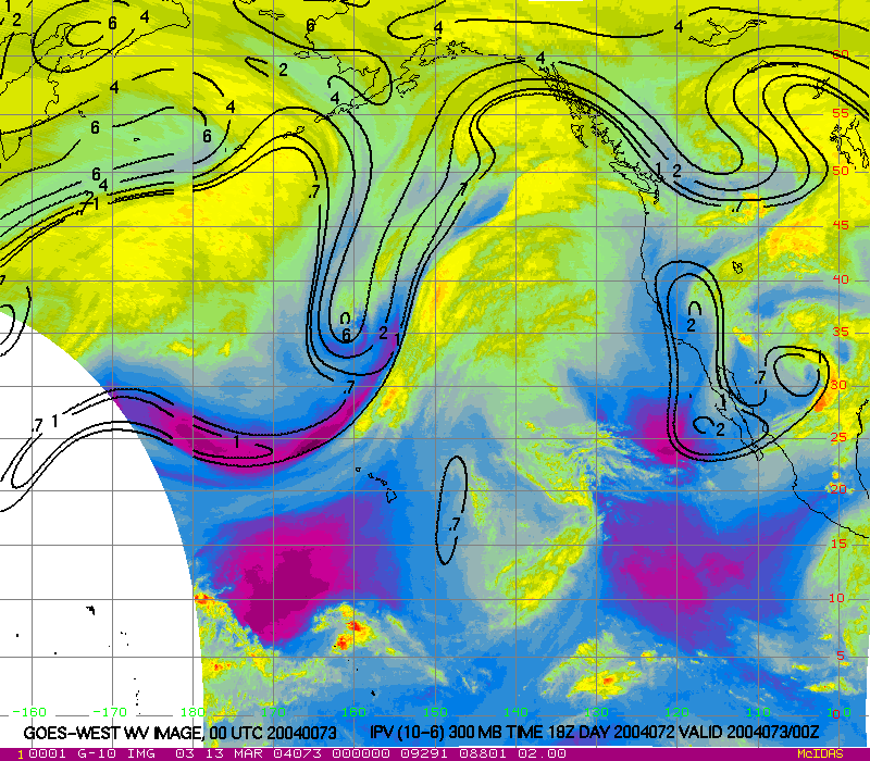
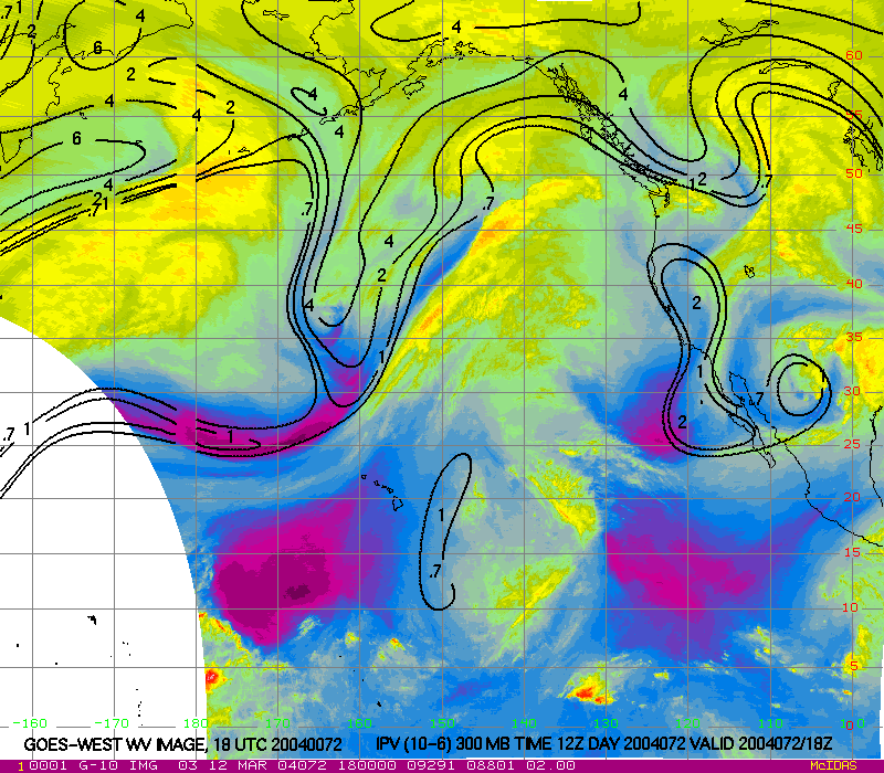
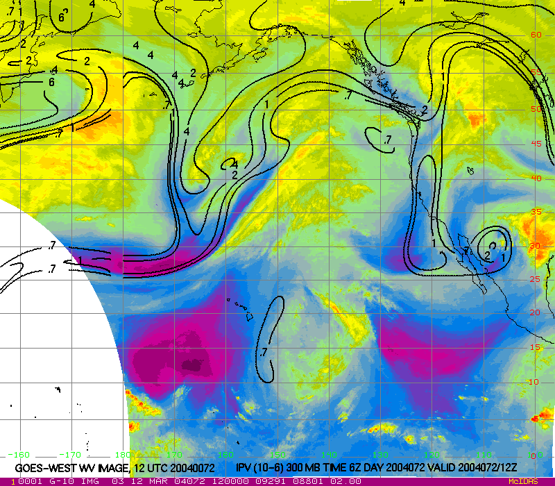
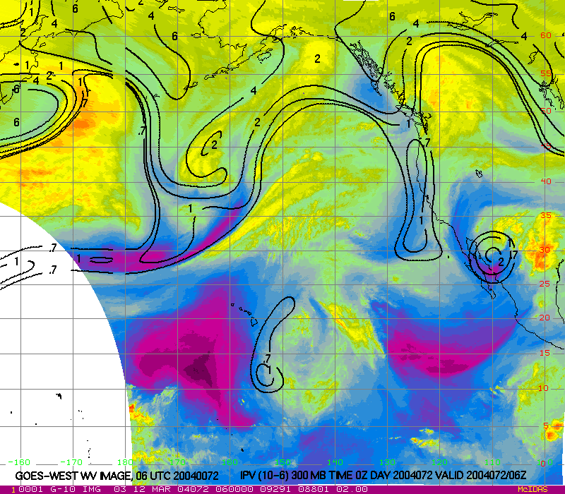
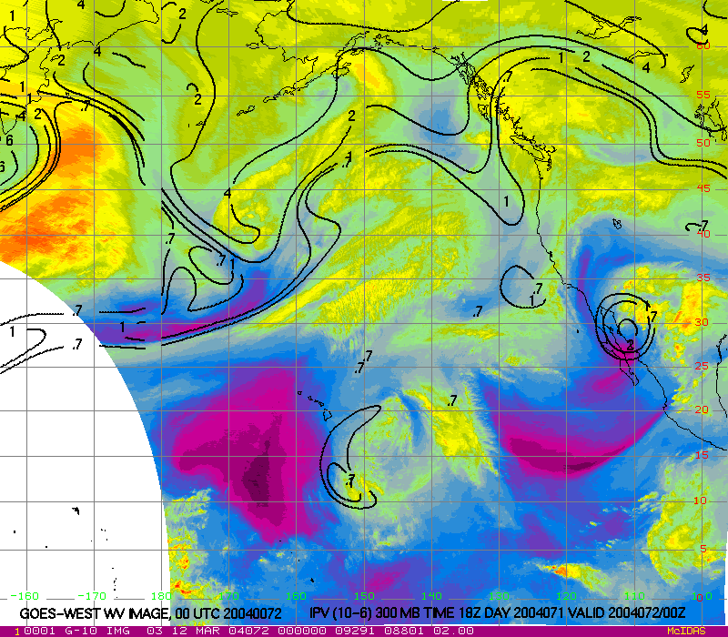
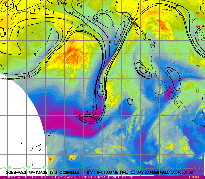
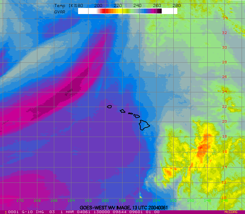
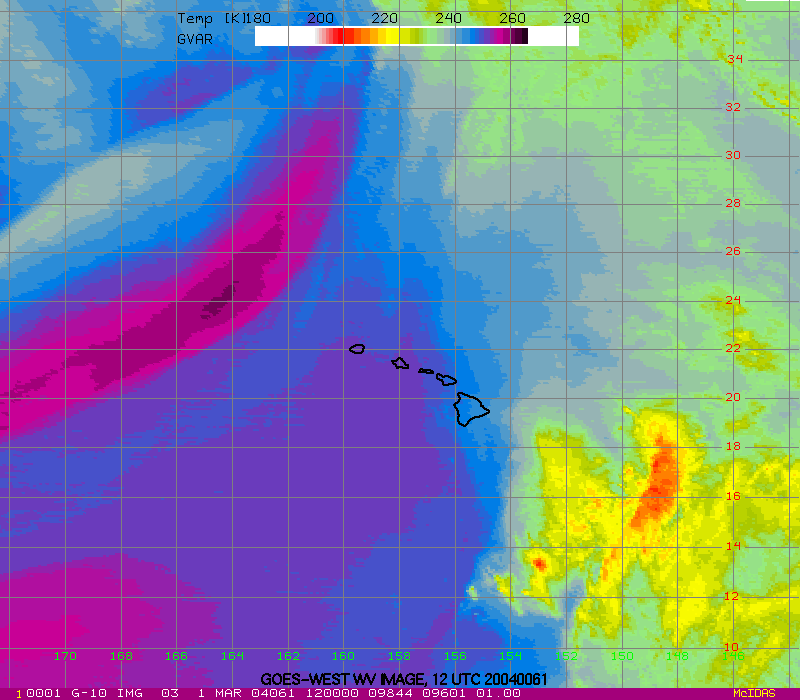
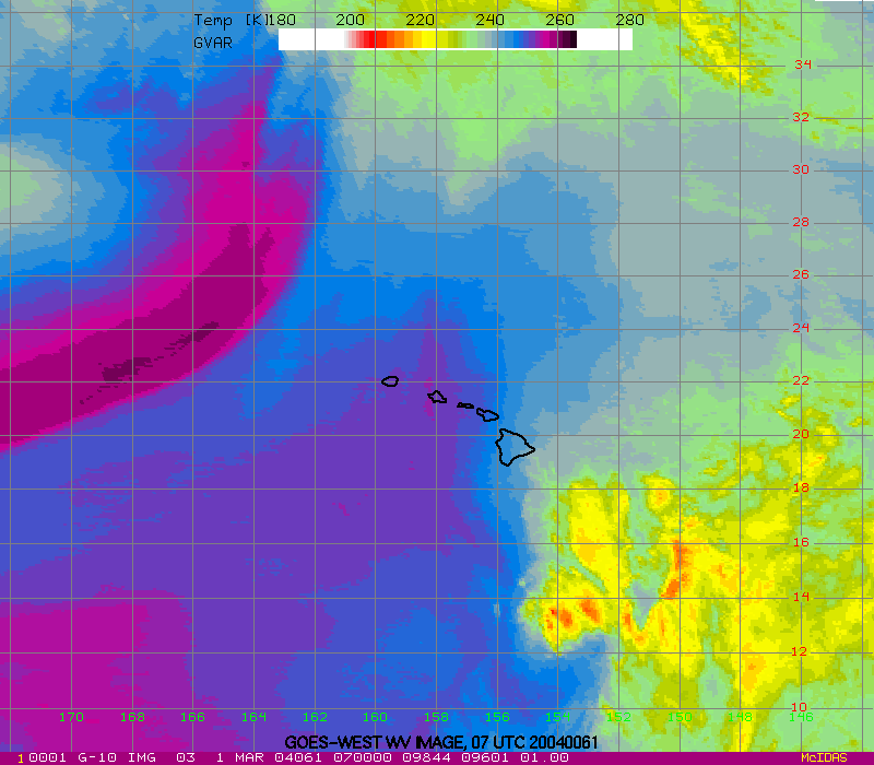
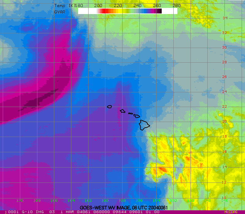
- 6-day water vapor loop These images are available every 6-hours. Contours are 300 hPa IPV. Purples and blues indicate dry air, and greens and yellows indicate moist air.
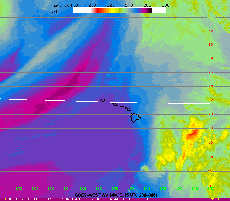
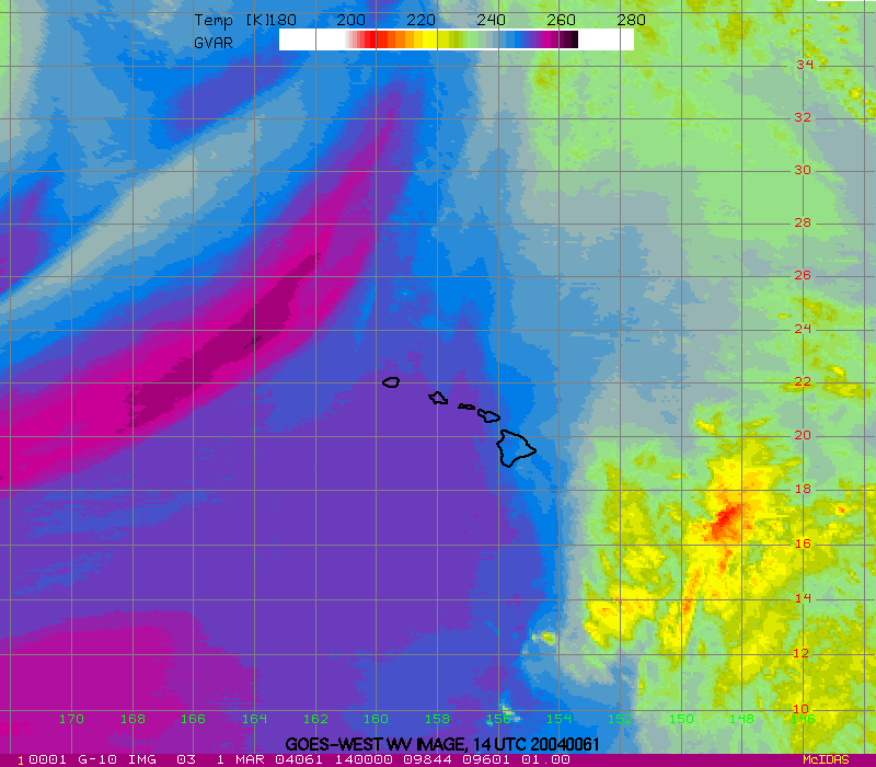
- 24-hour water vapor loop These images are available every hour. Purples and blues indicate dry air, and greens and yellows indicate moist air.
GFS Image Loops
View GFS product loops.
- 6-day loop of NCEP GFS dewpoint temperature These images are available every 6-hours. Contours and shading depict dewpoint temperature.
- 72-hour forecast loop of NCEP GFS dewpoint temperature Images available at forecast times of 00 06 12 18 24 30 36 42 48 60 and 72 hours. Contours and shading depict dewpoint temperature.
- 6-day loop of NCEP GFS dewpoint temperature with IPV These images are available every 6-hours. Contours depict IPV and shading depicts dewpoint temperature.
- 72-hour forecast loop of NCEP GFS dewpoint temperature with IPV Images available at forecast times of 00 06 12 18 24 30 36 42 48 60 and 72 hours. Contours depict IPV and shading depicts dewpoint temperature.
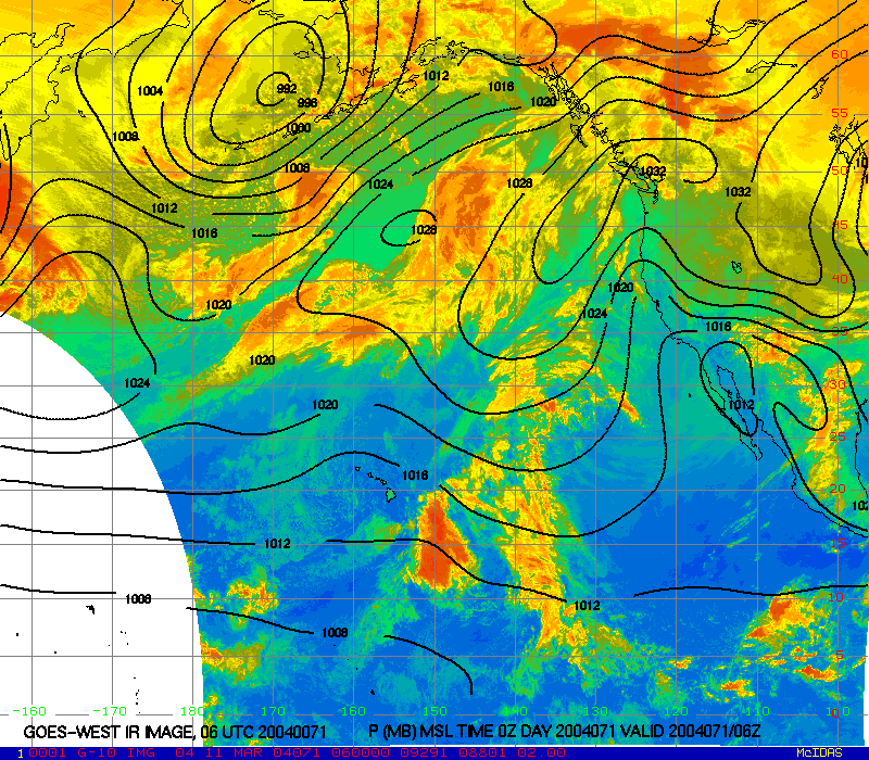
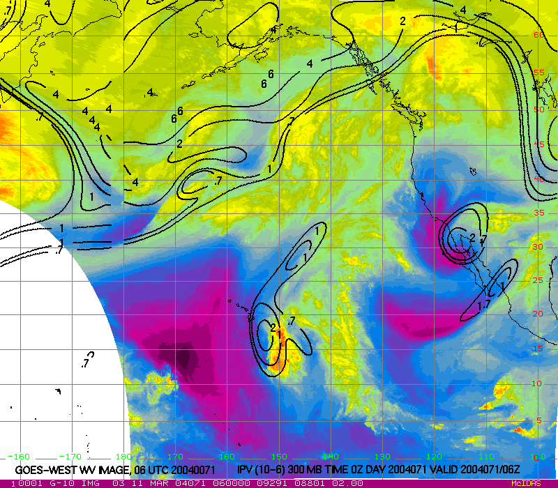
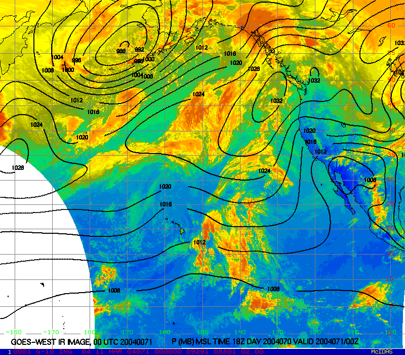
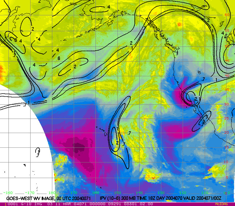
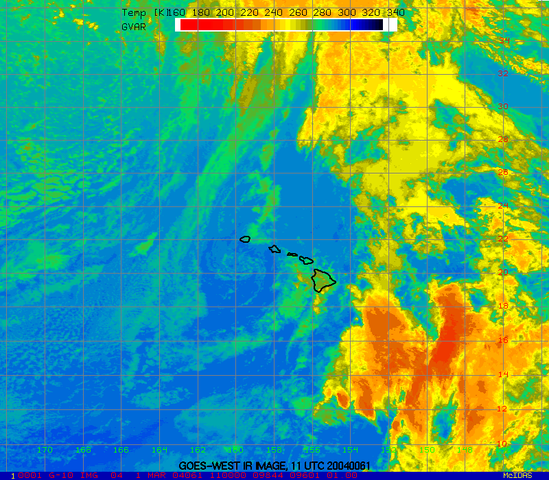
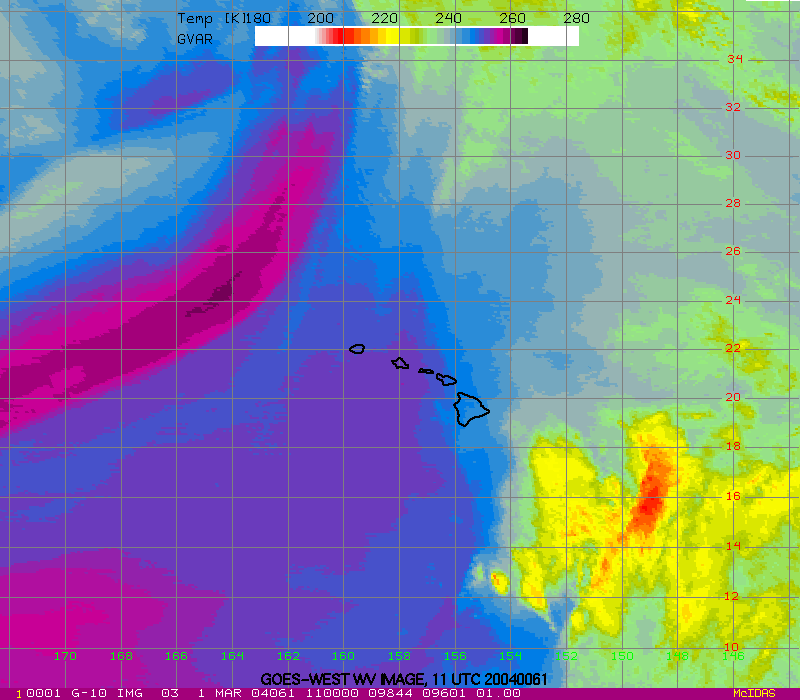
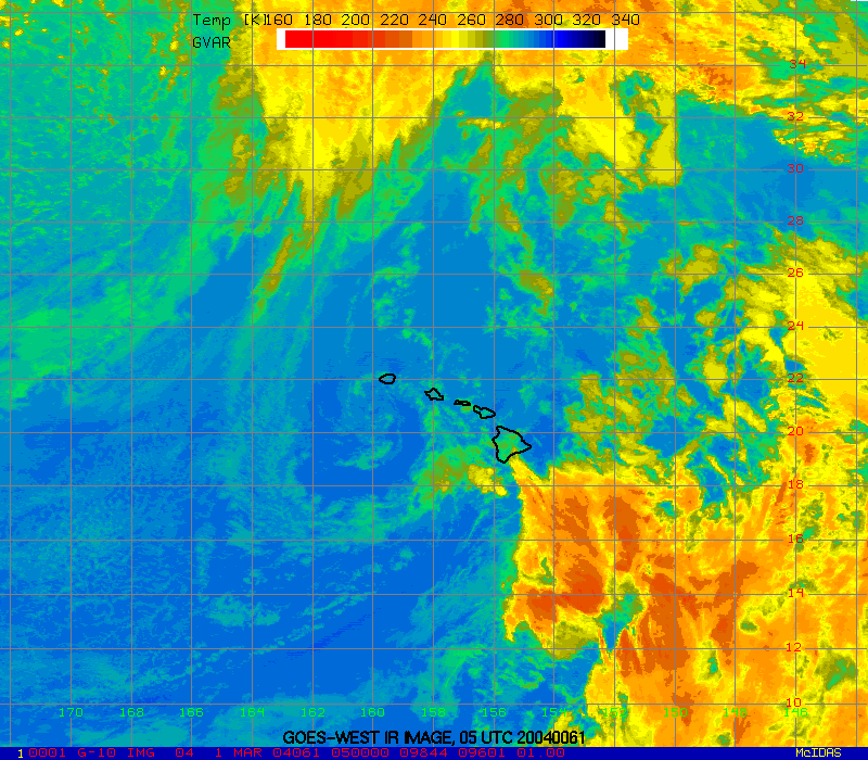
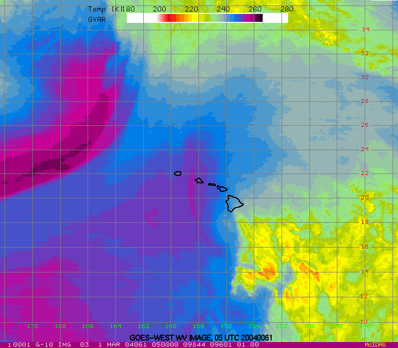
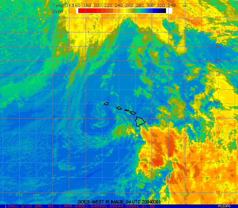
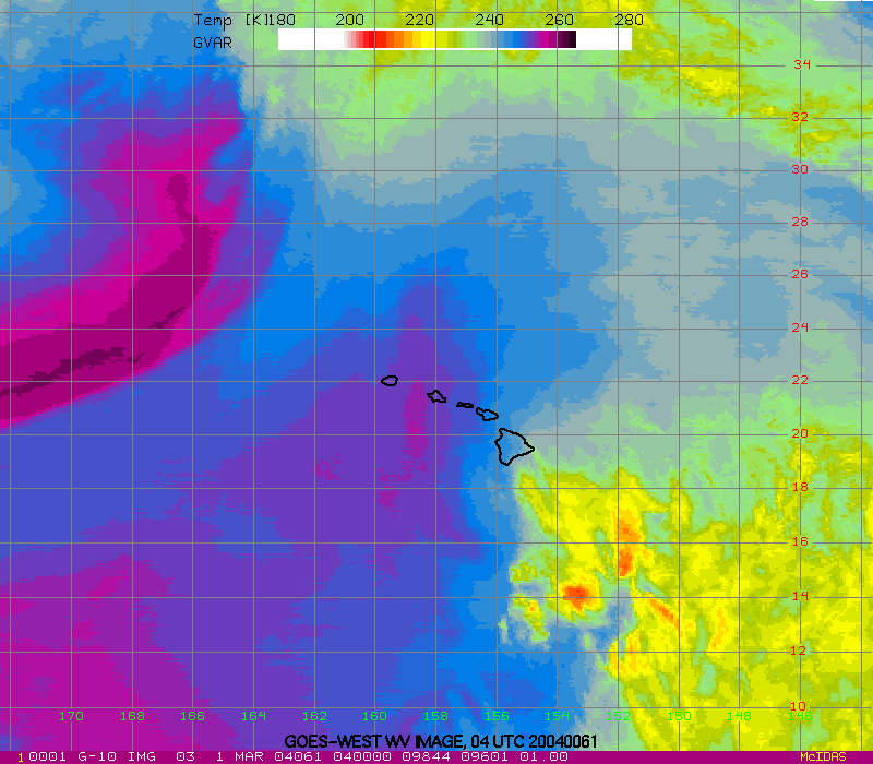
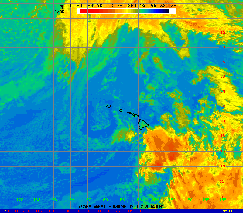
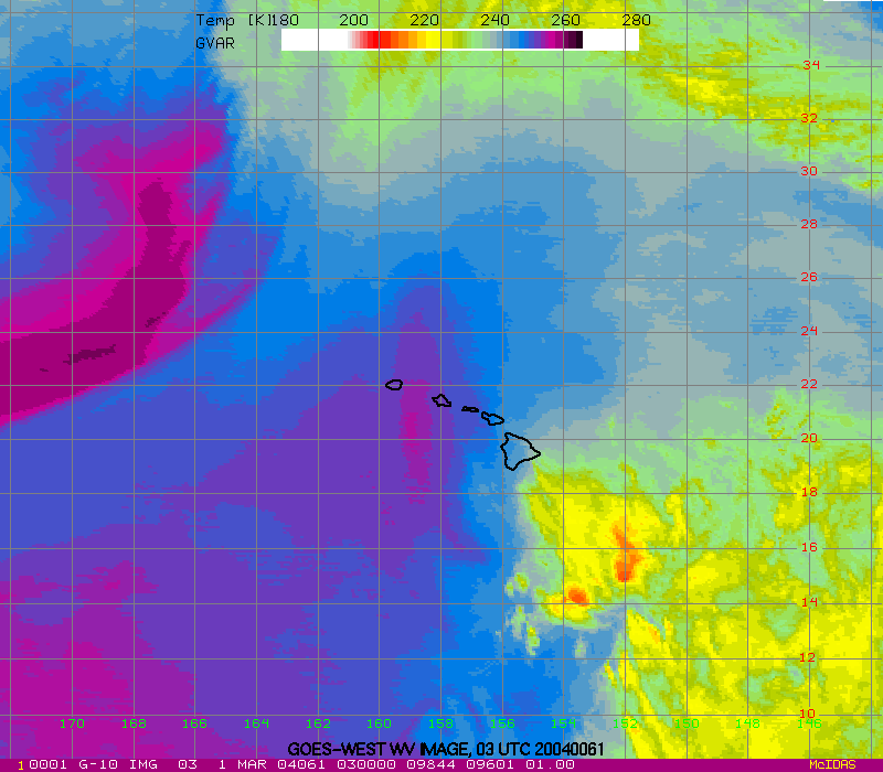
GOES-WEST IR and WV Images
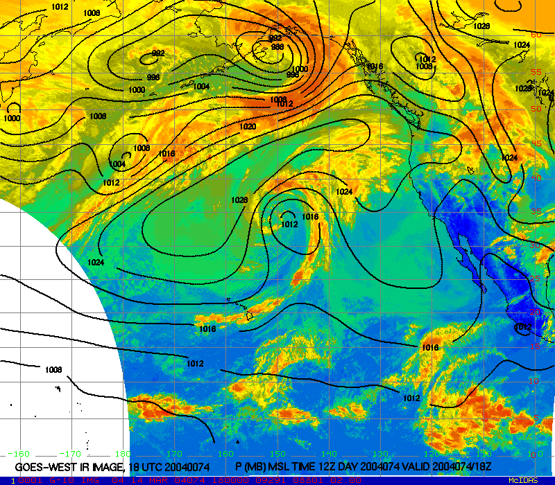
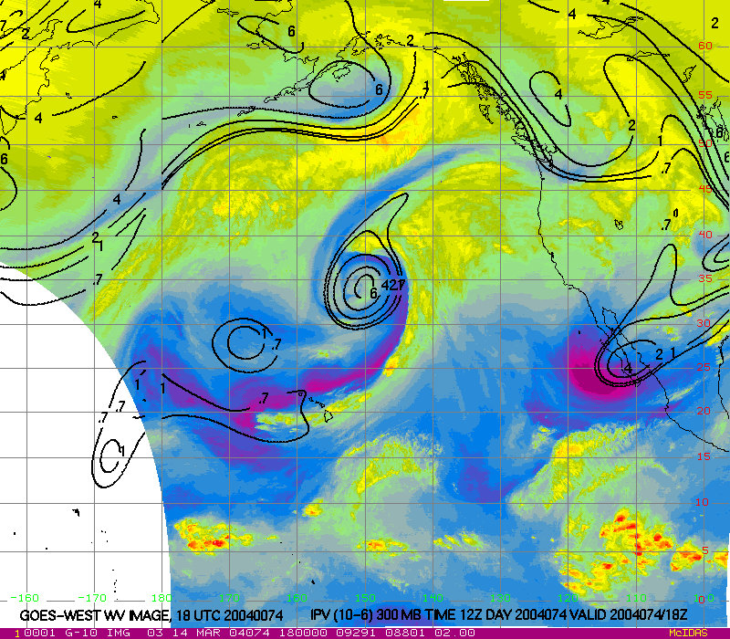
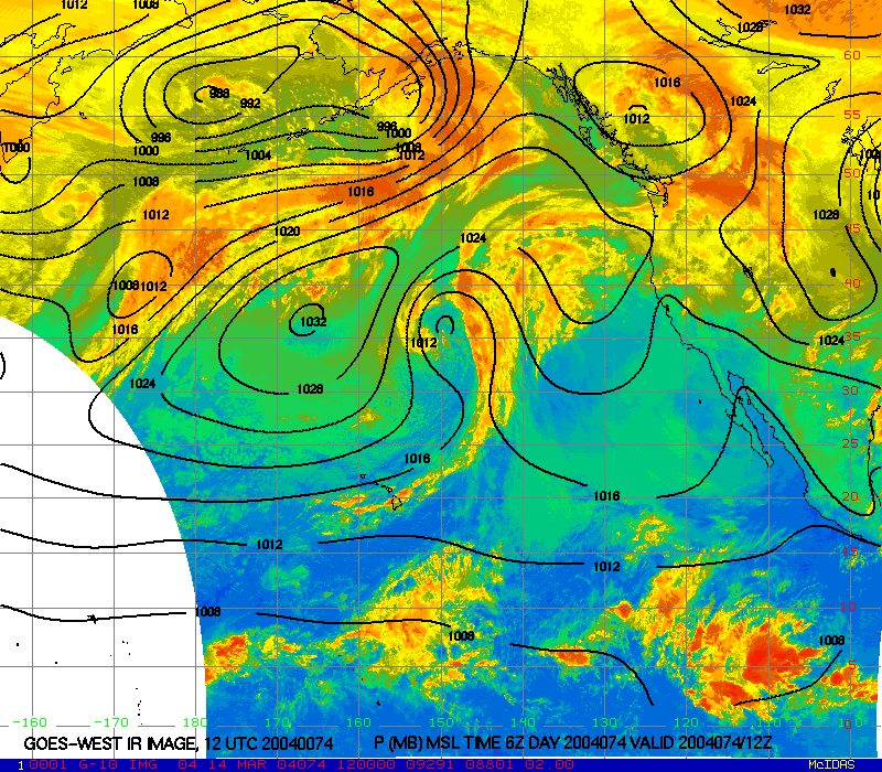
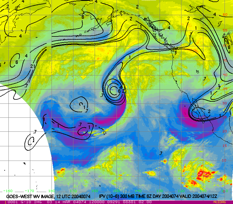
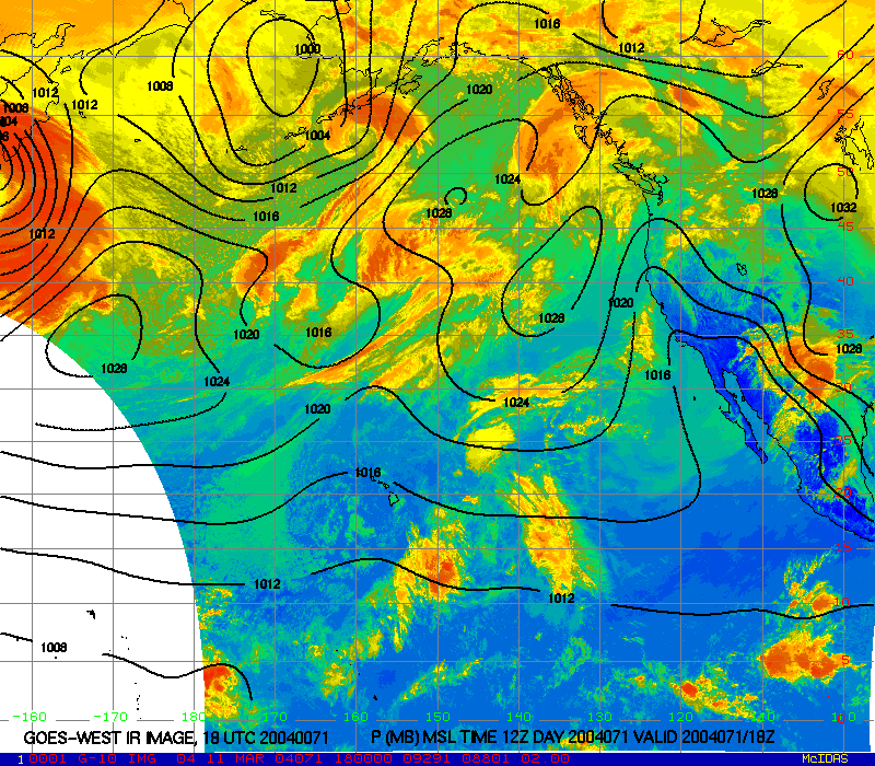
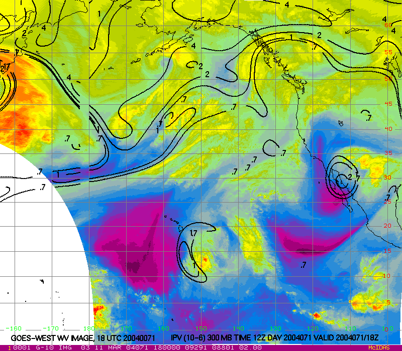
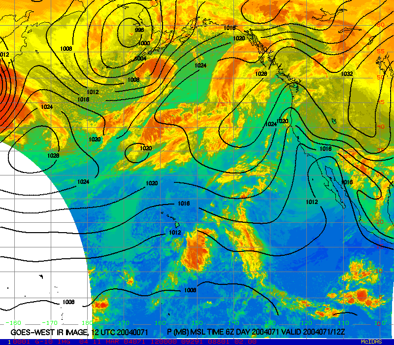
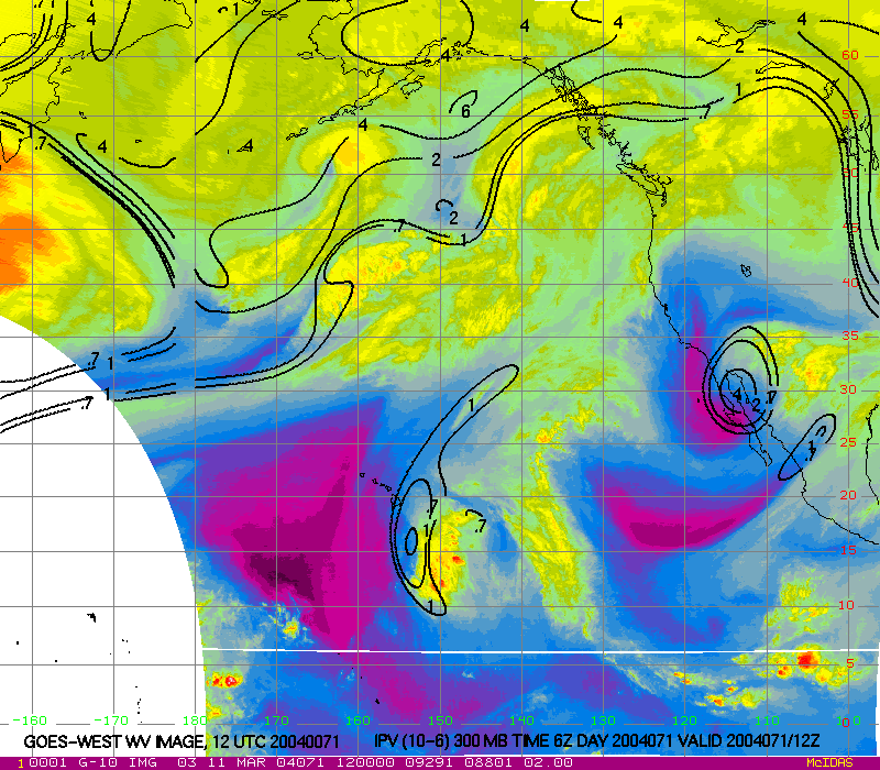
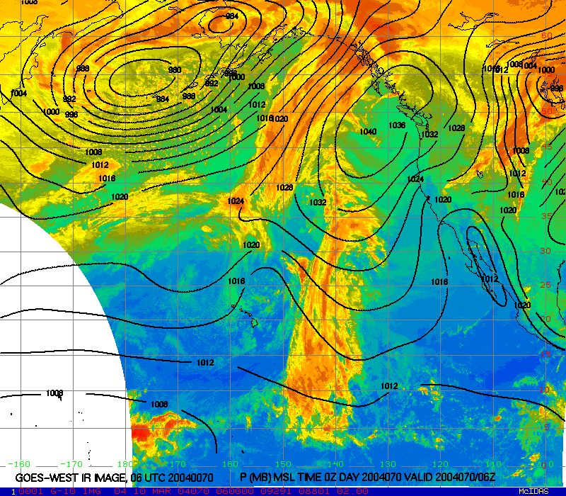
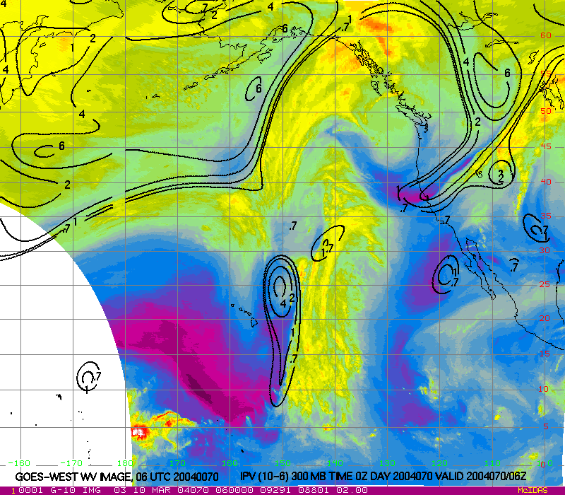
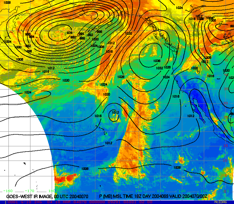
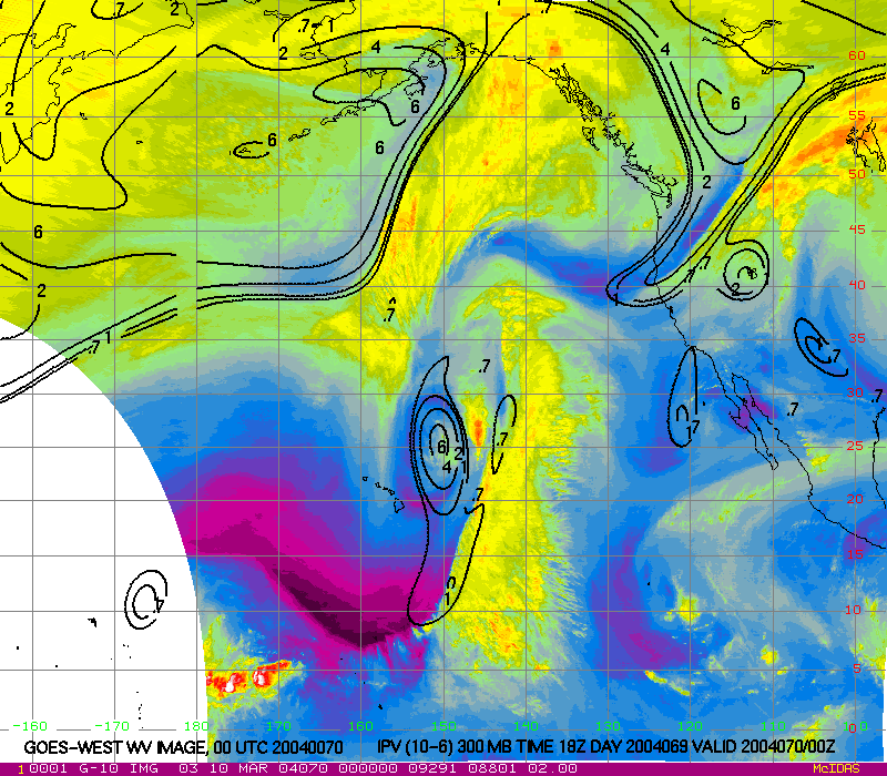
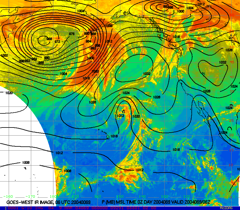
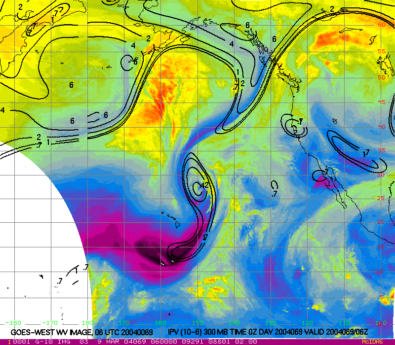
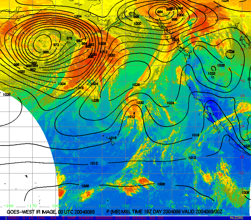
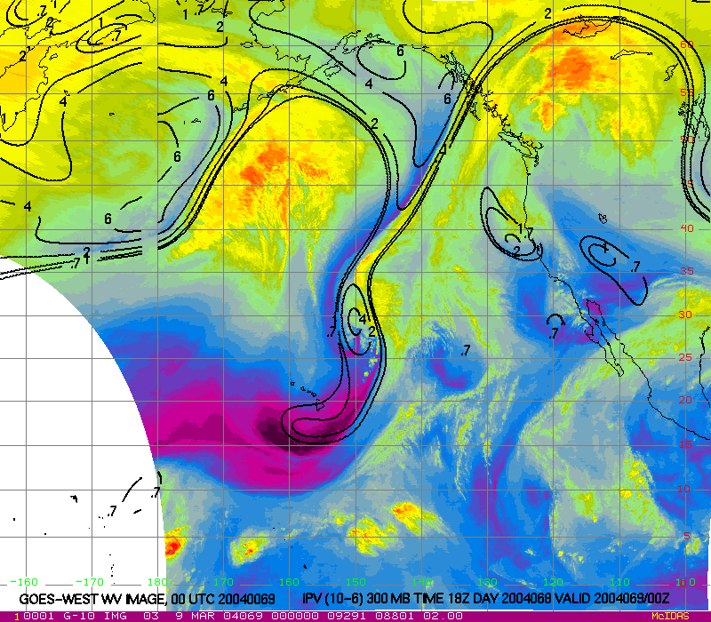
View individual 6-hourly GOES-WEST IR images with MSL pressure, or WV images with 300 hPa IPV.
| Hours back in time | IR & MSL pressure | WV & 300 hPa IPV |
|---|---|---|
| 0 | X | X |
| 6 | X | X |
| 12 | X | X |
| 18 | X | X |
| 24 | X | X |
| 30 | X | X |
| 36 | X | X |
| 42 | X | X |
| 48 | X | X |
| 54 | X | X |
| 60 | X | X |
| 66 | X | X |
| 72 | X | X |
| 78 | X | X |
| 84 | X | X |
| 90 | X | X |
| 96 | X | X |
| 102 | X | X |
| 108 | X | X |
| 114 | X | X |
| 120 | X | X |
| 126 | X | X |
| 132 | X | X |
| 138 | X | X |
| 144 | X | X |
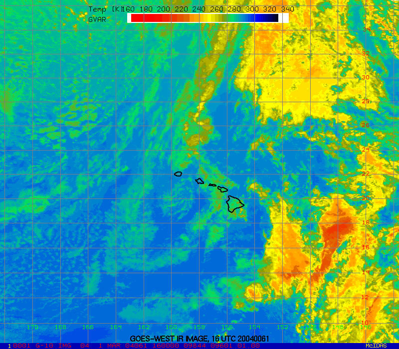
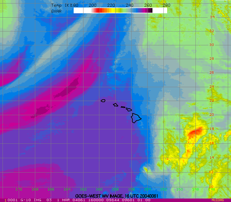
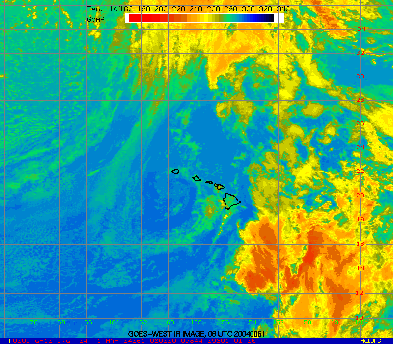
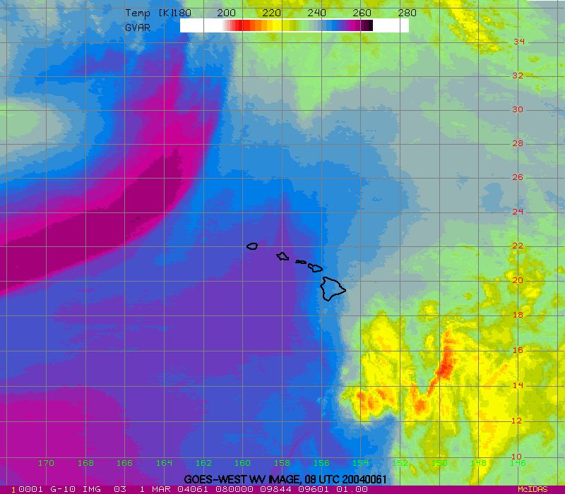
View individual hourly GOES-WEST IR or WV images.
| Hours back in time | IR | WV |
|---|---|---|
| 0 | X | X |
| 1 | X | X |
| 2 | X | X |
| 3 | X | X |
| 4 | X | X |
| 5 | X | X |
| 6 | X | X |
| 7 | X | X |
| 8 | X | X |
| 9 | X | X |
| 10 | X | X |
| 11 | X | X |
| 12 | X | X |
| 13 | X | X |
| 14 | X | X |
| 15 | X | X |
| 16 | X | X |
| 17 | X | X |
| 18 | X | X |
| 19 | X | X |
| 20 | X | X |
| 21 | X | X |
| 22 | X | X |
| 23 | X | X |
| 24 | X | X |
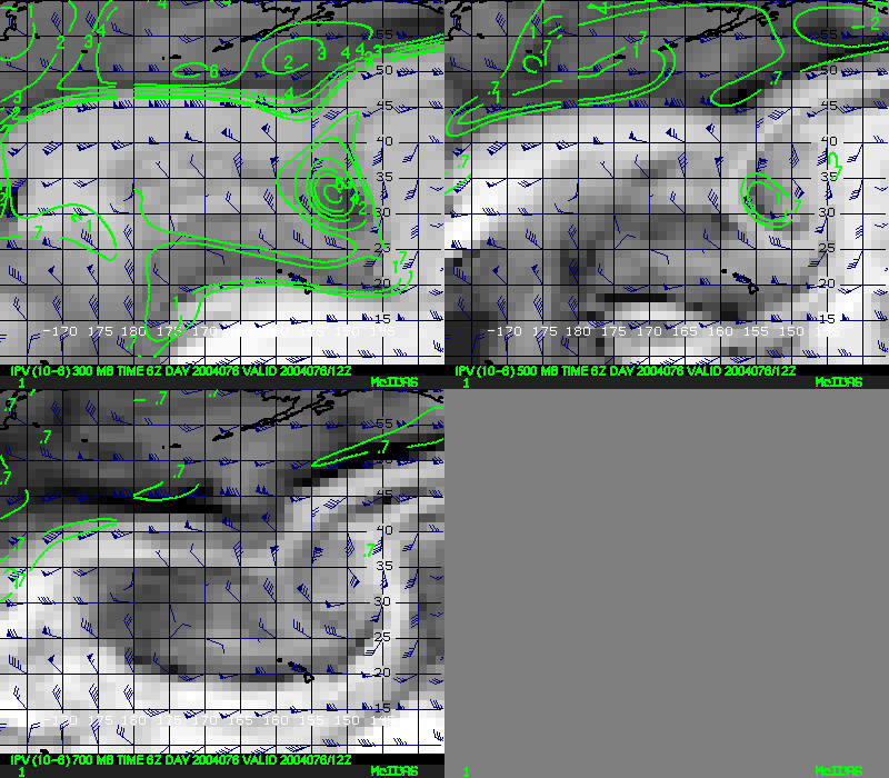
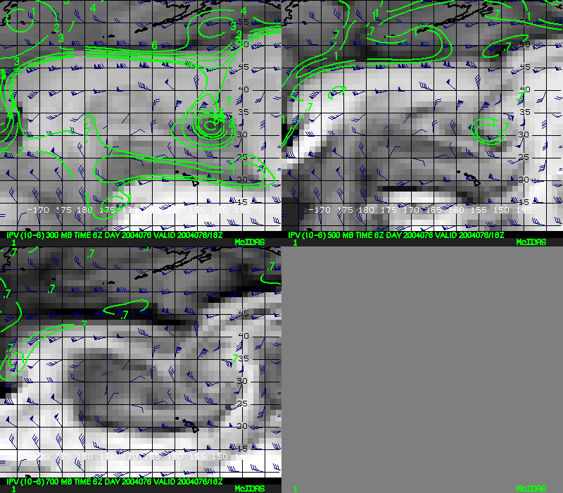
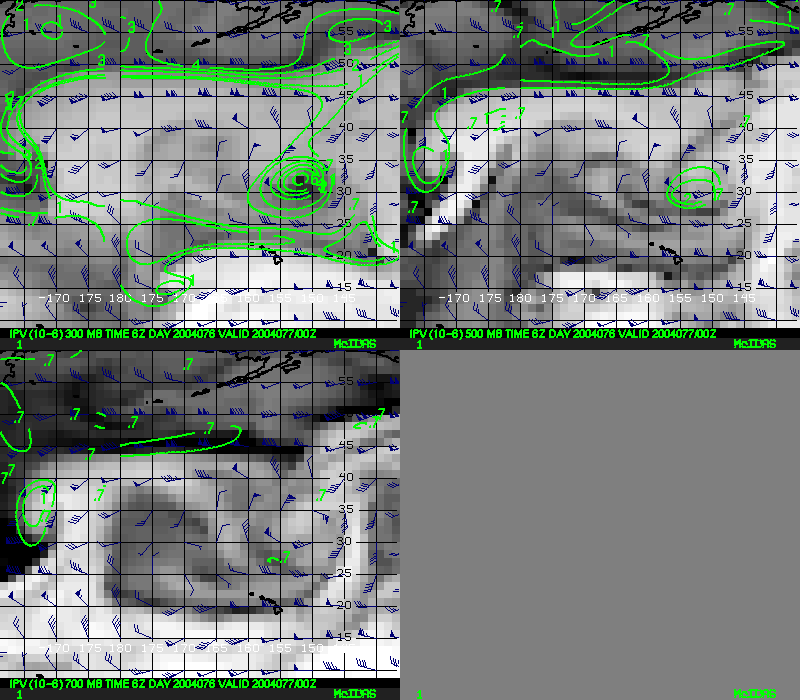
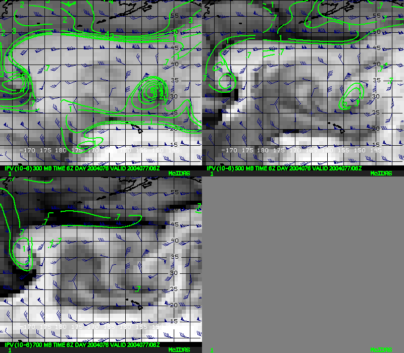
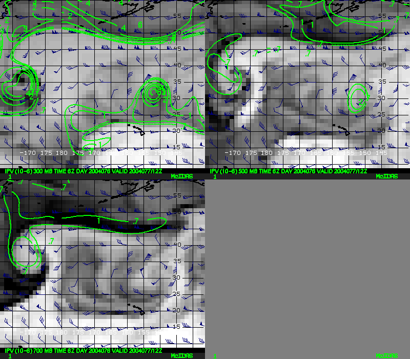
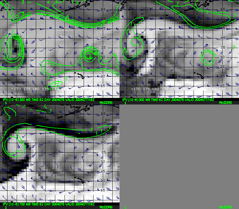
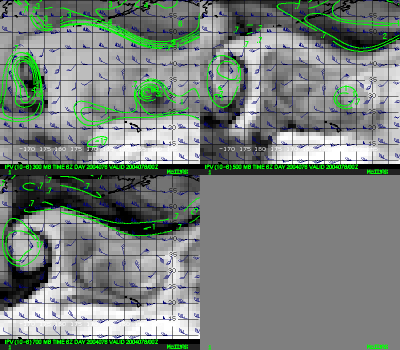
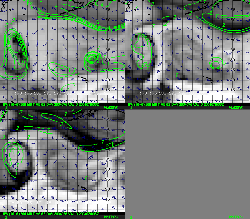
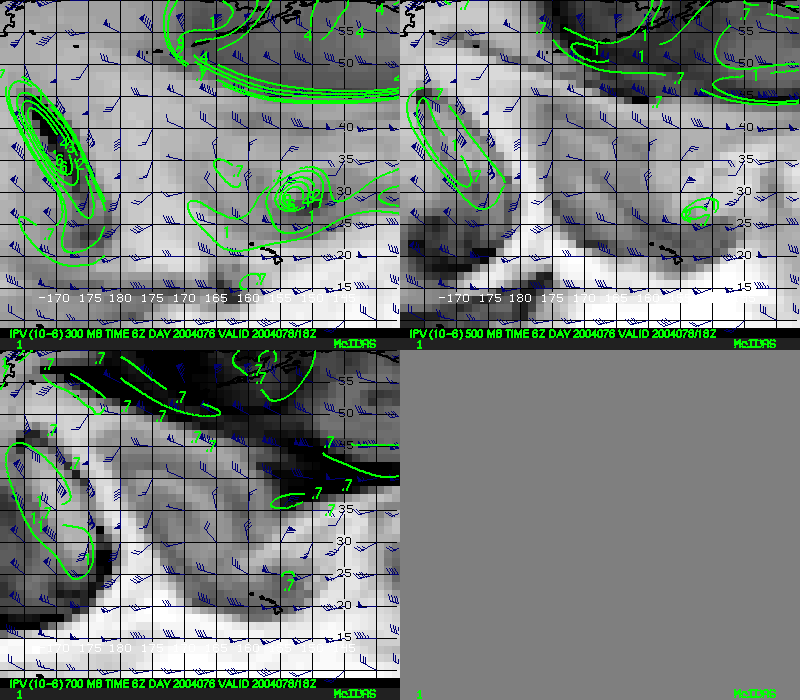
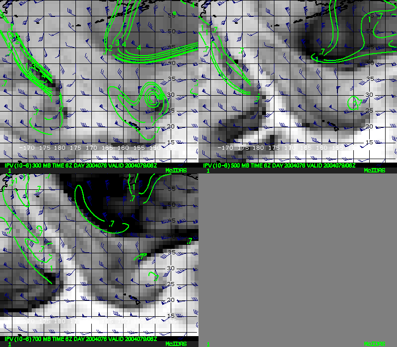
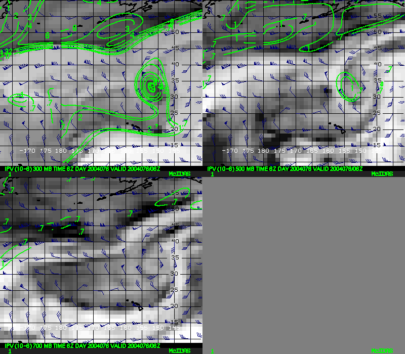
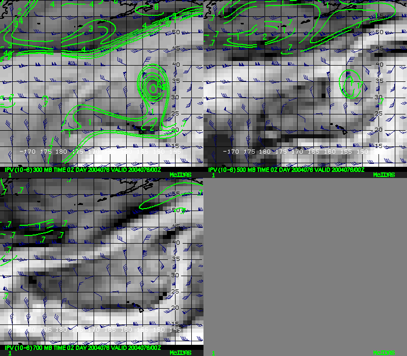
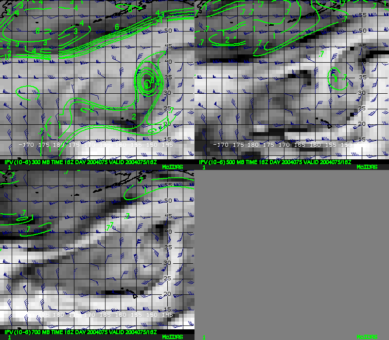
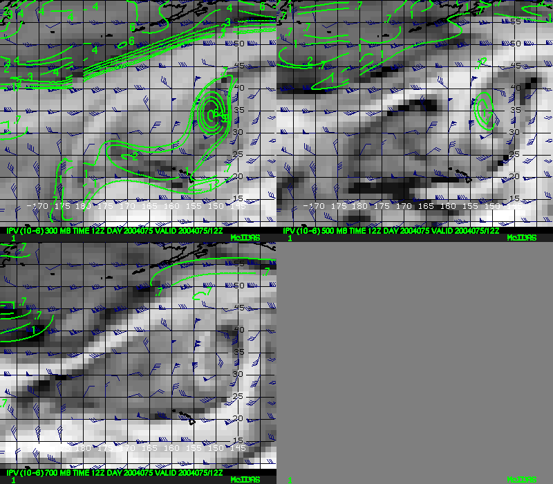
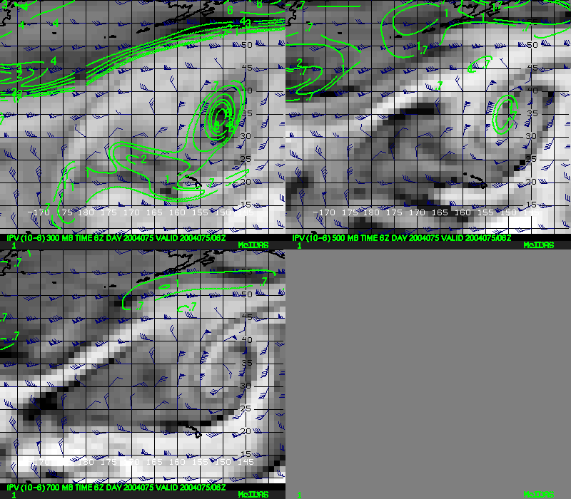
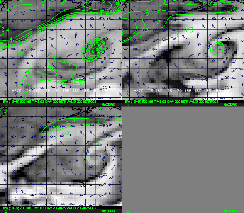
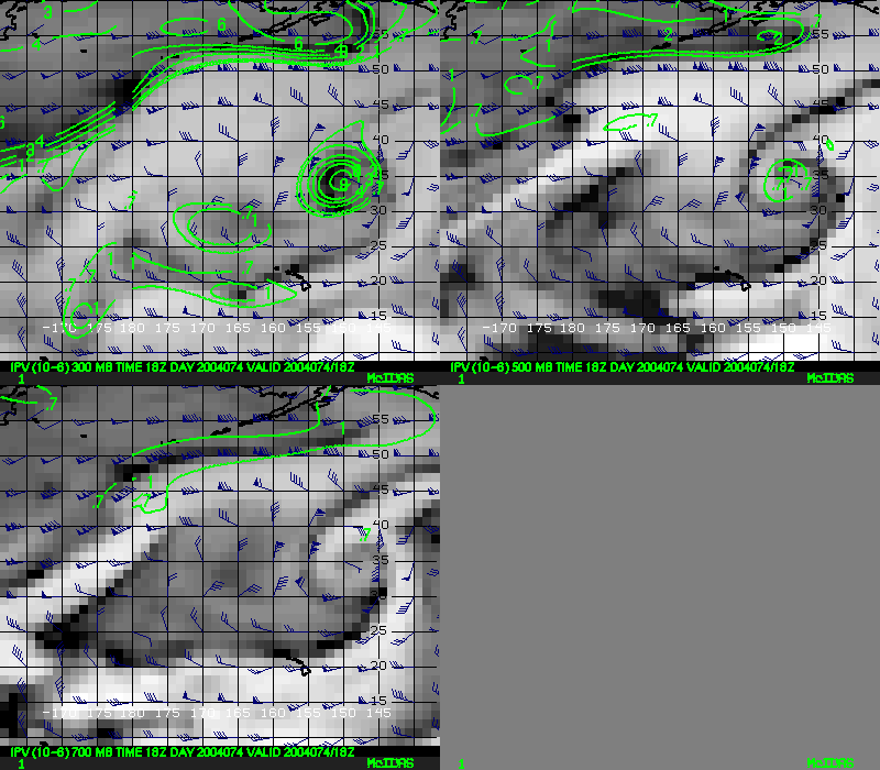
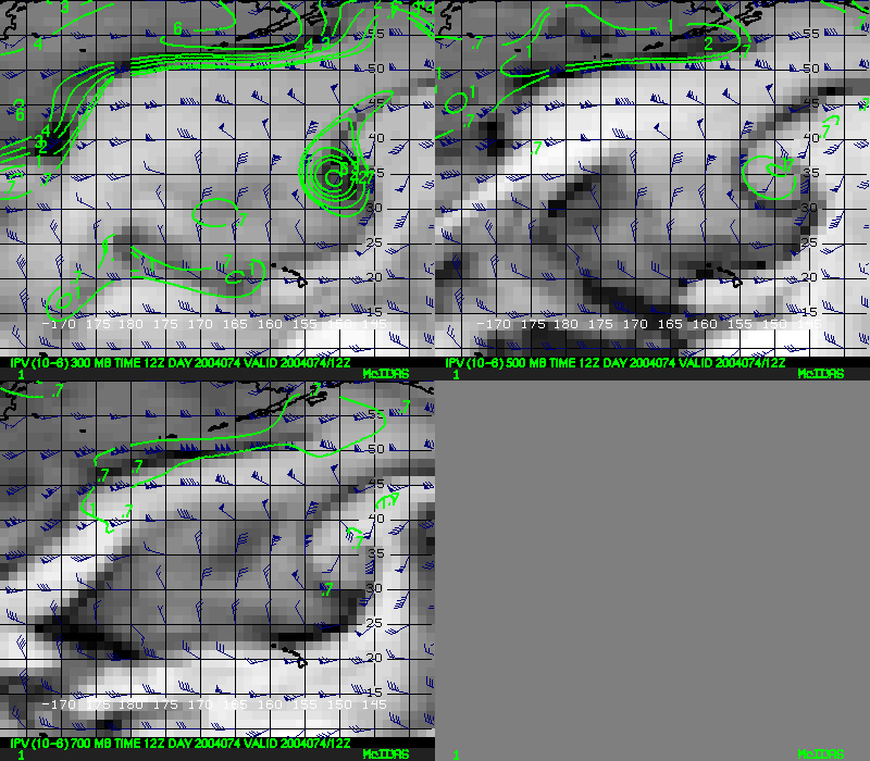
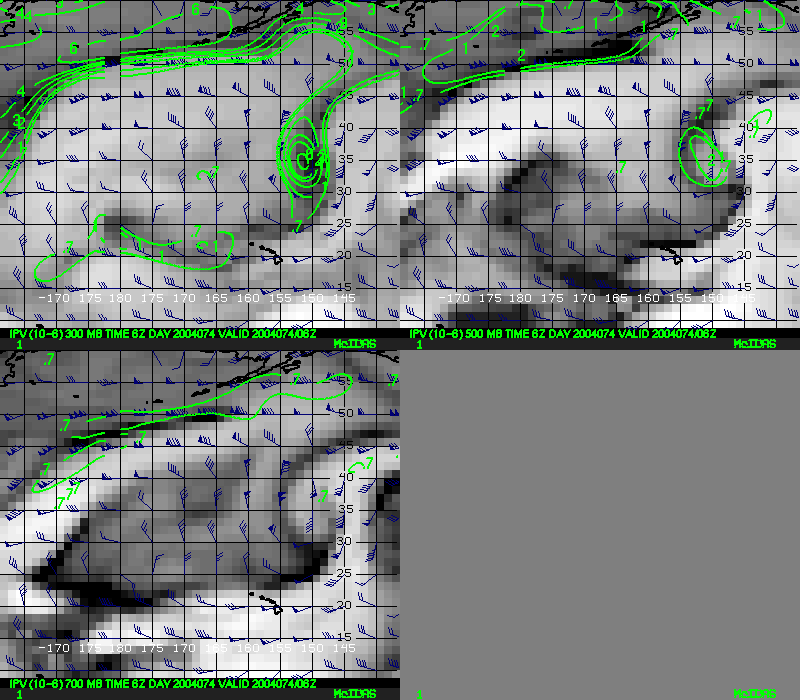
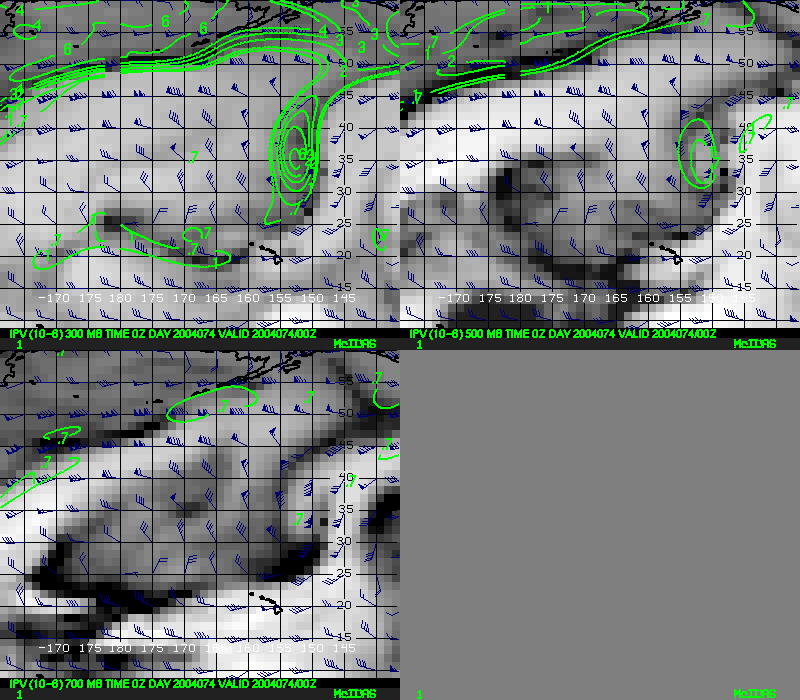
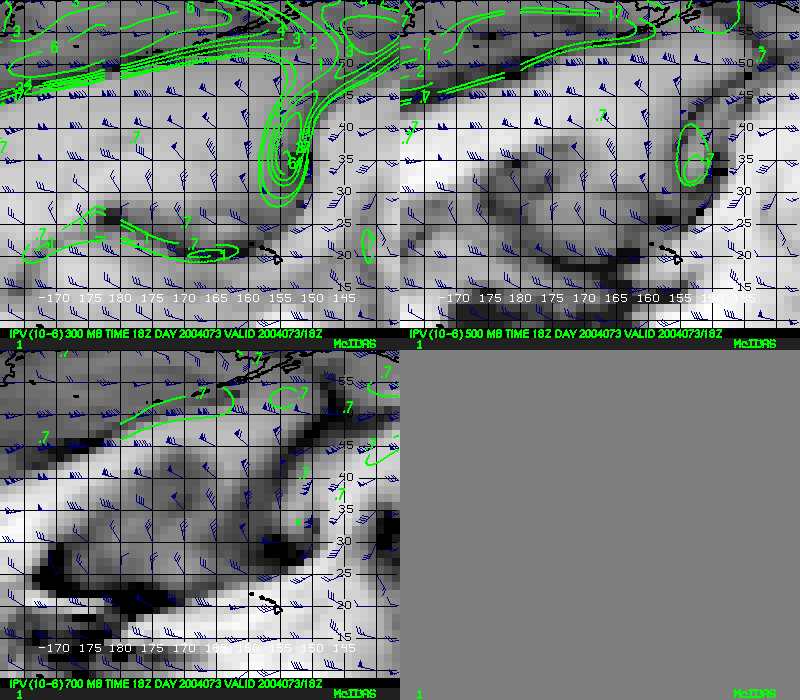
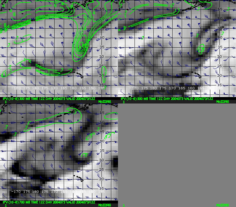
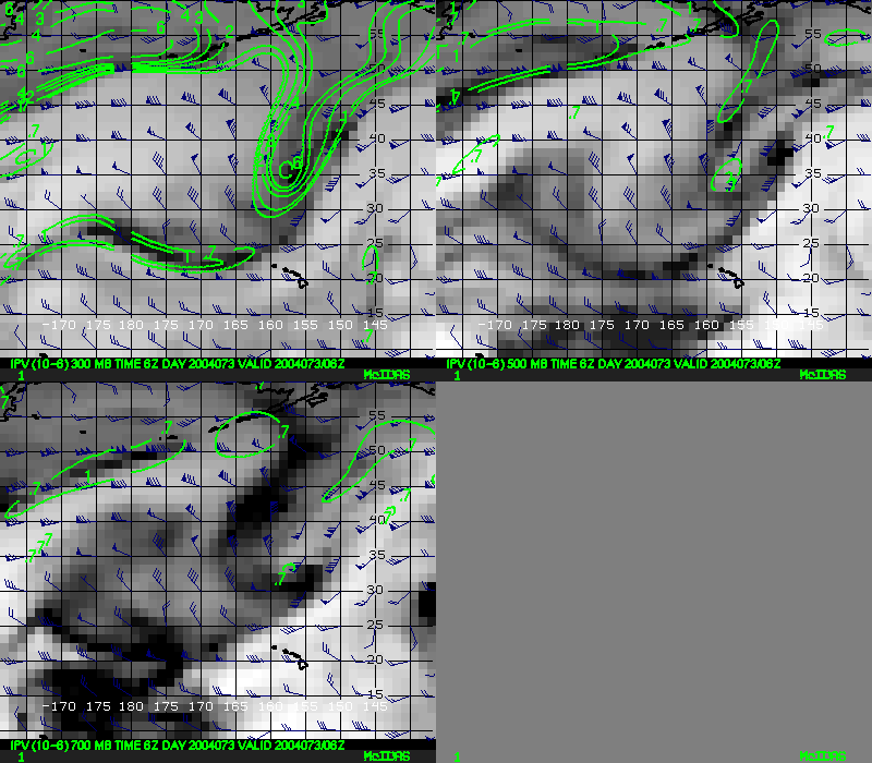
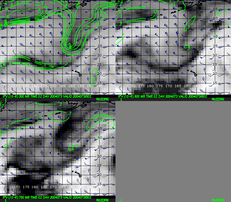
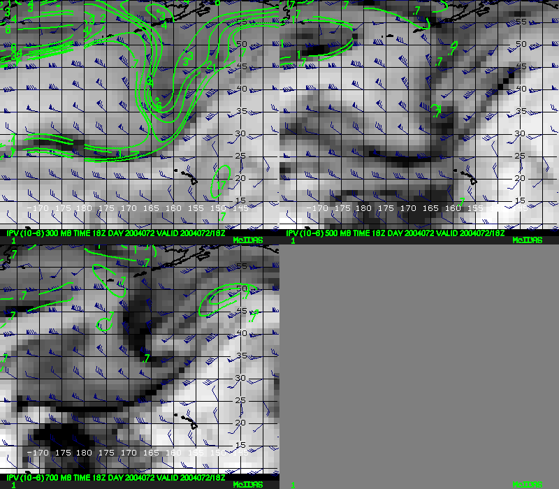
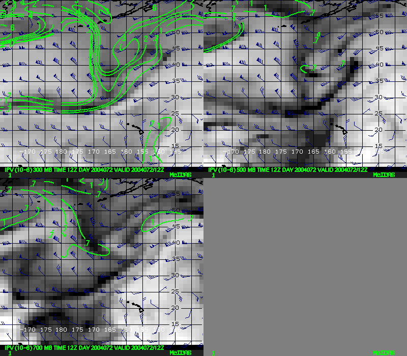
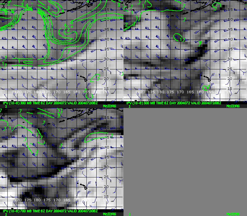
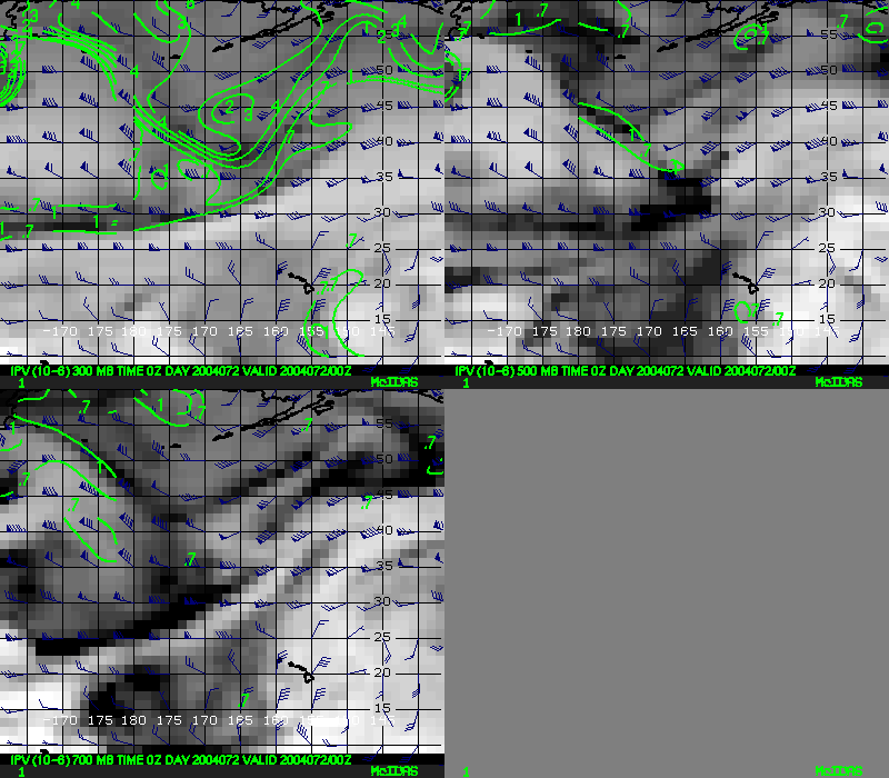
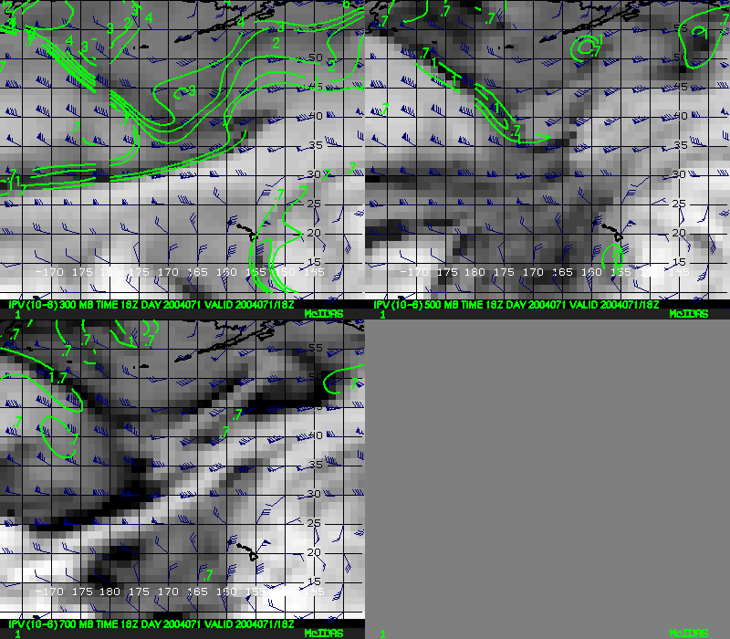
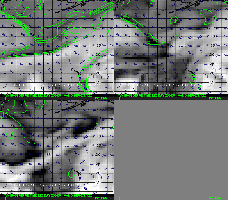
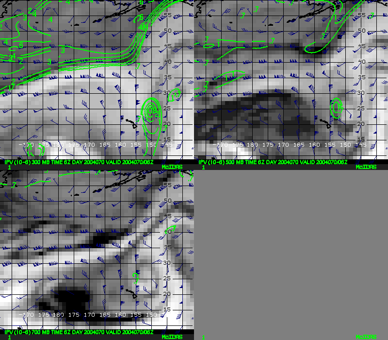
GFS plots
View individual GFS forecast plots of dewpoint temperature and IPV. Each plot shows data at 300, 500, 700 and 850 hPa.
| Forecast hour | Dewpoint only | Dewpoint with IPV contours |
|---|---|---|
| 0 | X | X |
| 6 | X | X |
| 12 | X | X |
| 18 | X | X |
| 24 | X | X |
| 30 | X | X |
| 36 | X | X |
| 42 | X | X |
| 48 | X | X |
| 60 | X | X |
| 72 | X | X |
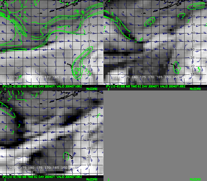
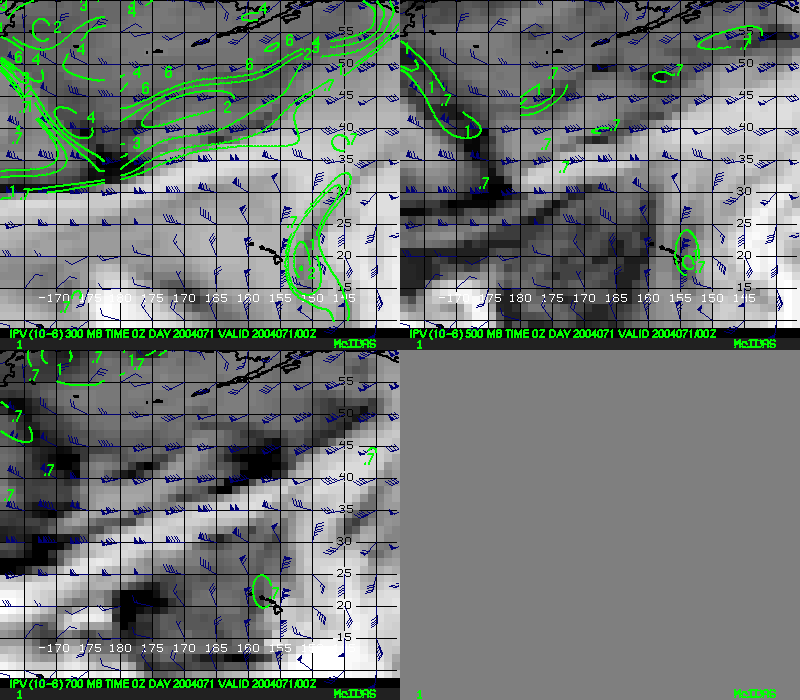
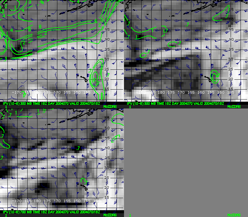
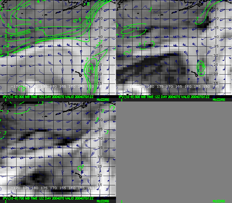
View individual 6-hourly GFS plots of dewpoint temperature and IPV. Each plot shows data at 300, 500, 700 and 850 hPa.
| Hours back in time | Dewpoint only | Dewpoint with IPV contours |
|---|---|---|
| 0 | X | X |
| 6 | X | X |
| 12 | X | X |
| 18 | X | X |
| 24 | X | X |
| 30 | X | X |
| 36 | X | X |
| 42 | X | X |
| 48 | X | X |
| 54 | X | X |
| 60 | X | X |
| 66 | X | X |
| 72 | X | X |
| 78 | X | X |
| 84 | X | X |
| 90 | X | X |
| 96 | X | X |
| 102 | X | X |
| 108 | X | X |
| 114 | X | X |
| 120 | X | X |
| 126 | X | X |
| 132 | X | X |
| 138 | X | X |
| 144 | X | X |