A .gov website belongs to an official government organization in the United States.
A lock () or https:// means you've safely connected to the .gov website. Share sensitive information only on official, secure websites.
FIREX-AQ combines the previously separate NASA FIREChem and NOAA FIREX aircraft campaigns to study the atmospheric effects of wildland and agricultural fires in the U.S. with a unique mix of instrumented airborne, satellite and ground stations.
From space, NOAA and NASA satellites will observe fires and emissions from both geostationary and polar orbits, and will obtain spatial, spectral and atmospheric measurements from a number of earth-orbiting sensors.
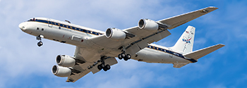
The NASA DC-8, the world's largest flying chemistry laboratory, is the flagship of FIREX-AQ and carries a comprehensive suite of chemistry and aerosol instruments to analyze fire emissions in flight and study chemical reactions and transformations in smoke from both Western wildfires and agricultural/land-management burning emissions across the United States.
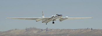
A NASA ER-2 high-altitude research aircraft is the intermediate step between in-situ and satellite observations and will acquire replicate data collected by orbiting satellites at the same time that other aircraft and ground sensors are sampling in smoke plumes. Correlating the in-flight measurements of other aircraft with the ER-2's high-resolution observations will expand the ability of scientists to utilize lower-resolution data provided by satellites to understand what's happening on the ground.
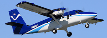
Two NOAA Twin Otter aircraft will provide a complementary near-field ability to study daytime and nighttime chemical processing in lofted plumes from Western wildfires. The NOAA-CHEM Twin Otter explores chemistry occurring in fire plumes at night.
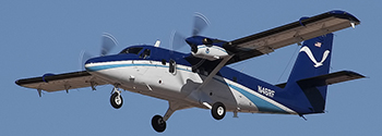
The NOAA-MET Twin Otter is equipped to study measurements of air movements right at the boundaries of fires to improve understanding and modeling of how fires affect weather locally, and how they spread.
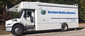
A sophisticated Aerodyne Mobile Laboratory drives between focus areas to investigate low-level smoke chemistry from smoldering fires and chemistry related to human health impacts.
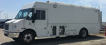
The NASA Langley Mobile Laboratory provides comprehensive measurements of particles and aerosols of wildfire smoke and interactions with clouds.
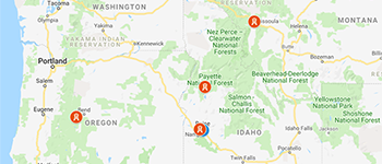
Ground-based measurements at multiple sites capture wildfire smoke and haze episodes impacting the surface. Smoke often settles into valleys at night where the Missoula, McCall and Boise ground sites can provide diurnal profiles to understand potential high exposures for residents at night. The Mount Bachelor Observatory is a high altitude site aimed at capturing long range transport of fire plumes. Additional mobile ground-based measurement platforms can travel to wherever major fires burn.