Atmospheric Composition & Chemical Processes: Projects

Field Campaigns

USOS, Salt Lake City, Utah. Researchers will investigate summertime ozone in the Wasatch Front region of northern Utah during the Utah Summer Ozone Study (USOS) in the summer of 2024. NOAA CSL will carry out observations through a combination of mobile laboratory (instrumented vehicle and small aircraft) measurements and augmentation of fixed ground sites with research grade instruments. More Info

USOS logo

AEROMMA, Coastal U.S. megacities. Atmospheric Emissions and Reactions Observed from Megacities to Marine Areas (AEROMMA) addresses emerging research needs in urban air quality, marine chemistry influences on cloud formation, and interactions at the marine-urban interface. Researchers will investigate anthropogenic and marine emissions that alter tropospheric composition and impact air quality and climate from science and ground site activities based in Palmdale, California, Dayton, Ohio, and the NYC metro area during Summer 2023. More Info

NYC skyline

BLEACH, Bermuda. The Bermuda boundary Layer Experiment on the Atmospheric Chemistry of Halogens (BLEACH) is a project designed to measure the abundance and cycling of an extensive suite of reactive gaseous and particulate halogens at the Bermuda Institute of Ocean Sciences (BIOS) Tudor Hill Marine Atmospheric Observatory during two seasons. CSL deploys the nitric oxide (NO) laser induced fluorescence (LIF) instrument and Portable Optical Particle Spectrometer (POPS) in the summer of 2022 and again in the winter 2023. More Info

BLEACH logo

CalFiDE, California. The California Fire Dynamics Experiment (CalFiDE) is a six week study of wildfire behavior and its response to spatially and temporally evolving wind fields in the California summer of 2022. The experiment will provide new data on the emissions and chemistry leading to ozone formation in wildfire plumes and in populated areas impacted by these plumes. Instrumented mobile platforms include a NOAA Twin Otter, outfitted with a high-resolution infrared imaging system to track the behavior of the active flame front and other sensors to measure fire radiative power (FRP). More Info

CALFiDE logo

SABRE, Ellington Field. Stratospheric aerosols are an important component of Earth's albedo, and therefore energy balance, and provide surface area for heterogeneous chemistry, which can lead to stratospheric ozone loss. Acquiring a comprehensive database of stratospheric aerosol, trace gas and dynamical observations to establish the baseline state and background variability of the stratosphere is essential. CSL integrates instruments aboard the the NASA WB-57 research aircraft. Test flights commence from Ellington Field, Houston, Texas in January 2022. An Arctic deployment occurs February-March 2023, followed by tropical science Summer 2025 and southern hemisphere science Summer 2026. More Info

SABRE logo

ACCLIP, South Korea. The Asian Summer Monsoon Chemical & CLimate Impact Project (ACCLIP) will deploy from Osan Air Base in South Korea the Summer of 2022. The Asian Summer Monsoon (ASM) is the largest meteorological pattern in the Northern Hemisphere (NH) summer season. Persistent convection and the large anticyclonic flow pattern in the upper troposphere and lower stratosphere (UT/LS) associated with ASM leads to a significant enhancement in the UT/LS of trace species from pollution and biomass burning origins. The monsoon convection occurs over South, Southeast, and East Asia, a region of uniquely complex and rapidly changing emissions tied to both its high population density and significant economic growth. The coupling of the most polluted boundary layer on Earth to the largest dynamical system in the summer season through the deep monsoon convection has the potential to create significant chemical and climate impacts. An accurate representation of the ASM transport, chemical and microphysical processes in chemistry-climate models is much needed for characterizing ASM chemistry-climate interactions and for predicting its future impact in a changing climate. CSL integrates instruments aboard the the NASA WB-57 research aircraft. Test flights commence from Ellington Field, Houston, Texas in Summer 2021. More Info

ACCLIP logo

B2SAP, global. The Balloon Baseline Stratospheric Aerosol Profiles (B2SAP) measurement program is a NOAA CSL and GML led effort in collaboration with university and international colleagues to provide balloon-borne ozone, water vapor, aerosol, and aerosol optical depth profiles, compiled to characterize the background state and variability of radiatively important aerosols, water vapor, and ozone in Earth's stratosphere. Intensive operating periods occur over a five year period, including a rare opportunity in January 2022 to make in situ measurements of volcanic aerosols. More Info

red color of volcanic aerosols in La Réunion sunrise

SUNVEx, Los Angeles, CA and Las Vegas, NV. Southwest Urban NOx and VOC Experiment (SUNVEx) addresses emerging research needs in urban air quality ahead of AEROMMA. The project is part of Re-Evaluating the Chemistry of Air Pollutants in California (RECAP-CA) and evaluates ozone formation and its sensitivity to NOx and VOCs in Las Vegas. Researchers will investigate anthropogenic emissions that alter tropospheric composition and impact air quality and climate from ground-based activities during Summer 2021. More Info

LA haze

POPS Stratollite Mission, Tucson, Arizona. CSL is working with World View to make the first particle size distribution measurements onboard the Stratollite. The Stratollite is World View's remotely navigated, long-endurance stratospheric platform for remote-sensing and in situ observations. CSL will deploy Portable Optical Particle Spectrometer (POPS) to study stratospheric aerosol under background conditions, as well following natural injections of sulfur gases and aerosols from explosive volcanic eruptions and very large fires. More Info

site map

POPSnet-SGP, Southern Great Plains U.S. The primary objective of POPSnet-SGP (Southern Great Plains), a pilot Aerosol Microphysics Network, is to determine the statistical representativeness of single-point surface measurements of microphysical parameters within a typical global model grid cell domain. The campaign deploys a thirteen-site network of aerosol microphysical property measurements across the DOE ARM SGP domain in southern Kansas and northern Oklahoma for two years using low-cost, simple, and robust instruments. These instruments include the Printed Optical Particle Spectrometer (POPS). More Info

site map

NightFOX, Western U.S. The Nighttime Fire Observations eXperiment (NightFOX) performs nighttime wildfire observations from a Unmanned Aircraft System (UAS). UAS wildfire measurements made during the 2019 wildfire season will be used to characterize nighttime combustion efficiency, smoke, fire perimeter, and fire radiative power at high spatial resolution to inform, test, and improve fire weather forecasting. More Info

S2 UAS
Black Swift Technologies S2 (SuperSwift) UAS

FIREX-AQ, Western U.S. Fire Influence on Regional to Global Environments and Air Quality (FIREX-AQ) is a NOAA / NASA interagency intensive study of North American fires during the 2019 wildfire season. The project combines the previously separate NASA FIREChem and NOAA FIREX aircraft campaigns to better study the atmospheric effects of wildland and agricultural fires in the U.S. This offers significant advantages to the research community by optimally leveraging the scientific interests, personnel, and assets of NASA, NOAA, other agencies, and academic partners in a fully integrated program of field measurements, modeling, and interpretation. More Info

FIREX-AQ logo

EPOCH, Palmdale, California. The East Pacific Origins and Characteristics of Hurricanes (EPOCH) Project in August 2017 investigates how storms develop into hurricanes and intensify. Flights aboard NASA's Global Hawk unmanned aircraft are conducted from the NASA Armstrong Flight Research Center in Palmdale, California. CSD deployed the Global Hawk In-flight turbulence Sensor (GHIS), Printed Optical Particle Spectrometer (POPS), and instruments measuring ozone (O3) and low concentrations of sulfur dioxide (SO2). More Info

Global Hawk
NASA Global Hawk unmanned aircraft

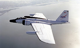
POSIDON, Guam. The Pacific Oxidants, Sulfur, Ice, Dehydration, and cONvection (POSIDON) Experiment is a focused airborne science mission to study the ozone distribution, sulfur chemistry, very short-lived ozone depleting species (VSLS), cloud microphysics, and dehydration in the tropical upper troposphere and lower stratosphere over the western Pacific. Instrumentation aboard the NASA WB-57F deploys in the fall 2016 to Guam. CSD and GMD federal and cooperative institute (CIRES) researchers and engineers have designed, built, and installed five of the 12 instruments and all of the balloon packages. Flight planning and meteorology/forecasting products provided by NASA and CSD. More Info

POSIDON logo

FIREX FireLab, Missoula, Montana. Wildfires have implications for air quality and carbon release, and changes in climate sharpen the problems involving widfires in the western U.S. The Fire Influence on Regional and Global Environments Experiment (FIREX) is a coordinated research effort to understand and predict the impact of North American fires on the atmosphere and ultimately support better land management. Laboratory studies at the USDA Fire Sciences Lab in Missoula commence in the fall of 2016. More Info

stack burn
Fire Science Lab stack burn

ATom, NASA Armstrong Flight Research Center. The Atmospheric Tomography Mission (ATom) studies the impact of human-produced air pollution on greenhouse gases and on chemically reactive gases in the atmosphere. Airborne instruments look at how atmospheric chemistry is transformed by various air pollutants and at the impact on methane and ozone which affect climate. Observations occur seasonally over three years (2016-2018). Flights aboard NASA's DC-8 originate from the NASA Armstrong Flight Research Center in Palmdale, California, fly north to the western Arctic, south to the South Pacific, east to the Atlantic, north to Greenland, and return to California across central North America for a systematic, global-scale sampling of the atmosphere. More Info

ATom logo

KORUS-AQ, Korea. KORUS-AQ is an international cooperative air quality field study in Korea. The need to monitor and understand air quality requires continual effort as populations grow, energy use increases, and industrial activity evolves. Air quality goals have also evolved as improved understanding of health effects has demonstrated the added benefit of setting lower targets for exposure of humans and ecosystems to ozone, fine particles, and other toxic pollutants in the air. Black carbon in a component in fine-particle pollution, which is associated with adverse health effects and impaired visibility. CSD deploys the Humidified-Dual Single Particle Soot Photometer (HD SP2) aboard the NASA DC-8 research aircraft, to observe single particles and aerosols containing refractory black carbon (rBC). More Info

KORUS-AQ logo

AeroMarine, La Réunion. The AeroMarine project was an international collaborative effort between NOAA (USA) and OSU-Réunion and LACy laboratory (France). The Southern Indian Ocean is potentially a hot spot for sea spray emission due to strong trade winds and high sea surface temperature. Hence, measurements taken from La Réunion are relevant for several topics related to marine aerosols and pristine oceanic regions. CSD deployed the POPS (Printed Optical Particle Spectrometer) instrument to La Réunion to observe marine aerosols during a two week field campaign in March 2016. More Info

ULA flight directed by Jerome Brioude
POPS on an ultra light aircraft flown from La Réunion

VIRGAS, Houston, Texas. The Volcano-plume Investigation Readiness and Gas-phase and Aerosol Sulfur (VIRGAS) field experiment in October 2015 helps to characterize the stratospheric sulfate aerosol layer in a non-volcanic time period, and test the possibility of a new standing capability for measuring SO2, other gases, and particles in the plumes from volcanic eruptions. Partnering with NOAA, NASA would deploy the WB-57F research aircraft soon after future volcanic eruptions, giving scientists an unprecedented opportunity to observe the volcanic plume and understand the implications for climate and the atmosphere. More Info

NASA WB-57
NASA WB-57 high-altitude research aircraft

SONGNEX, Western U.S. The goal of the Shale Oil and Natural Gas Nexus (SONGNEX) 2015 program is to quantify the emissions of trace gases and fine particles from several different tight oil and shale gas basins in the western U.S., and to study the chemical transformation of these emissions. The study focuses on basins which represent a mixture of oil and gas production regions at various stages of development. This airborne study involves the NOAA WP-3D aircraft mobile platform. More Info

oil and gas drilling site
Oil extraction equipment in Uintah Basin, Utah

SAOP UAS, Svalbard, Norway. Ny-Ålesund is a center for international Arctic scientific research and environmental monitoring. A study of aerosol optical properties (SAOP) with a Manta Unmanned Aircraft System (UAS) operated from the Kings Bay AS research facility in April 2015. CSD deployed two instruments on the Manta UAS, the recently developed miniaturized Printed Optical Particle Spectrometer (POPS) and the miniature Scanning Aerosol Sun Photometer (miniSASP; an upward-looking radiometer (ULR)). The payload measured the vertical profile from 50m up to 3000m over different sea and glacier terrains near Ny-Ålesund. More Info

Manta UAS launch at Kings Bay AS
NOAA Manta Unmanned Aircraft System (UAS) launch

TOPDOWN, North Dakota, Colorado, New Mexico. Twin Otter Projects Defining Oil/gas Well emissioNs (TOPDOWN) aims to understand the atmospheric impact of rapidly expanding oil and gas operations in the Bakken play in North Dakota. Subsequent flights also examine the Denver-Julesburg basin in NE Colorado, and the San Juan basin in New Mexico. Instruments integrated aboard the NOAA Twin Otter aircraft measure key atmospheric trace gases (CO2, CO, CH4, C2H6, O3, and many more) along with black carbon. More Info

Bakken Formation map
Bakken shale rock formation area map courtesy of USGS

NOAA SEED project. The NOAA Special Early-Stage Experimental or Developmental (SEED) project conducted the very first test flights for new instruments designed to measure properties and climate effects of airborne fine particles (aerosols) using the Manta Unmanned Aircraft System (UAS). CSD developed two new instruments for the Manta, the Printed Optical Particle Spectrometer (POPS) and an upward-looking radiometer (ULR), filling key measurement gaps in the payload. They contribute to a potentially powerful new tool for NOAA to address climate and air quality issues related to aerosols in remote and hard-to-access regions. More Info

NOAA Manta UAS launch
NOAA Manta Unmanned Aircraft System (UAS) launch

SEAC4RS, Houston, Texas. Studies of Emissions and Atmospheric Composition, Clouds and Climate Coupling by Regional Surveys (SEAC4RS) is based out of Ellington Field in August - September 2013. Focused on pollution emissions and the evolution of gases and aerosols in deep convective outflow, and the influences and feedbacks of aerosol particles from anthropogenic pollution and biomass burning on meteorology and climate, the project requires two aircraft to accomplish the goals. The NASA DC-8 provides observations from near the surface to 12 km, and the NASA ER-2 provides high altitude observations reaching into the lower stratosphere as well as important remote sensing observations connecting satellites with observations from lower flying aircraft and surface sites. More Info

SEAC4RS logo

ATTREX, Palmdale, California and Guam. Airborne Tropical Tropopause Experiment (ATTREX) is a series of measurement campaigns (September - November 2011, November 2012 - February 2013, January - March 2014). Instruments deployed on the high-altitude long-range NASA Global Hawk (GH) unmanned aerial system (UAS) based at NASA Armstrong (formerly Dryden) Flight Research Center make measurements to evaluate changes in stratospheric humidity and ozone concentration. More Info

ATTREX logo

SENEX, Southeast U.S. The goal of the Southeast Nexus (SENEX) 2013 program is to study the interactions between natural and anthropogenic emissions in the southeast at the nexus of the air quality and climate change. Scientists quantify the emissions of greenhouse gases and aerosol, and investigate the roles played by anthropogenic and natural emissions in the formation of ozone and aerosol in the atmosphere. This airborne study involves the NOAA WP-3D aircraft, forecast modeling and surface monitoring networks. More Info

Southeast mountains
Great Smoky Mountains National Park

DC3, Salina, Kansas. The Deep Convective Clouds & Chemistry (DC3) experiment investigates the impact of deep, midlatitude continental convective clouds, including their dynamical, physical, and lightning processes, on upper tropospheric composition and chemistry. Airborne measurements taken from the NASA DC-8 in July 2012 provide in situ observations to characterize the convective storm inflow and provide remote sensing to aid in flight planning and column characterization. Two of our SP2 black carbon instruments are aboard the NASA DC-8 aircraft. More Info

clouds

HIPPO IV & V, Pacific Basin. The HIAPER (High-performance Instrumented Airborne Platform for Environmental Research) Pole-to-Pole Observations (HIPPO) of Carbon Cycle and Greenhouse Gases Study measures cross sections of atmospheric concentrations approximately pole-to-pole, from the surface to the tropopause, five times during different seasons over a three year period. The main goal of HIPPO is to determine the global distribution of carbon dioxide and other trace atmospheric gases by sampling at various altitudes and latitudes in the Pacific Basin. More Info

GV in flight
NSF / NCAR Gulfstream V HIAPER

MACPEX, Houston, Texas. The Mid-latitude Airborne Cirrus Properties Experiment (MACPEX) is an airborne field campaign to investigate cirrus cloud properties and the processes that affect their impact on radiation. The campaign involves the NASA WB-57 based at Ellington Field, TX in the March / April 2011 timeframe. Science flights focus on central North America vicinity with an emphasis over the DoE ARM SGP site in Oklahoma. More Info

MACPEX logo

GloPac, Palmdale, California. Flights of the Global Hawk for the Global Hawk Pacific Mission (GloPac) are conducted in support of the Aura Validation Experiment (AVE). This mission takes place out of NASA Dryden Flight Research Center in 2010, expected to encompass the entire offshore Pacific region with four to five 30 hour flights. Aura is one of the A-train satellites supported by NASA Earth Observation System. More Info

GloPac logo

ARCPAC, Fairbanks, Alaska. As part of the International Polar Year of 2008, NOAA engaged in an airborne field measurement campaign targeted at improving understanding climate-relevant processes. The Aerosol, Radiation, and Cloud Processes affecting Arctic Climate (ARCPAC) effort was focused on direct measurements of properties and processes that can be used to reduce uncertainty in radiation and climate models. The measurements were made in the Alaskan Arctic to closely coordinate with remote-sensing and in situ observations from aircraft and ground sites in the vicinity of Barrow, Alaska. Field support operations in collaboration with NASA's Arctic Research of the Composition of the Troposphere from Aircraft and Satellites (ARCTAS) based out of Fairbanks, Alaska. More Info

WP-3D over Brooks Range
NOAA WP-3D aircraft over the Brooks Range, AK

Prior field campaigns in which ACCP instruments were a part of the payload: